Rowing to the Fraser River North Arm Jetty and back

Fraser River North Arm Jetty row.
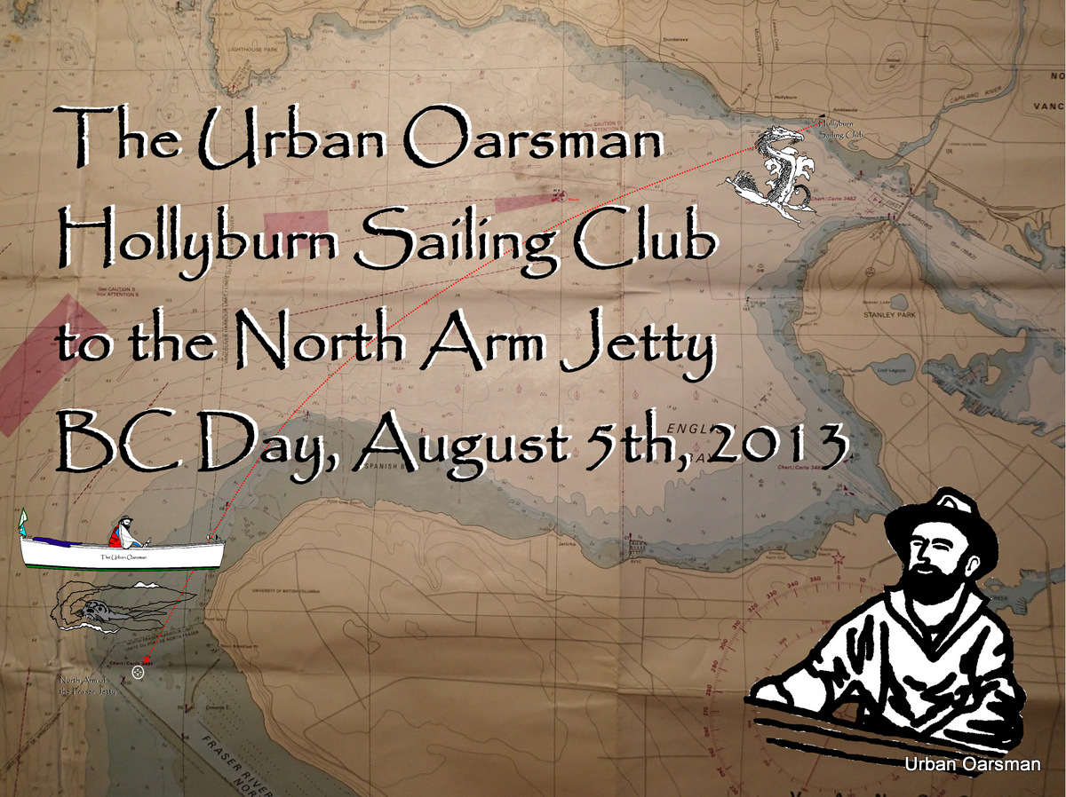
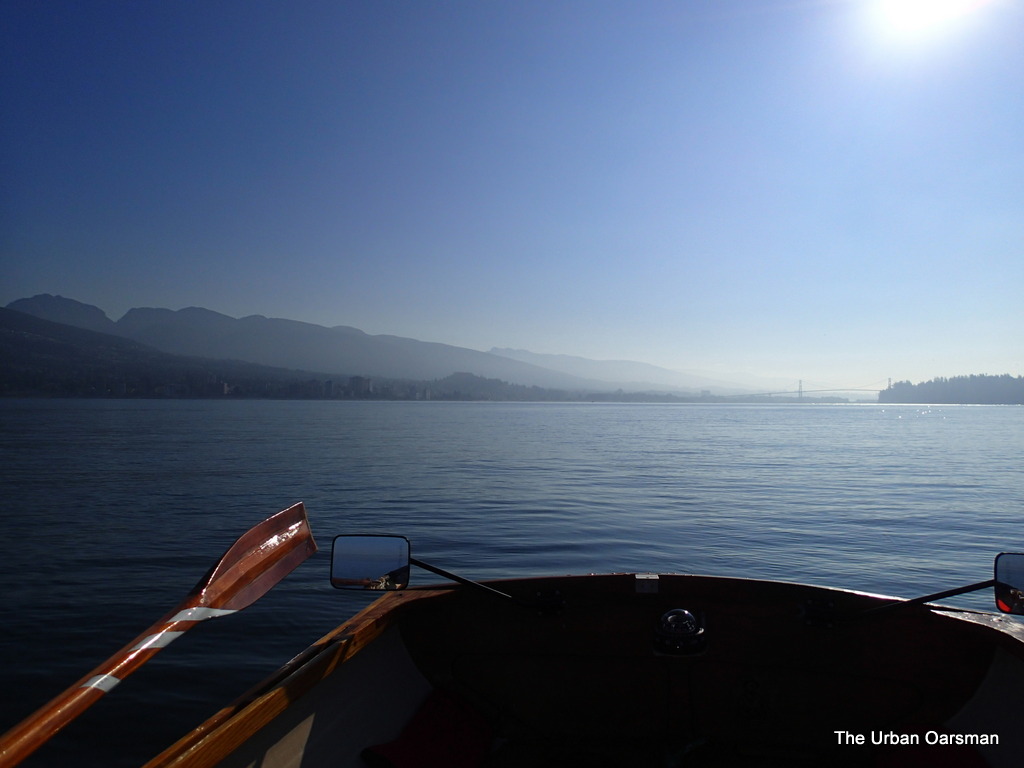
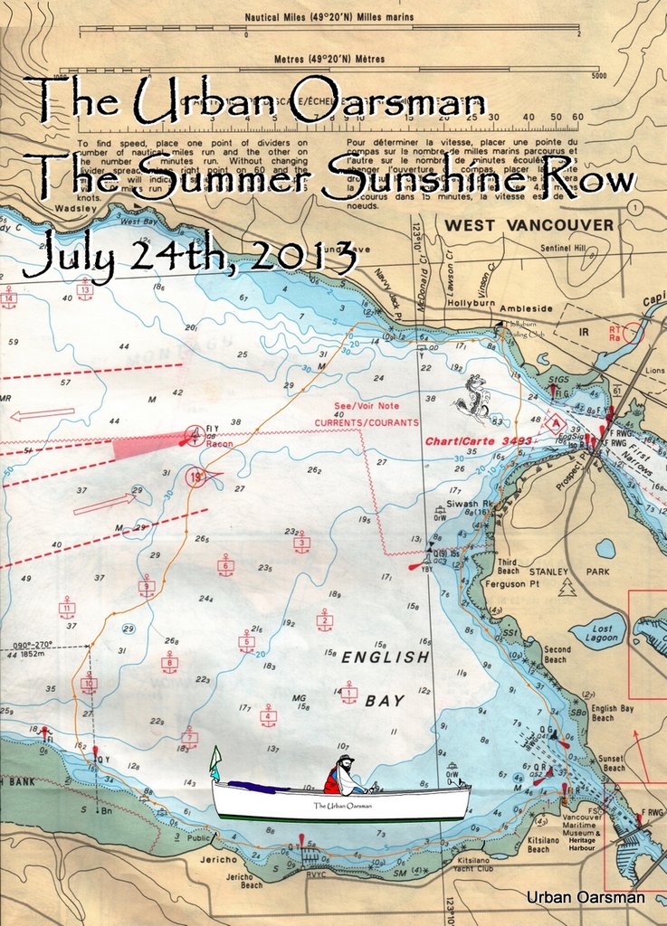
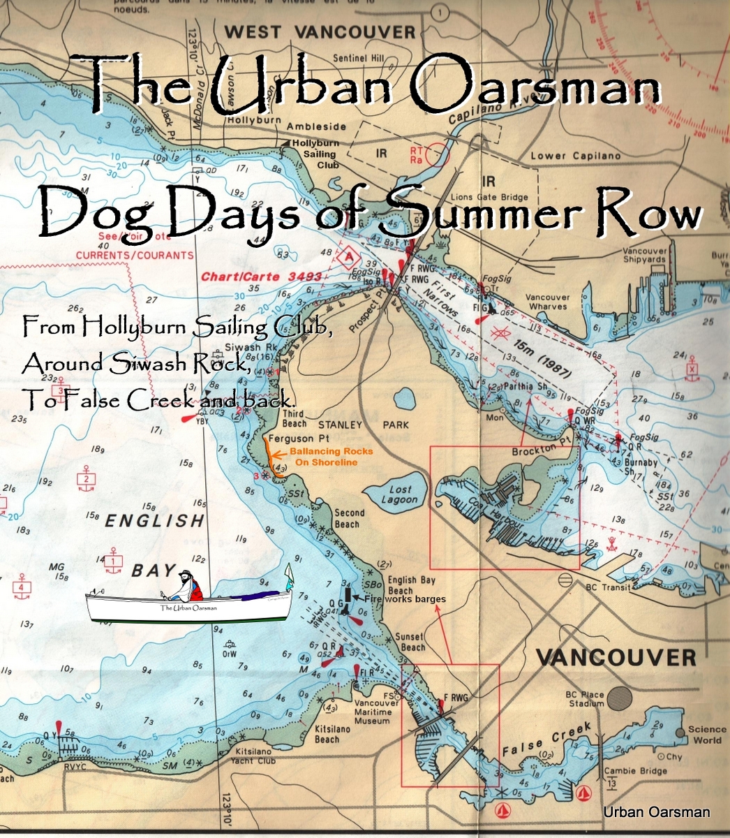
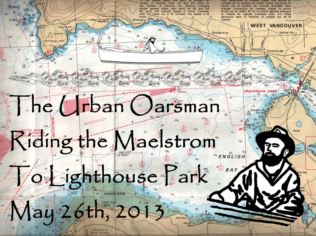
The rowing plan is to row with the ebbing tide out of English Bay, row along Point Grey to the North Arm Jetty, and then row with the flooding tide back to Hollyburn Sailing Club.The tides at Point Atkinson are:
Low High:  4:23am, 4.0 meters or 13.1 feet
Low Low: 11:35am, 1.1 meters or 3.6 feet
High High: 6:52pm, 4.3 meters or 14.1 feet.

I estimate that it will take 3 to 3 1/2 hours to row to the North Arm Jetty so I must be on the water by 8:00am. I have to be at the North Arm at the change in the tide, around 11:30am to begin the row home.

The Urban Oarsman row to the North Arm of the Fraser from Hollyburn Sailing Club.
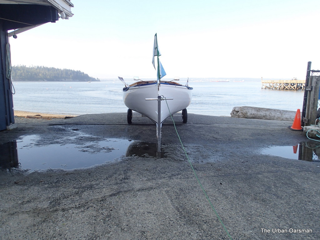
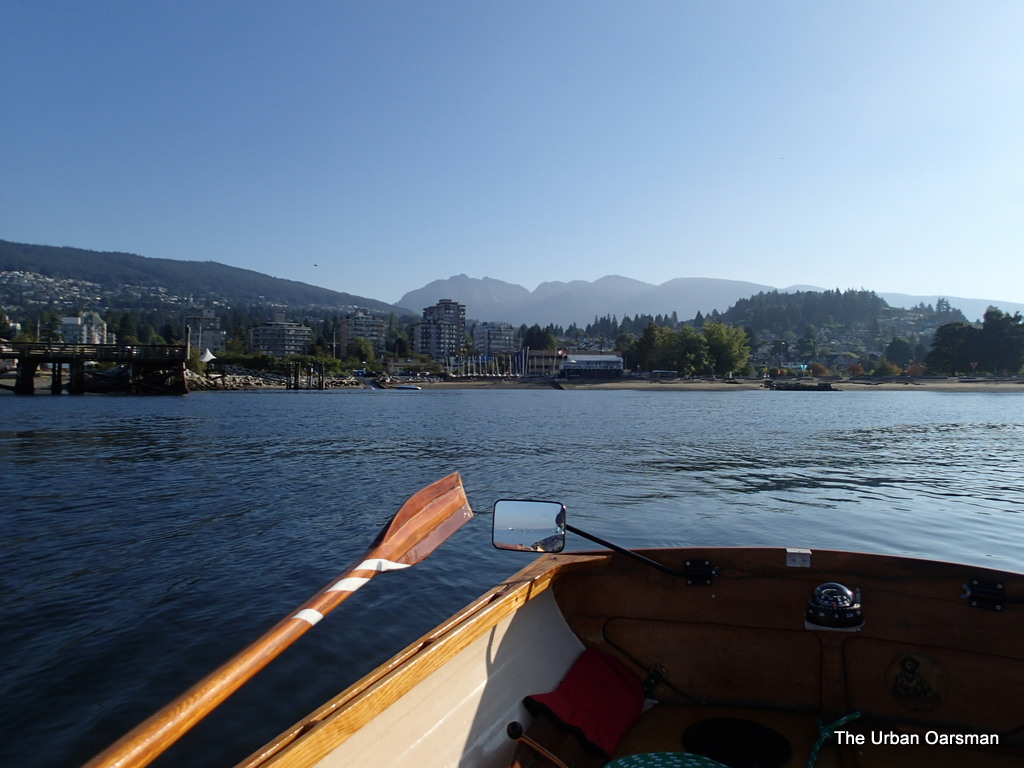
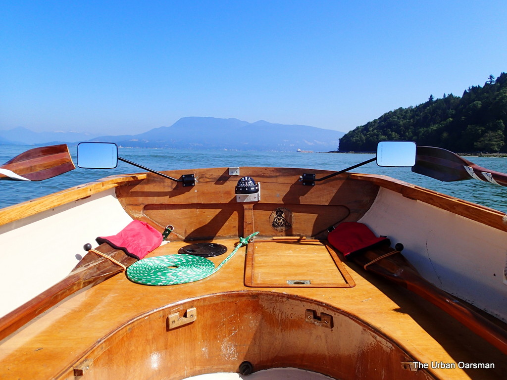
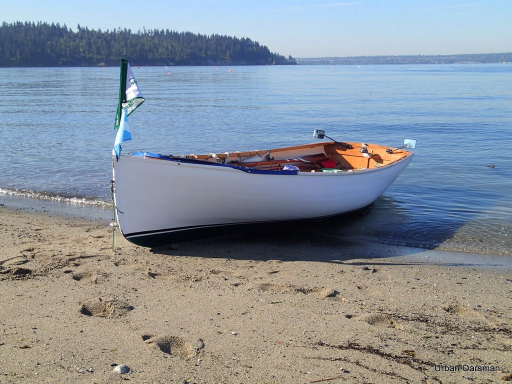
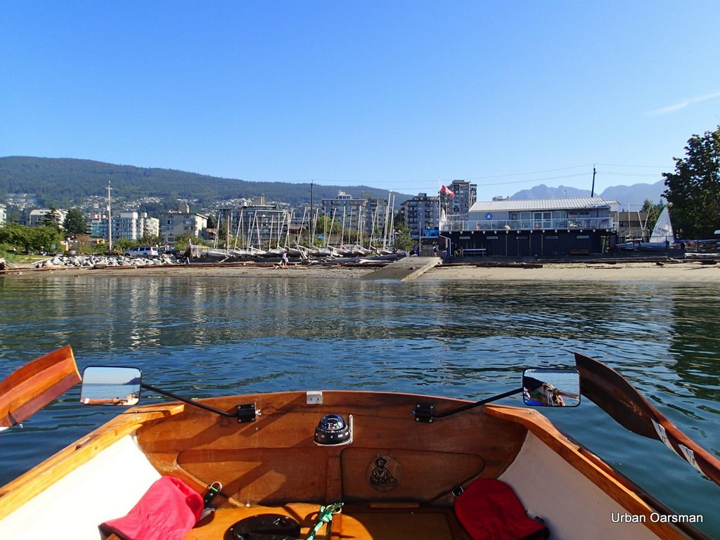
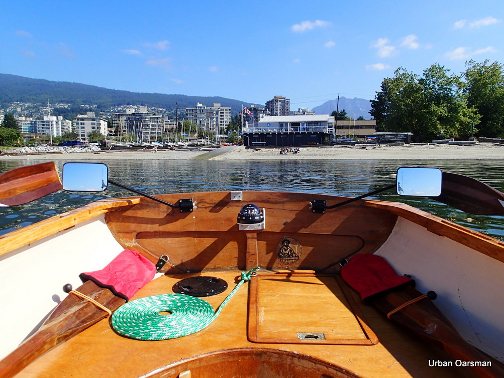
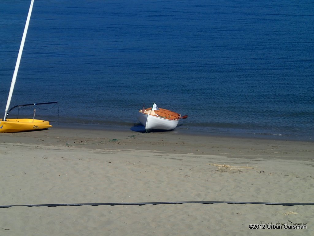
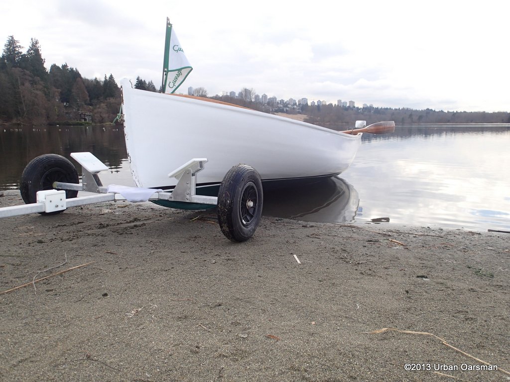
7:56am, top of the Hollyburn Sailing Club ramp, ready to launch.

I am all packed, ready to go.  There is a slight Easterly threatening.

The Urban Oarsman row to the North Arm of the Fraser from Hollyburn Sailing Club.
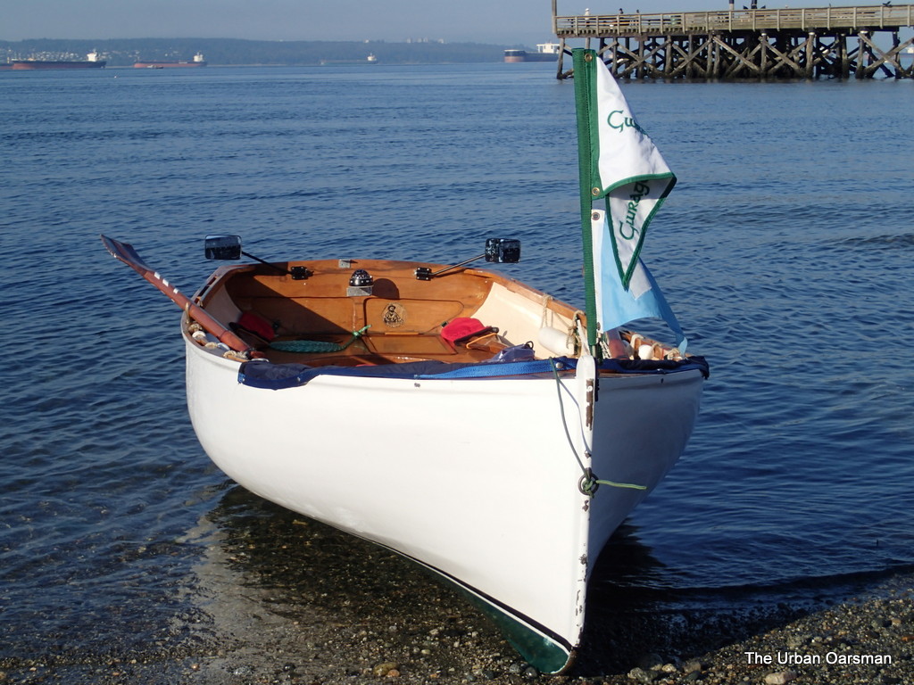
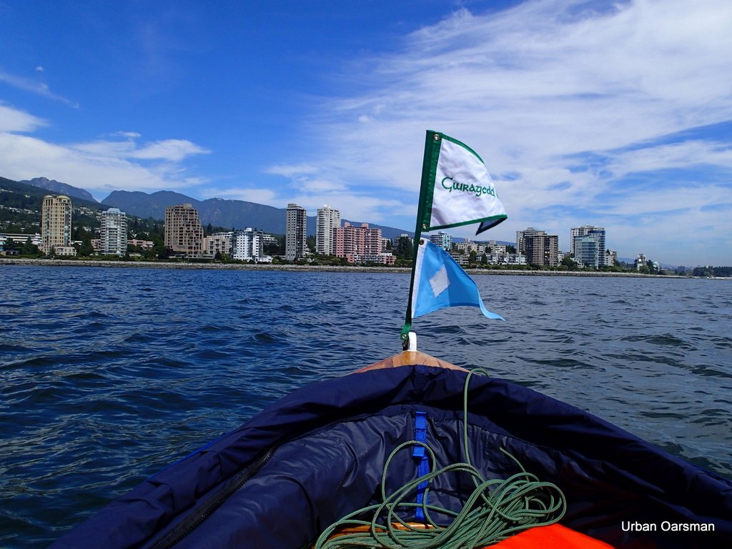
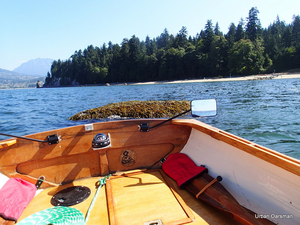
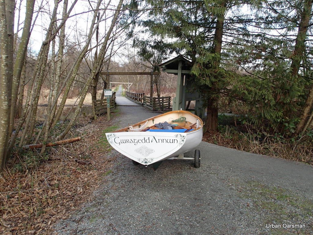
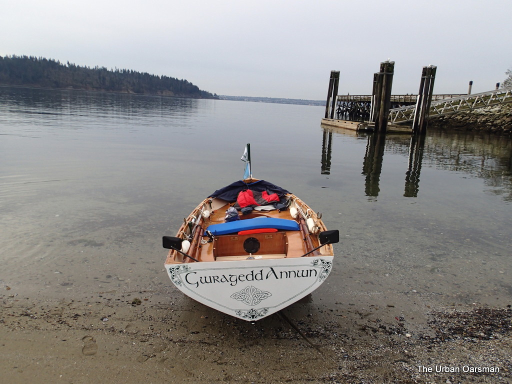
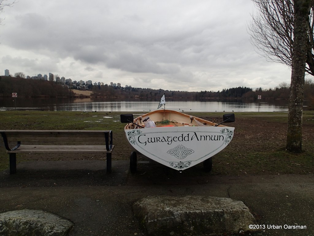
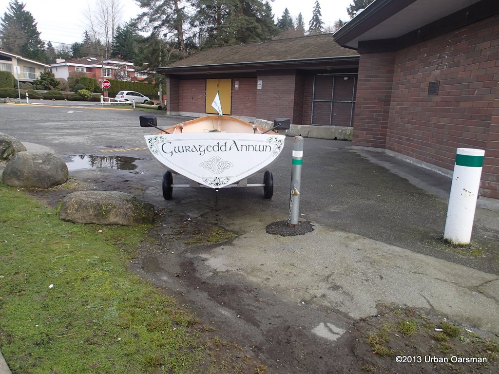
Gwragedd Annwn awaits on the beach while I put her dolly away.

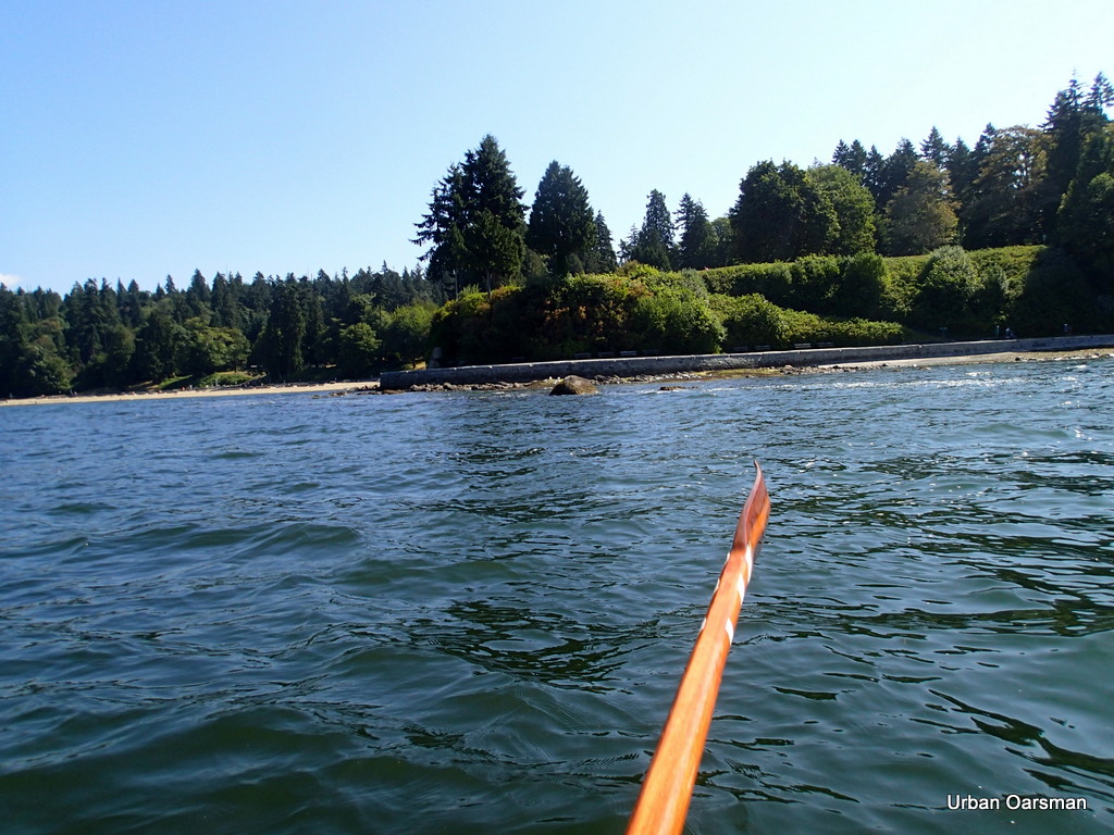
I shove off the beach and begin to row for the “Maelstrom”.

The Urban Oarsman row to the North Arm of the Fraser from Hollyburn Sailing Club.
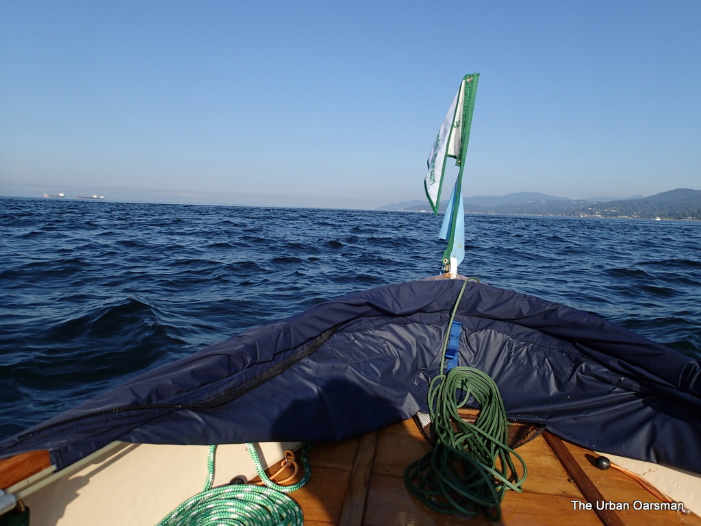
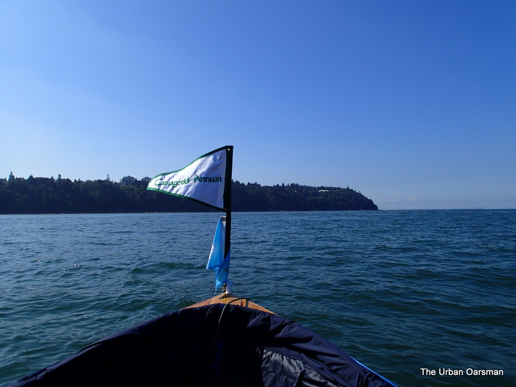
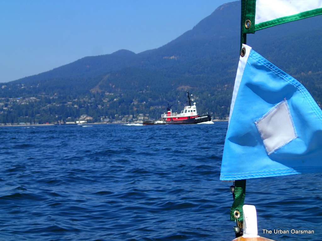
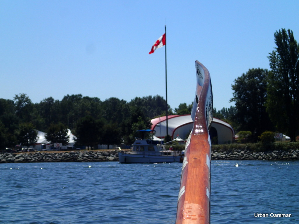
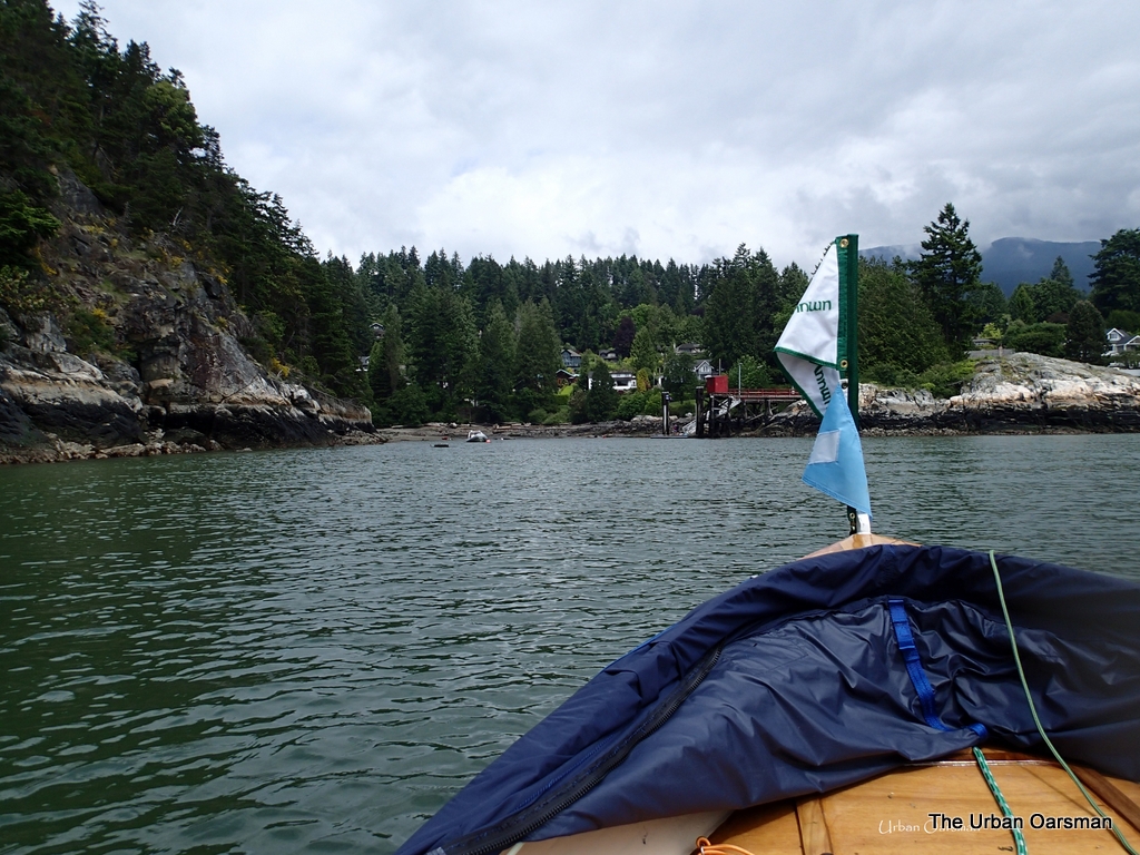
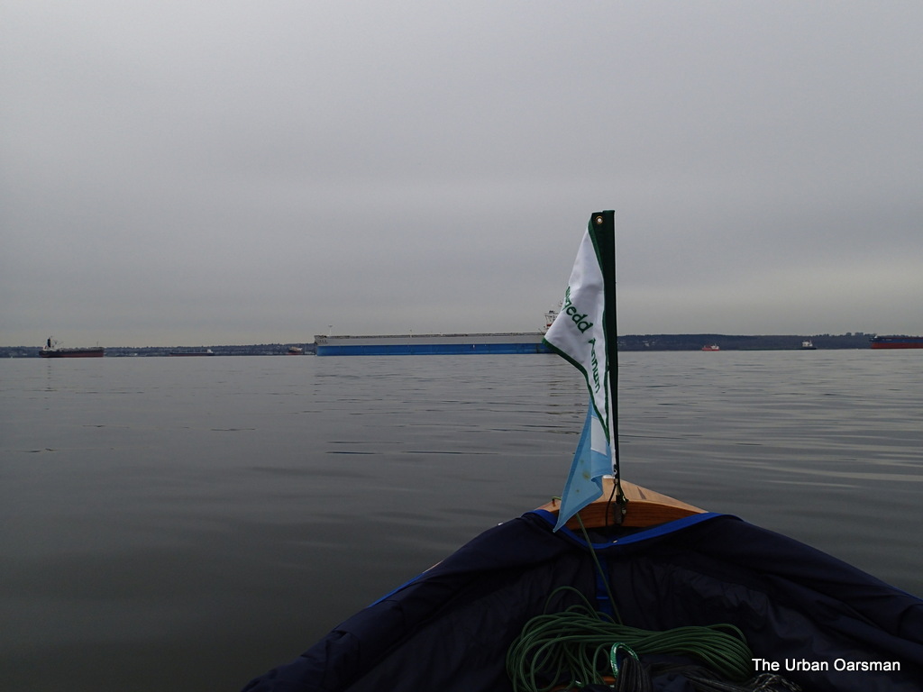
The flag shows an Easterly drift.

I row South towards the ebbing current.  The water is pretty flat.

The Urban Oarsman row to the North Arm of the Fraser from Hollyburn Sailing Club.
Leaving HSC behind.  That dot in the upper left is a helicopter
The Urban Oarsman row to the North Arm of the Fraser from Hollyburn Sailing Club.
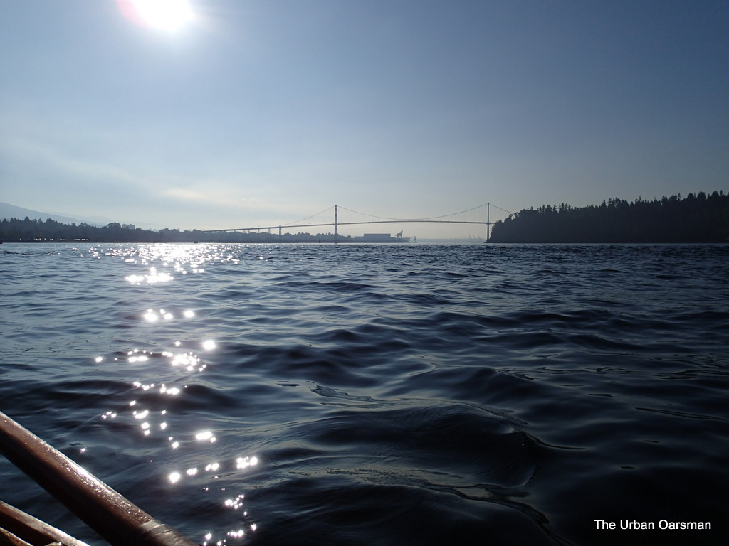
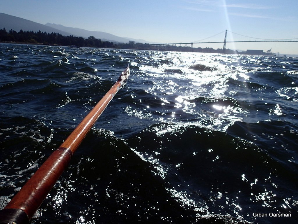
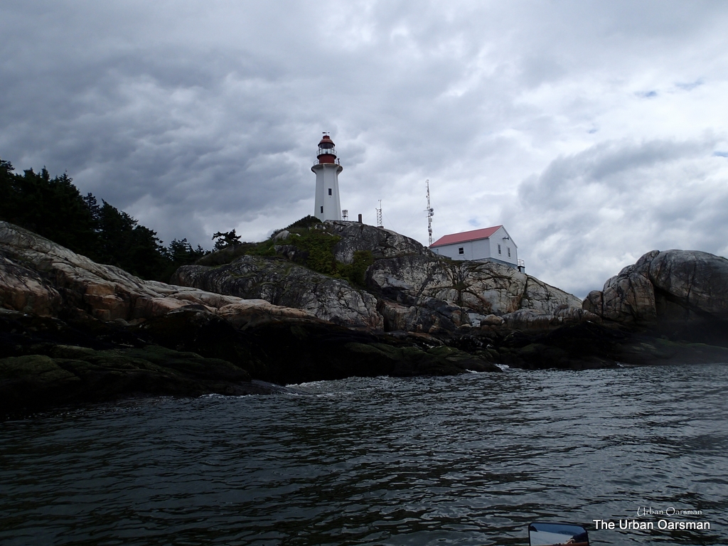
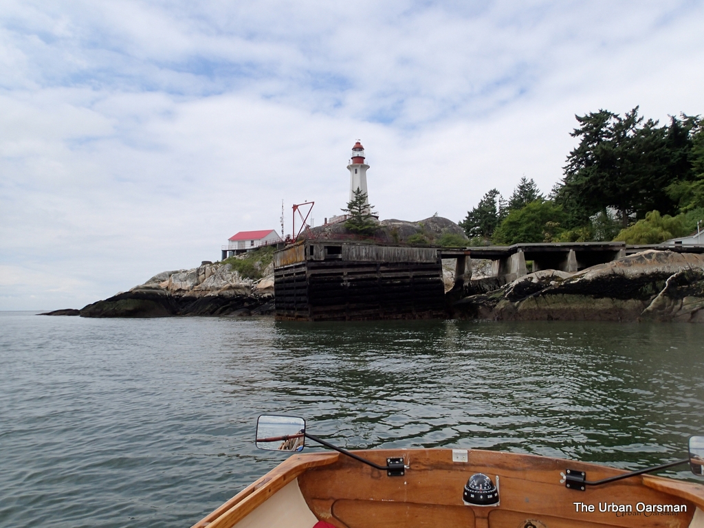
Lions Gate Bridge, First Narrows.  The rough water is where the ebbing tide is flowing.  The “Maelstrom” that will take me out of English Bay towards Point Atkinson and Lighthouse Park.
The Urban Oarsman row to the North Arm of the Fraser from Hollyburn Sailing Club.
Gwragedd Annnwn in the Maelstrom, looking West. 

The Maelstrolm is all the agitated water in the photo.  The ebb tide current goes all the way out to Point Atkinson / Lighthouse Park.

The Urban Oarsman row to the North Arm of the Fraser from Hollyburn Sailing Club.
Rowing the Maelstrom  West.

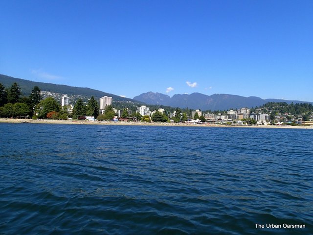
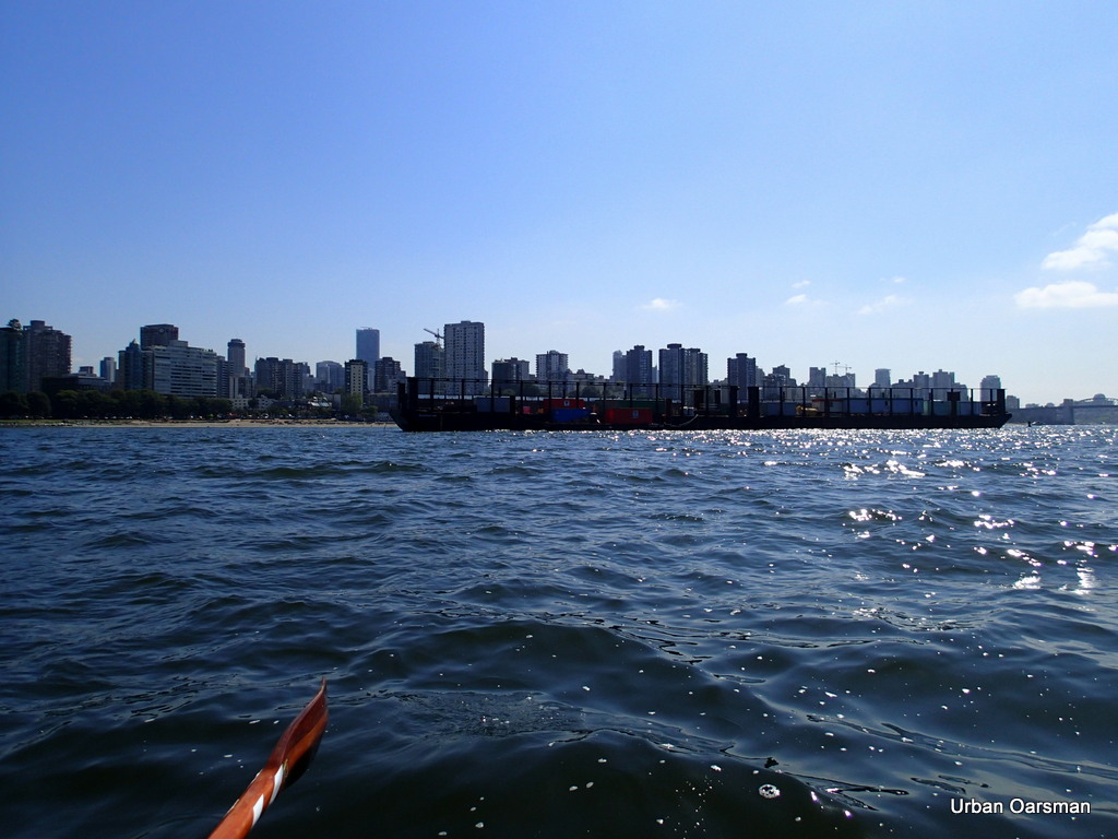
Looking South, across English Bay towards Kits, Jericho and Spanish Bank beaches.

The Urban Oarsman row to the North Arm of the Fraser from Hollyburn Sailing Club.
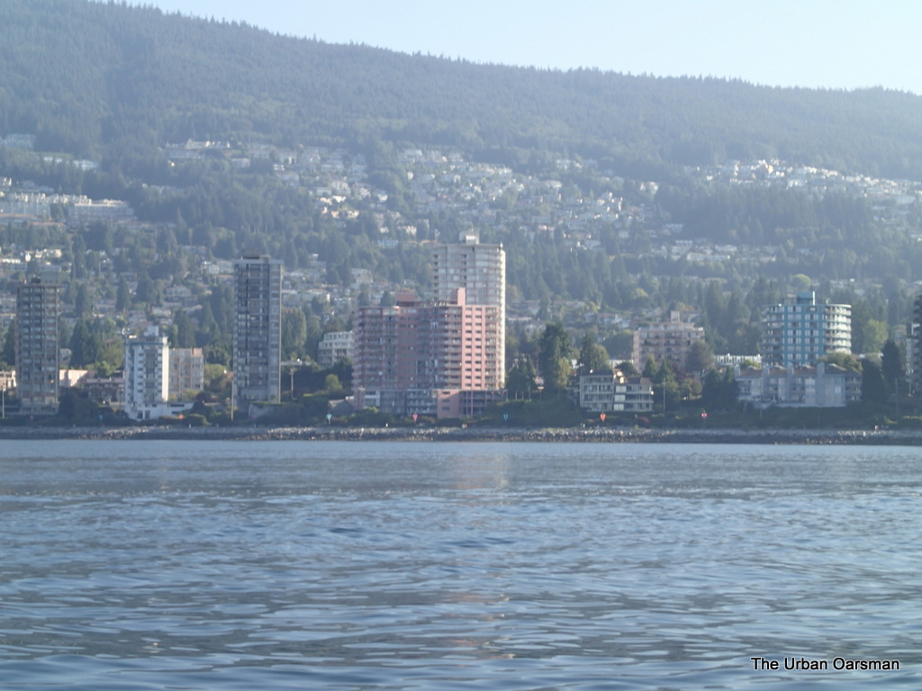
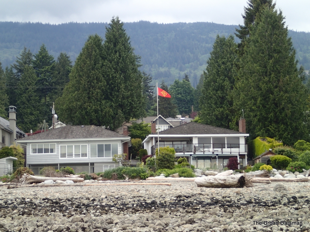
The famous “Pink Building”, Villa Maris, 2222 Bellevue Avenue.
The Urban Oarsman row to the North Arm of the Fraser from Hollyburn Sailing Club.
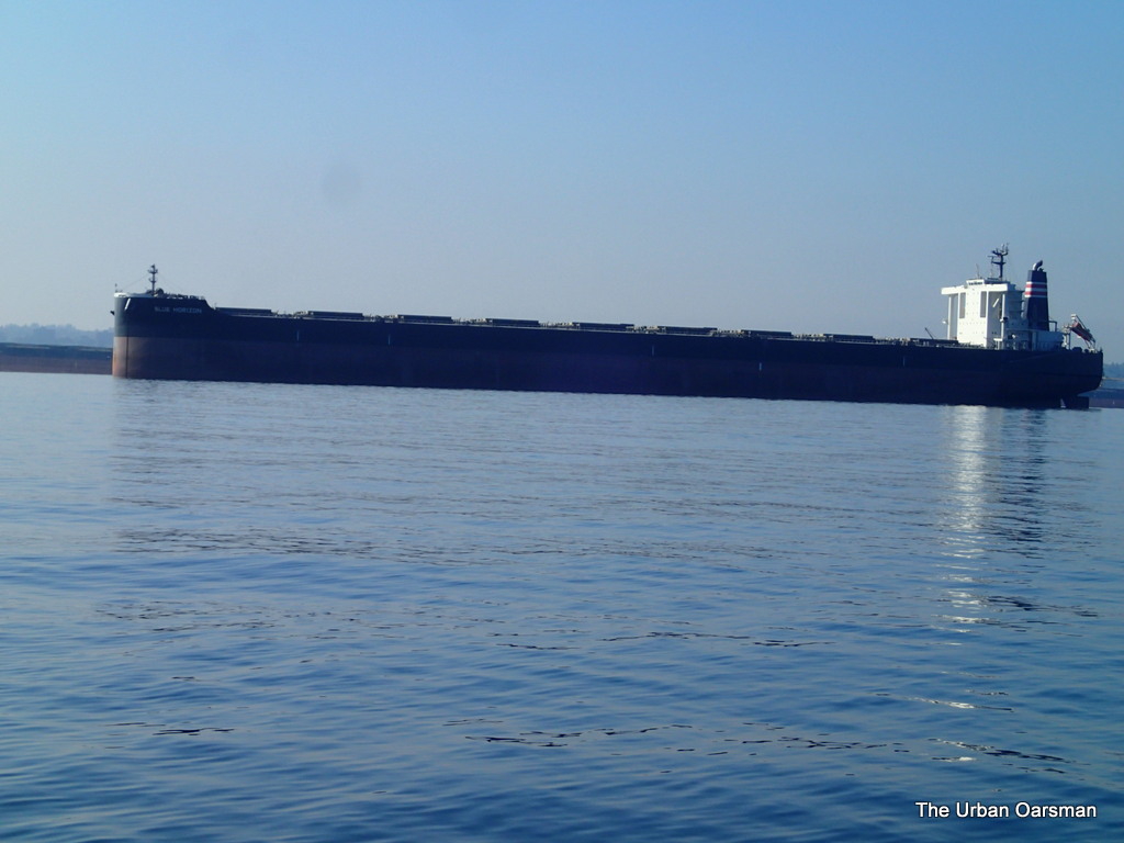
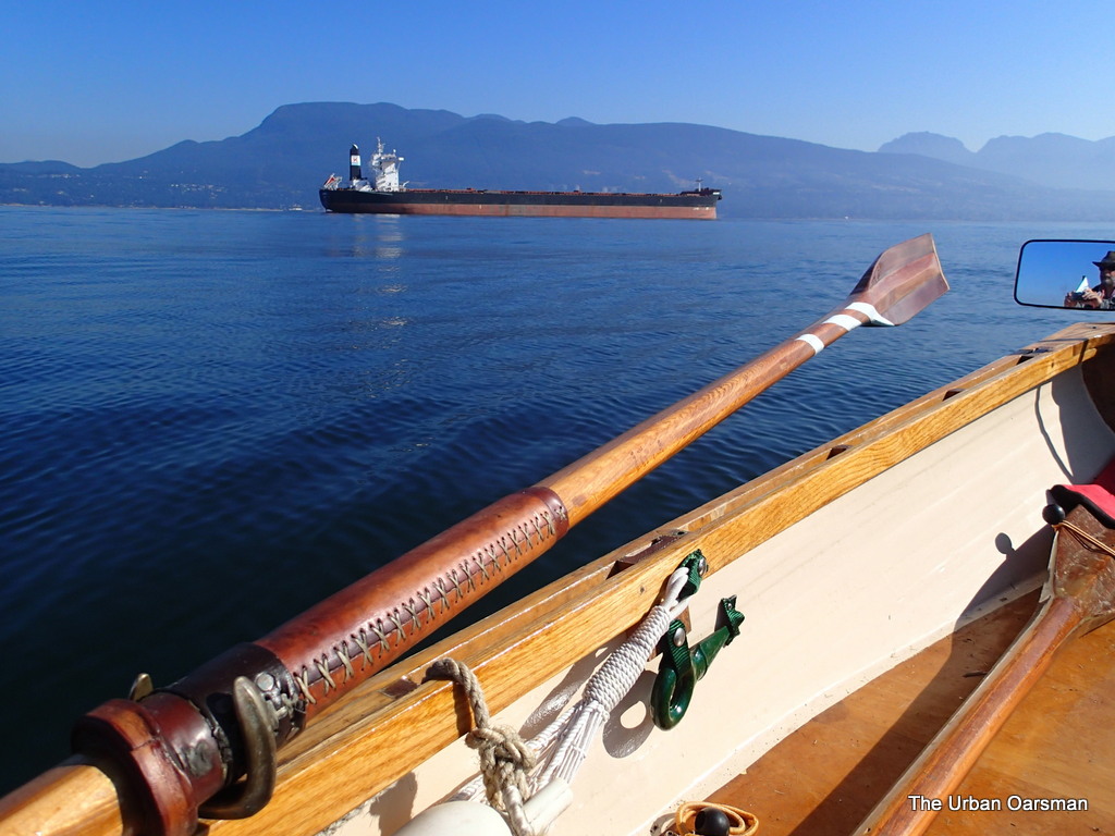
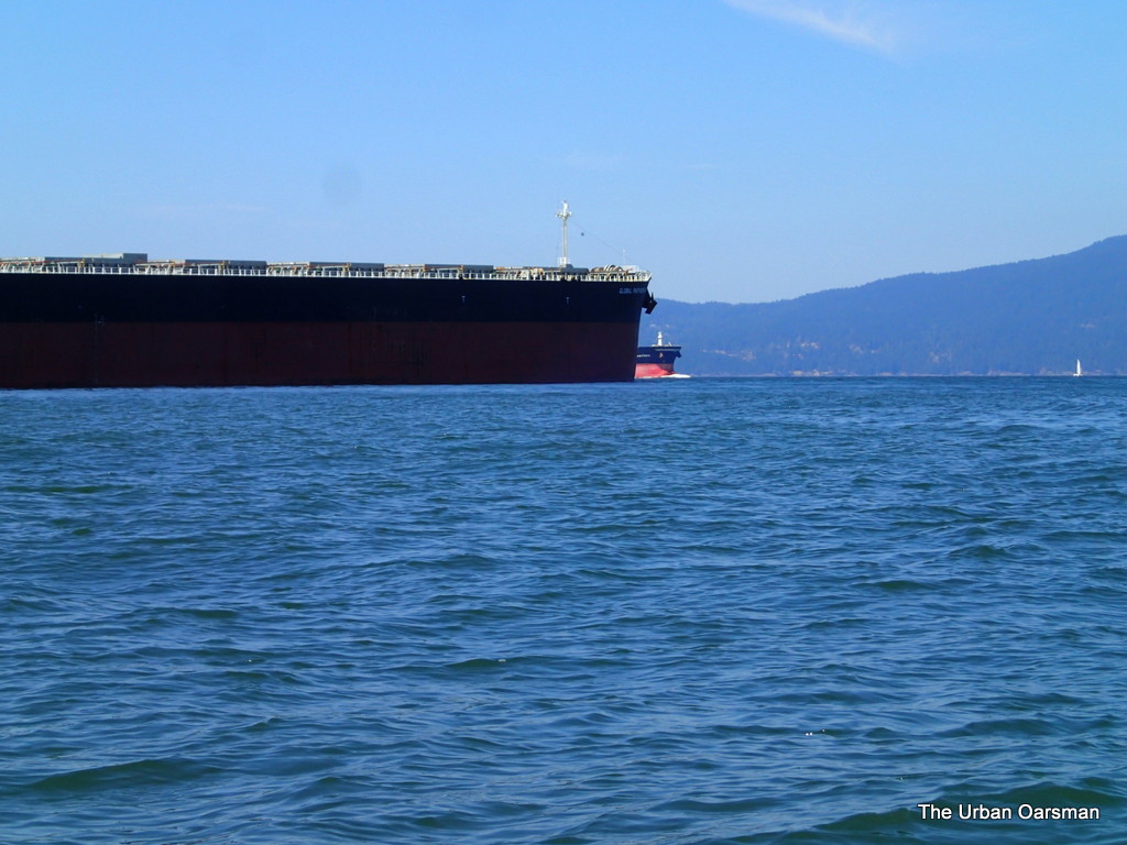
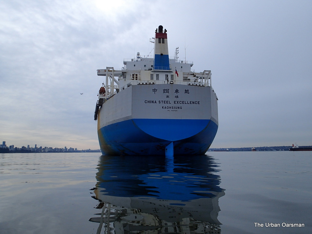
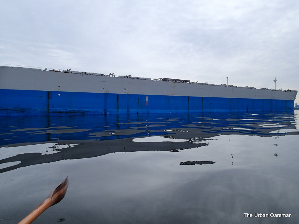
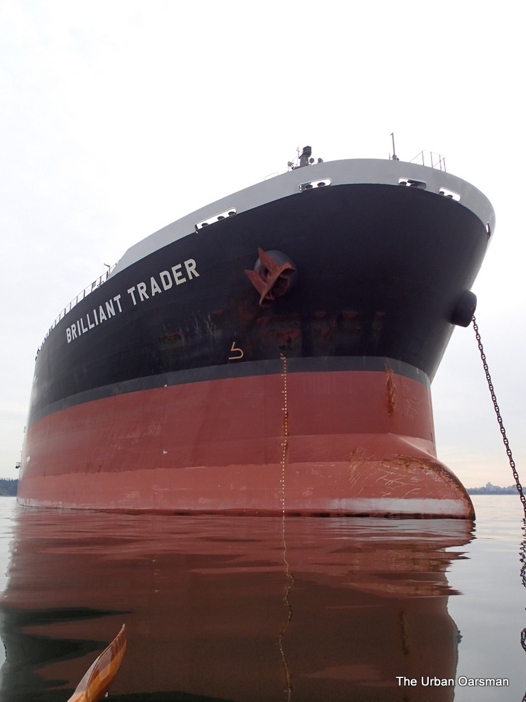
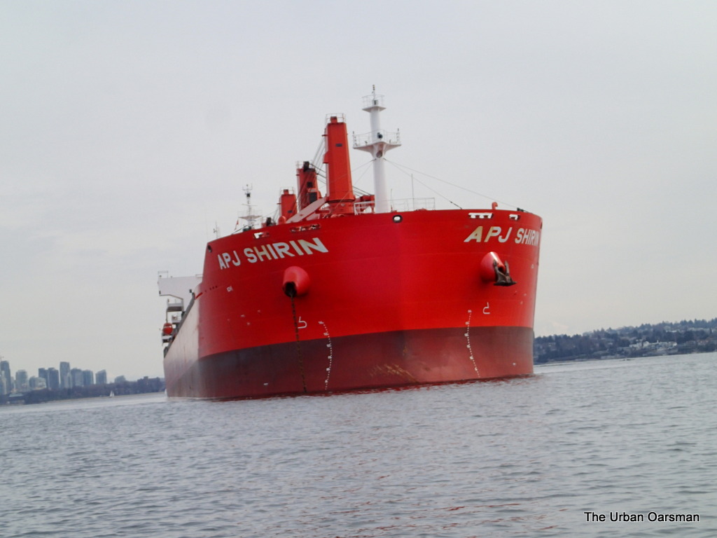
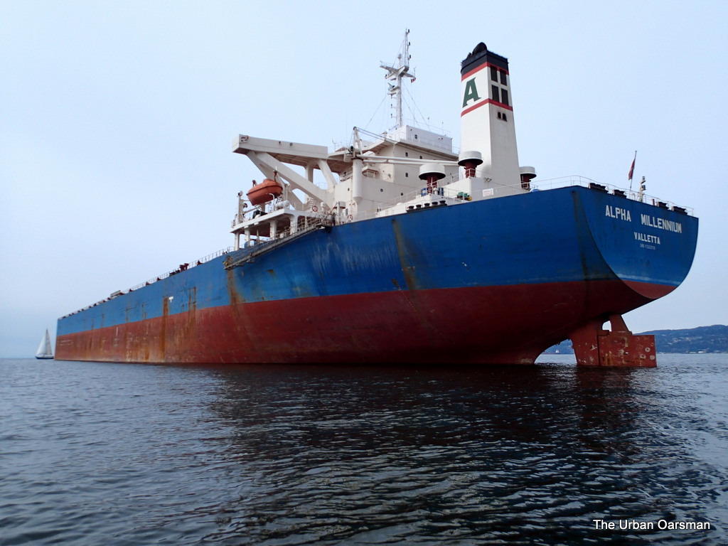
Deep Sea Freighter Blue Horizon

Blue Horizon has one of the bluntest bows I have ever seen,  No Bulbousness here.

The Urban Oarsman row to the North Arm of the Fraser from Hollyburn Sailing Club.
Looking East towards Lions Gate and First Narrows.

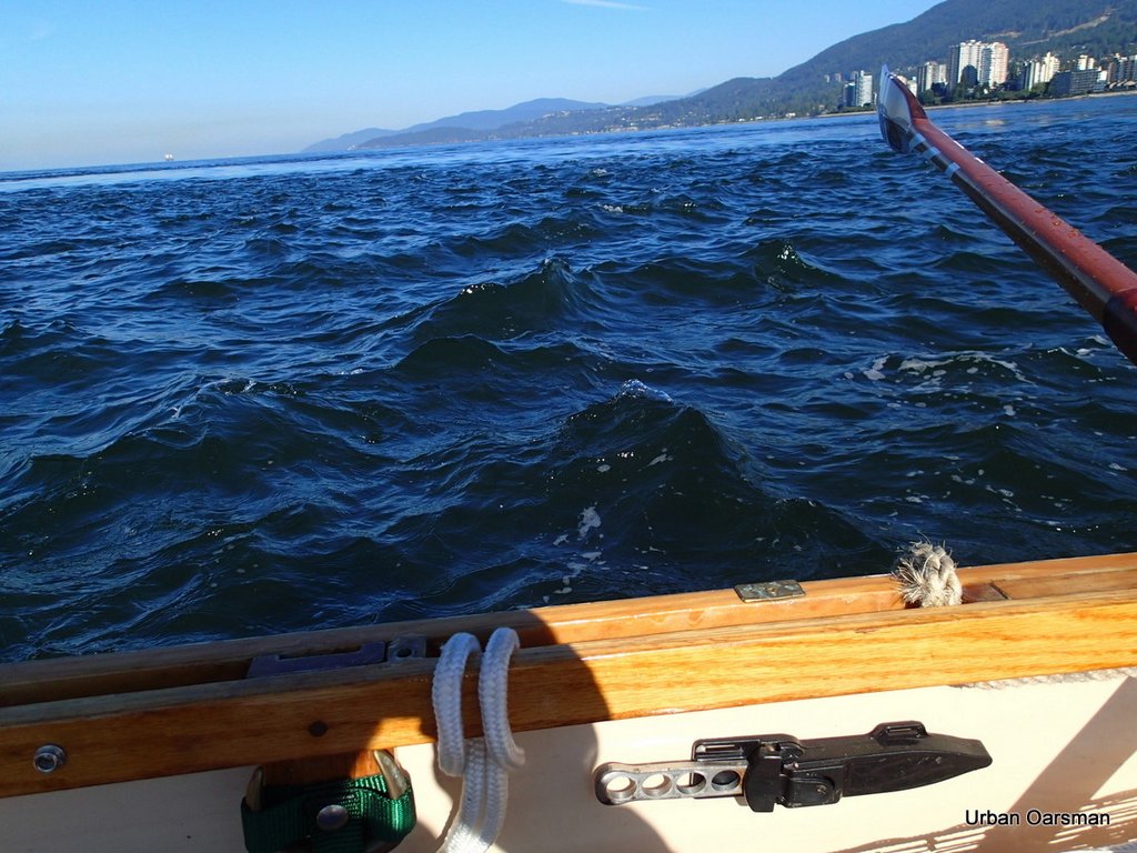
I have rowed south out of the main body of the current.  See how flat the water is towards the bridge.

The Urban Oarsman row to the North Arm of the Fraser from Hollyburn Sailing Club.
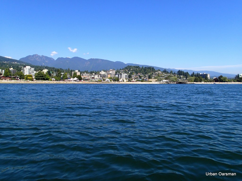
Out of the Maelstrom, heading for Point Grey.

There is almost no wind.  English Bay is almost glossy.  A good day to row.

The Urban Oarsman row to the North Arm of the Fraser from Hollyburn Sailing Club.
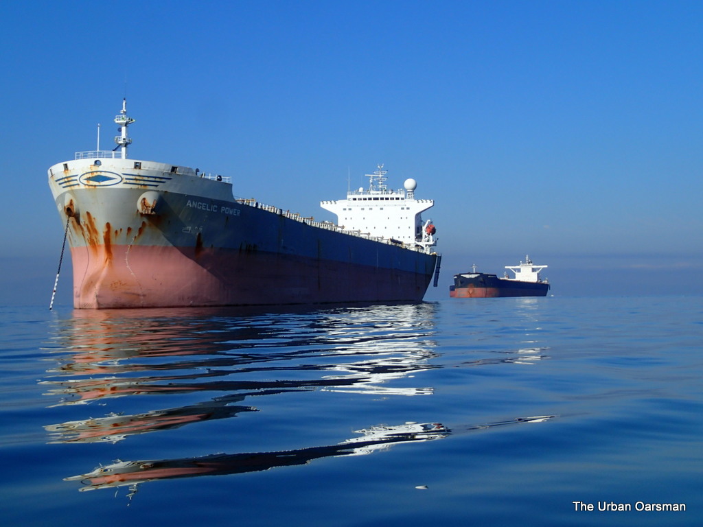
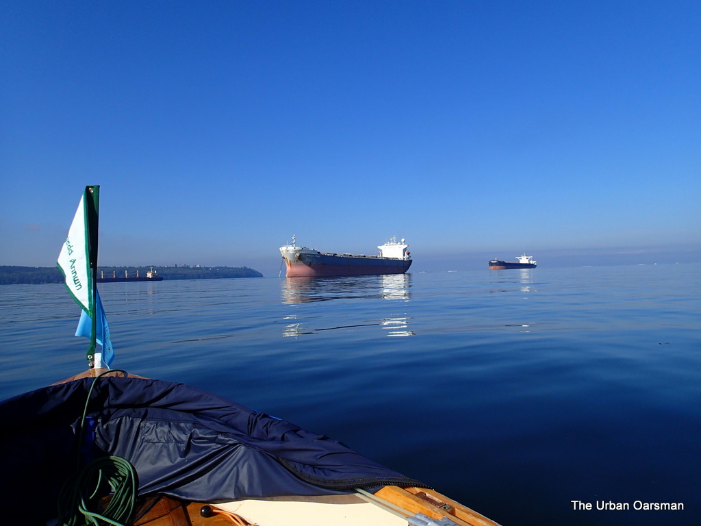
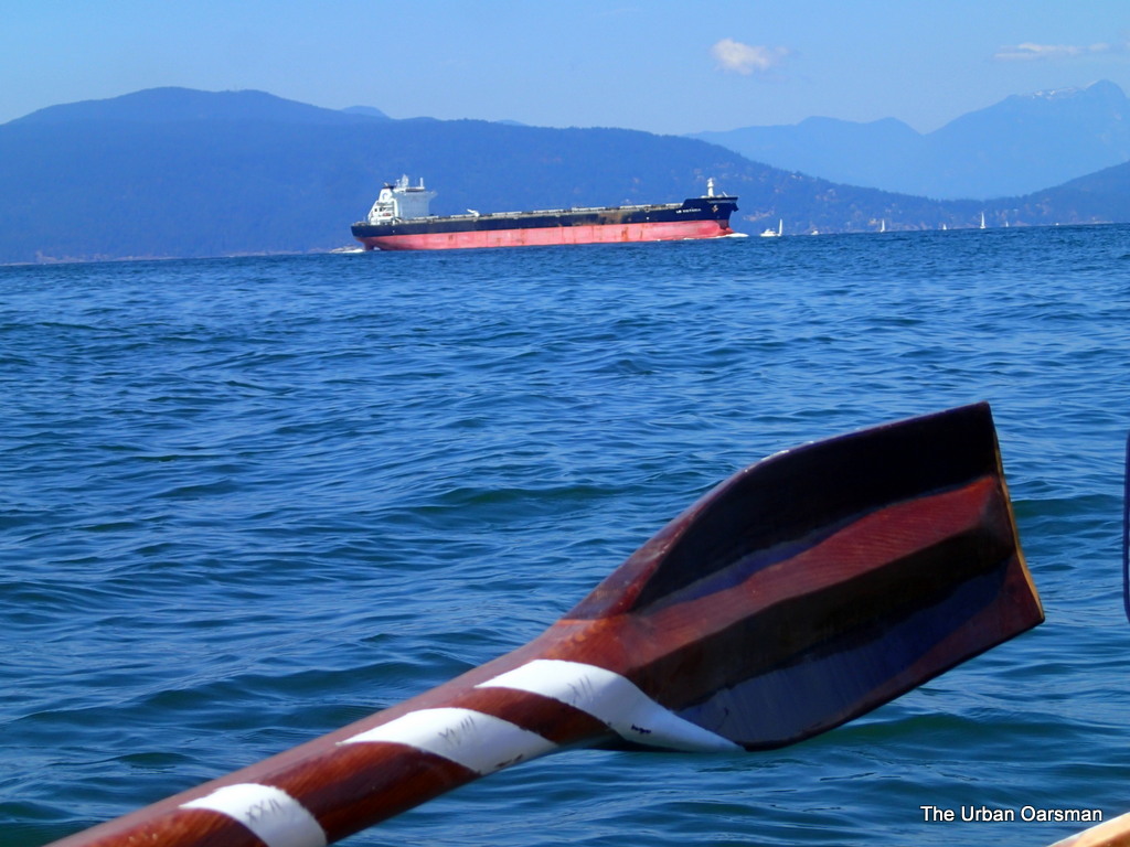
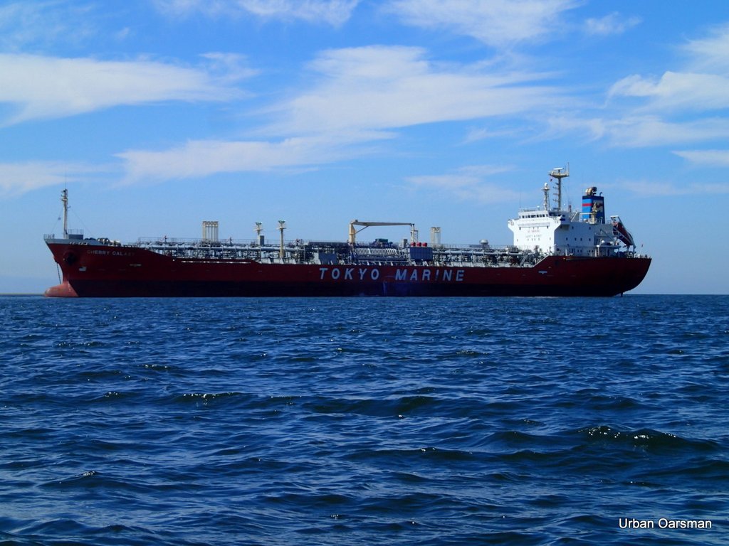
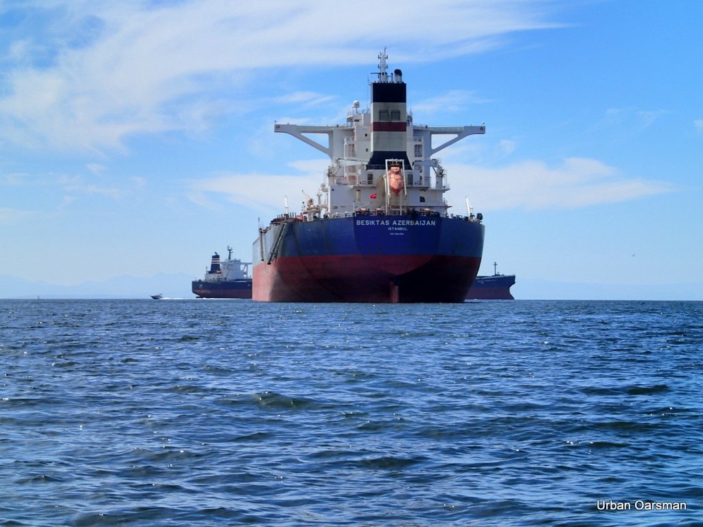
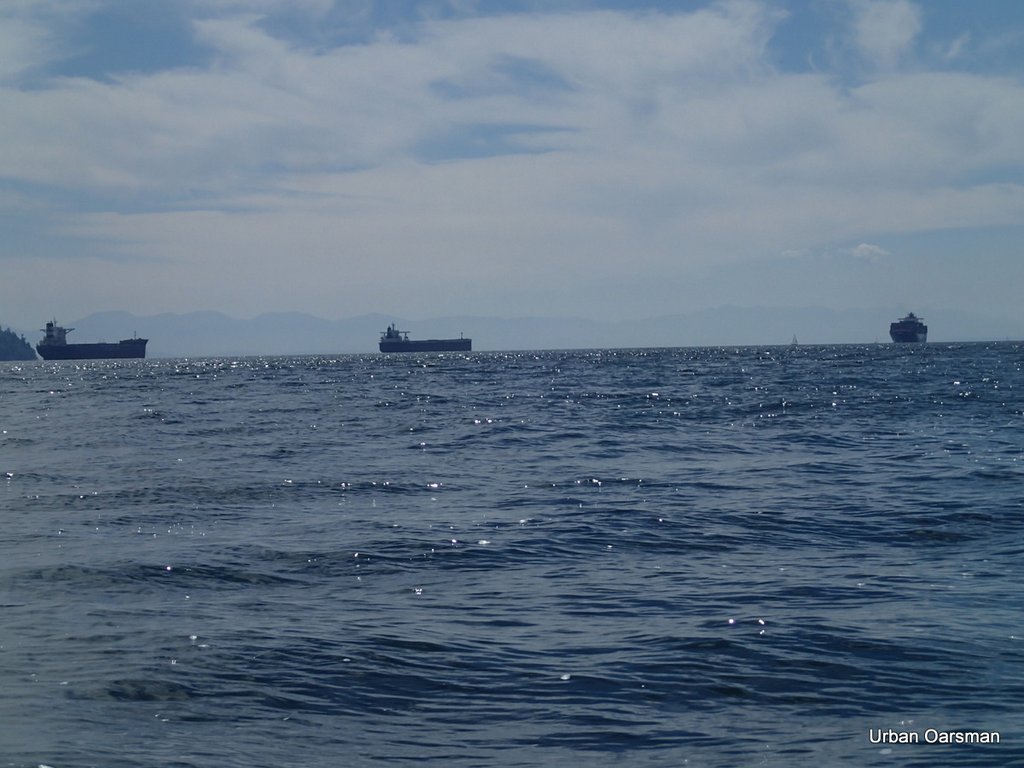
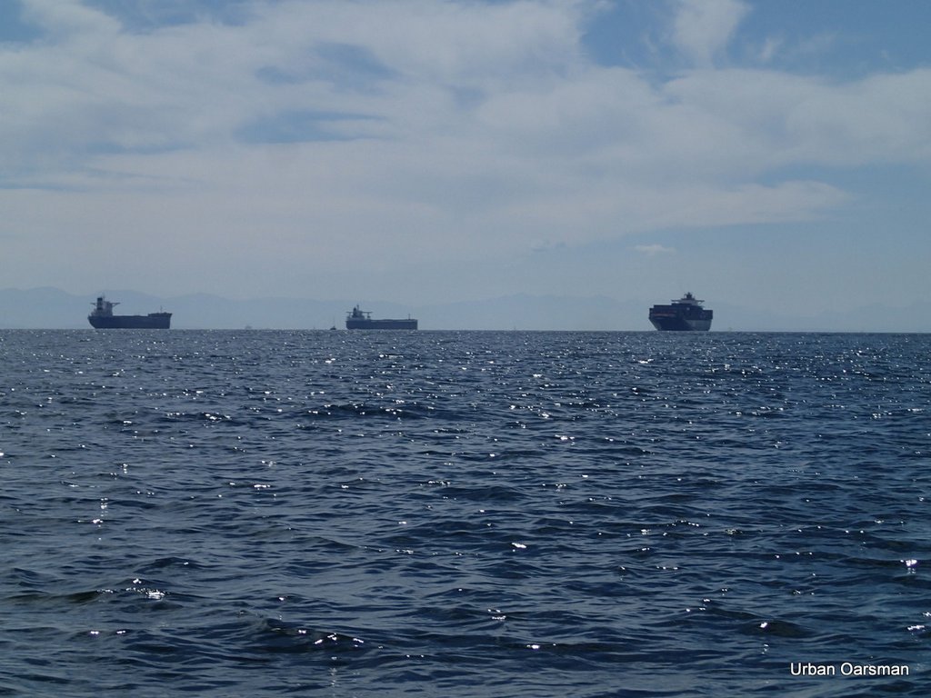
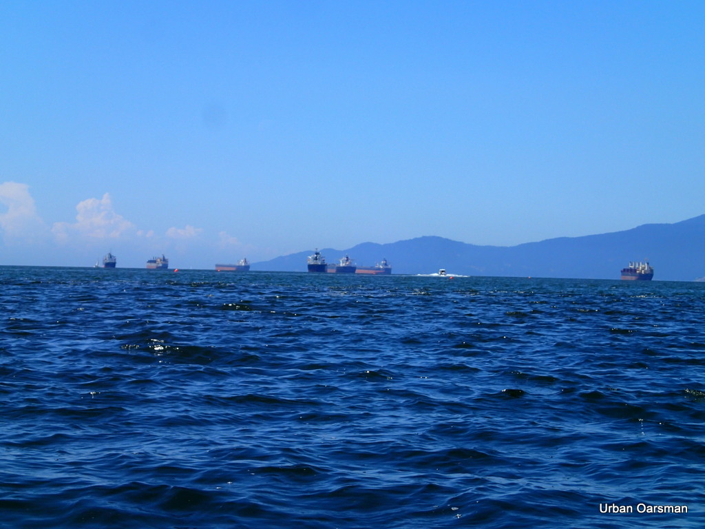
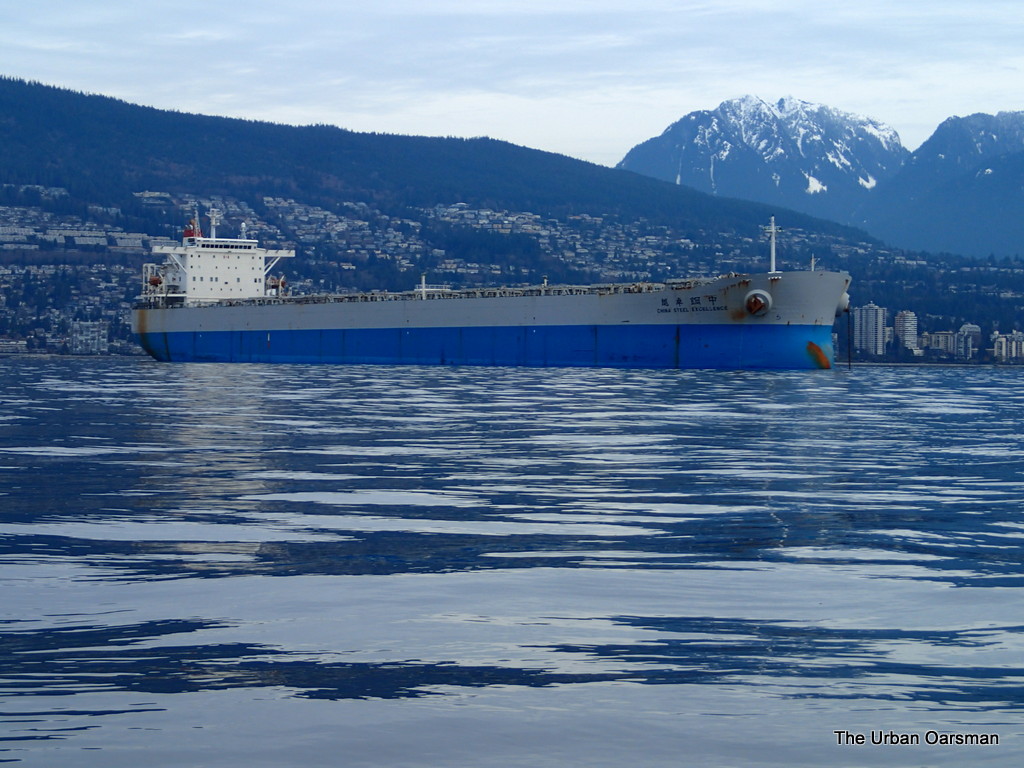
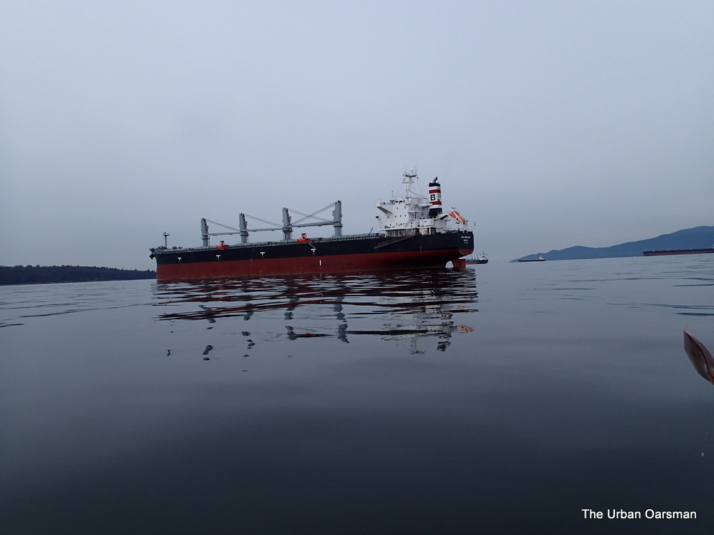
Angelic Power leads the line of Freighters anchored at anchorages 12, 14 & 16.

The deep sea freighters Angelic Power, Aquamarine and Global Partnership anchored in English Bay.

The Urban Oarsman row to the North Arm of the Fraser from Hollyburn Sailing Club.
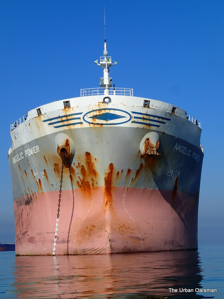
Bow of Angelic Power.  Note the painted figurehead.

Not a lot of current flowing here.  All freighters are massive.

The Urban Oarsman row to the North Arm of the Fraser from Hollyburn Sailing Club.
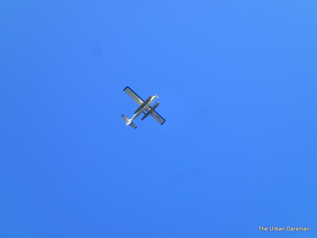
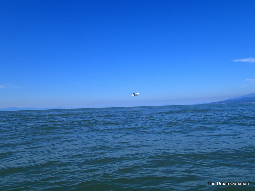
Floatplane heading from Victoria?

There is always a lot of floatplane traffic over English Bay.

The Urban Oarsman row to the North Arm of the Fraser from Hollyburn Sailing Club.
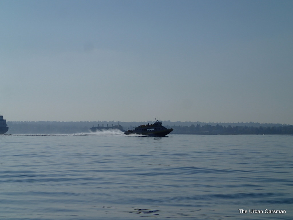
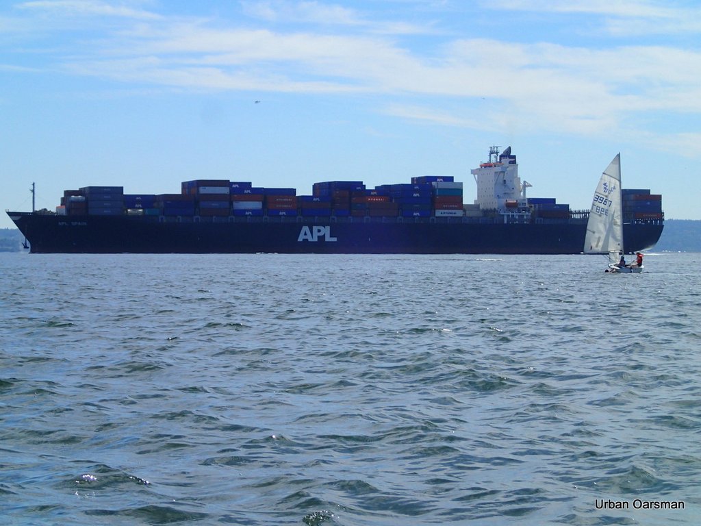
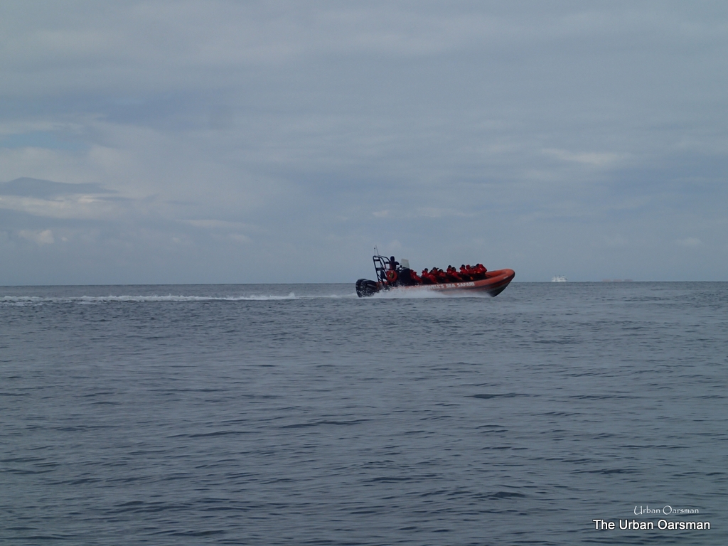
Prince of Whales tour boat.

There must be whales (or something for the tourists to see) to the west of us. 

The Urban Oarsman row to the North Arm of the Fraser from Hollyburn Sailing Club.
Gwragedd Annwn leaves the Aquamarine in her wake.

I continue rowing for Point Grey.

The Urban Oarsman row to the North Arm of the Fraser from Hollyburn Sailing Club.
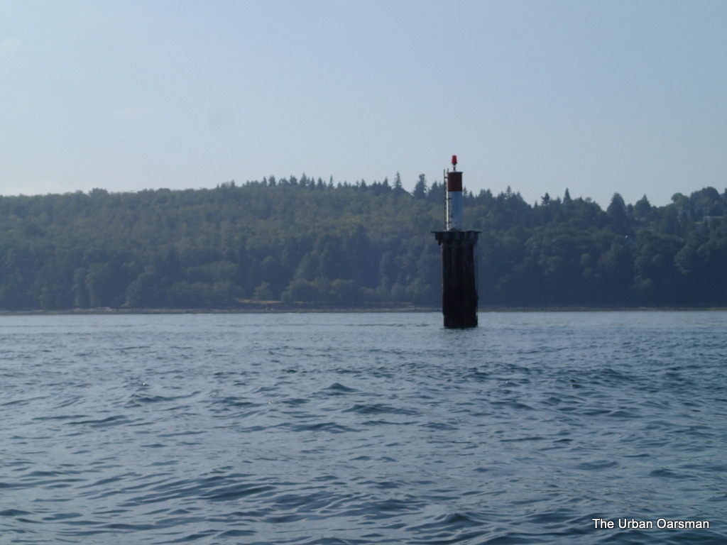
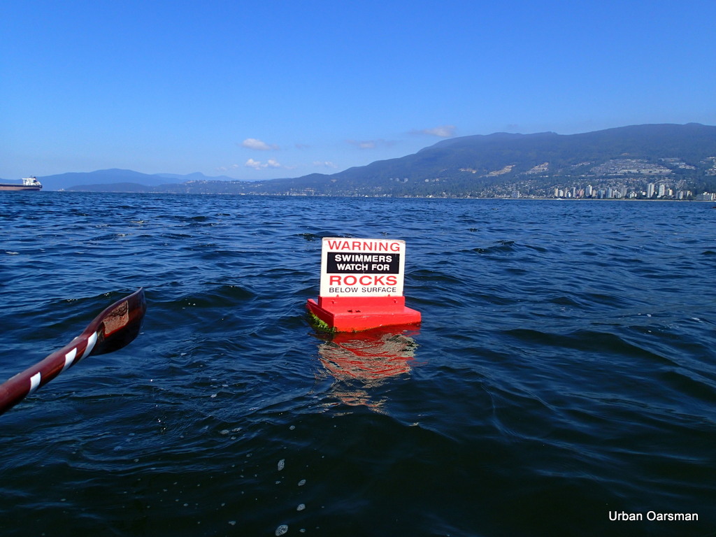
Marker FI(2) R at Spanish Banks.

I row past the marker at the edge of Spanish Banks.  It is shallow (drying) to the South and East of this marker.

The Urban Oarsman row to the North Arm of the Fraser from Hollyburn Sailing Club.
Leaving Spanish Banks behind.

I row on along the drop-off towards the North Arm.

067b BC Day row to North Fraser arm breakwater070a
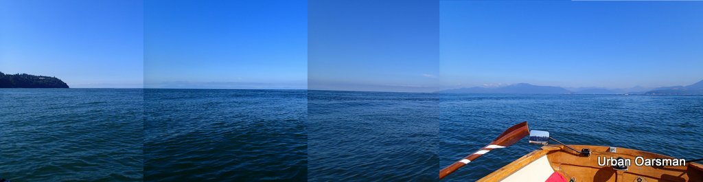
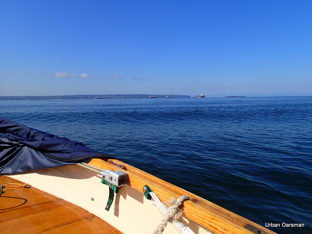
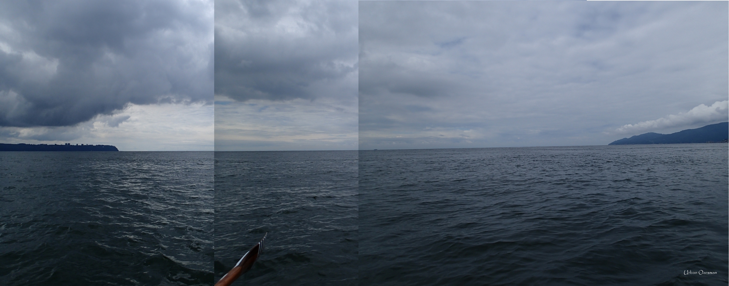
Cobbled-together picture looking West towards Vancouver Island.

When you are on the edge of English Bay, there is a lot of open ocean between you and Vancouver Island.  In this photo, Point Grey is on the left, Point Atkinson is on the right.  About 35 miles to Vancouver Island.

The Urban Oarsman row to the North Arm of the Fraser from Hollyburn Sailing Club.
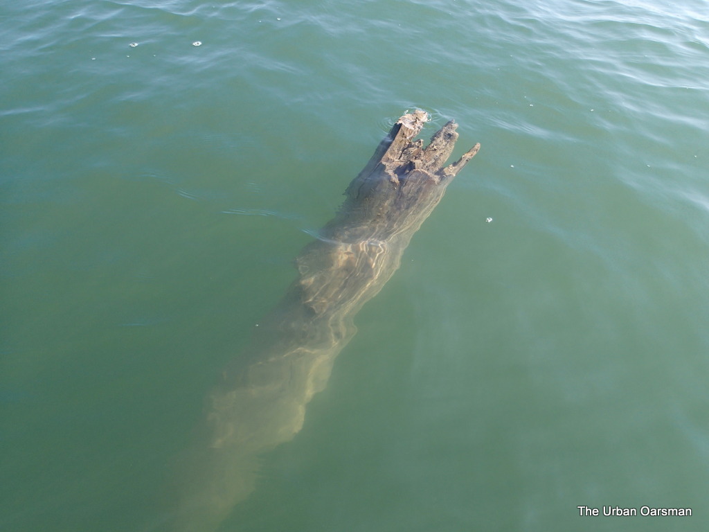
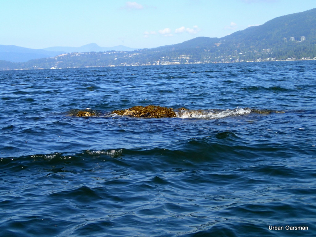
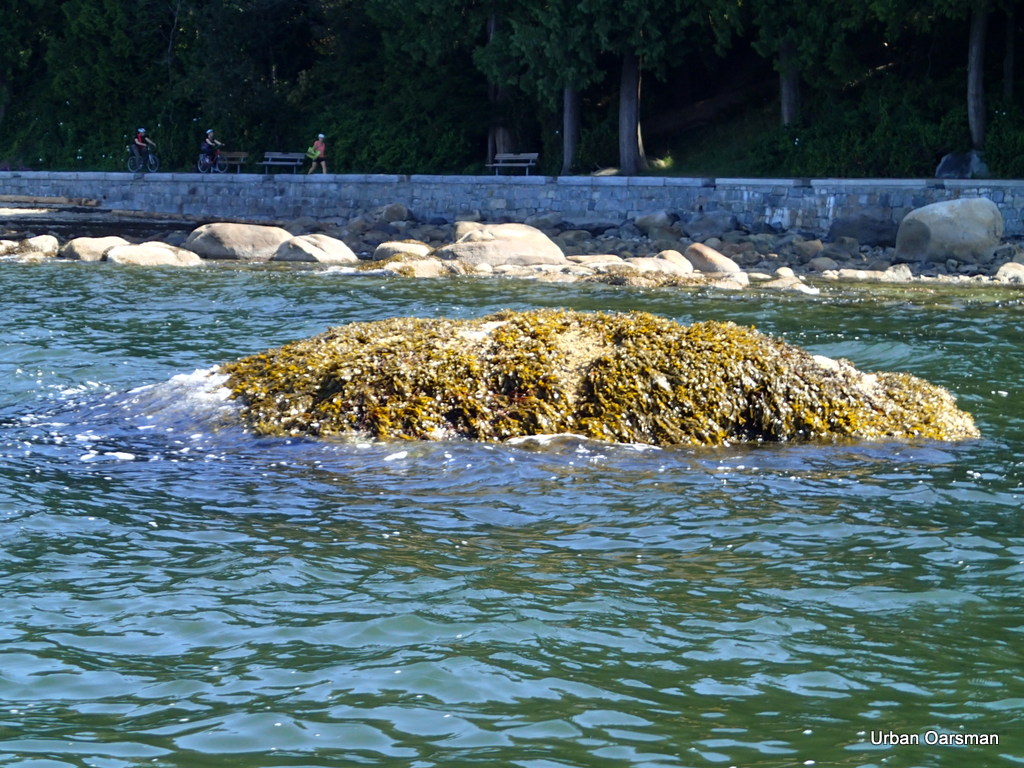
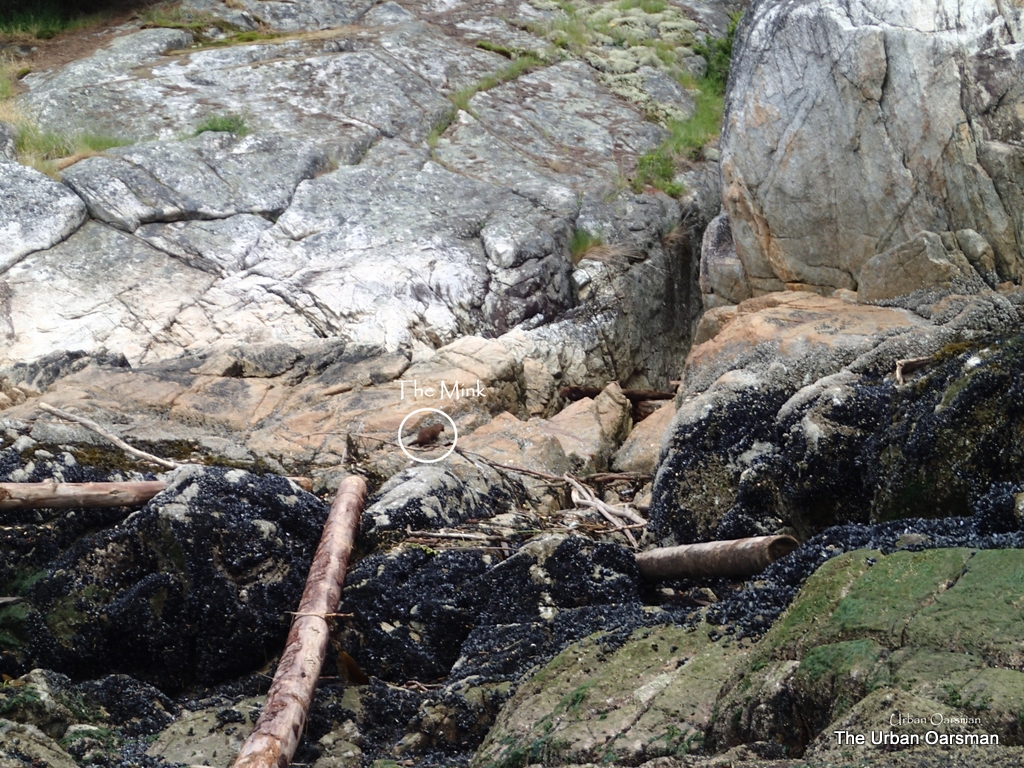
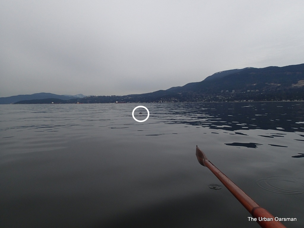
A deadhead lurks for the unwary Oarsman.

This is a smaller deadhead.  Still, if a boat hit this at speed, it would cause a lot of damage.  Good thing that I saw it in time to avoid it.
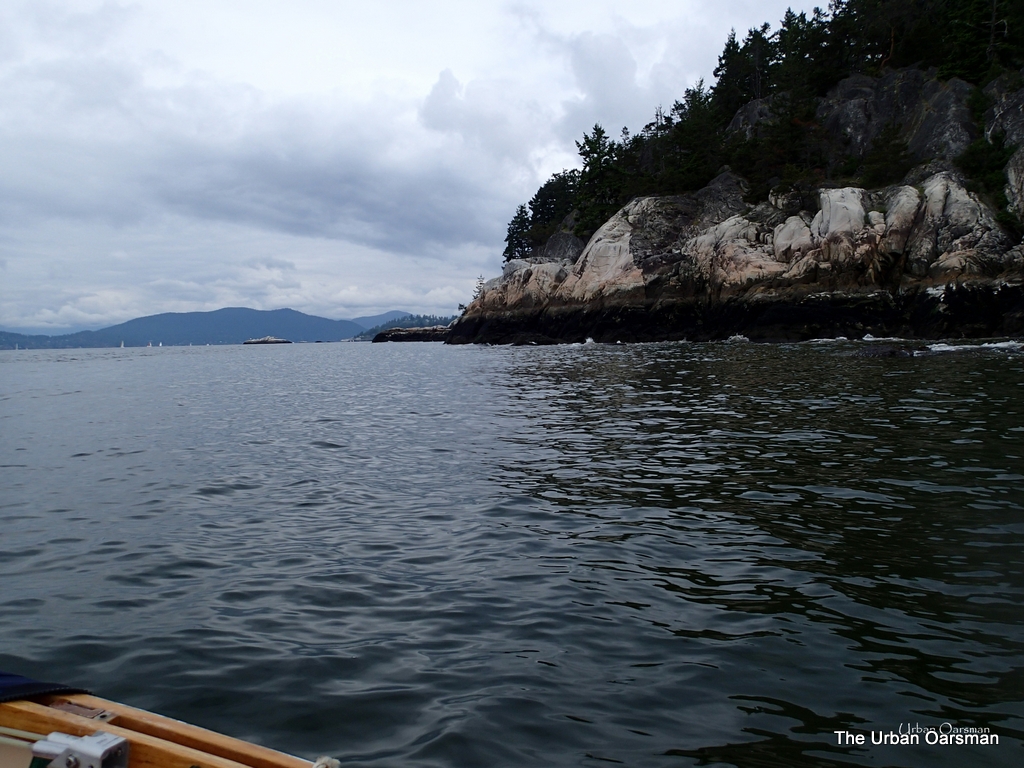
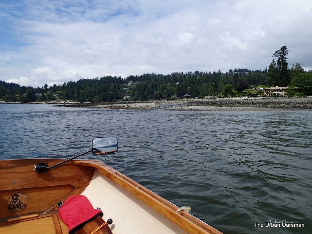
The Urban Oarsman row to the North Arm of the Fraser from Hollyburn Sailing Club.
Point Grey.

Getting closer to point Grey.  Amost no current here.

The Urban Oarsman row to the North Arm of the Fraser from Hollyburn Sailing Club.
Stand-Up Paddleboarder heading back
In calm water, you can make some very long voyages.  The most likely spot that this SUP came from is Jericho Sailing Centre, about  3 1/2 miles away from here.
The Urban Oarsman row to the North Arm of the Fraser from Hollyburn Sailing Club.
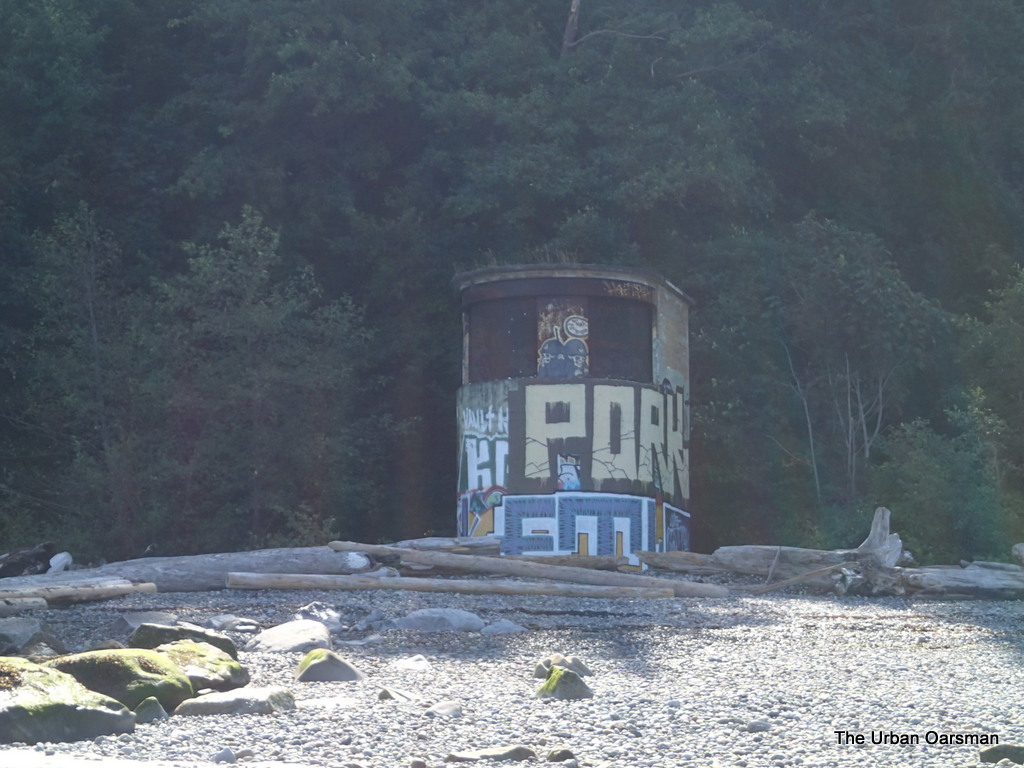
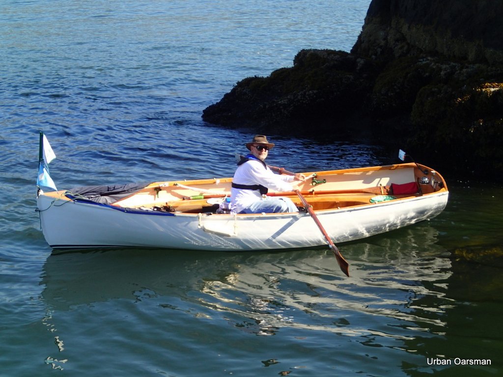
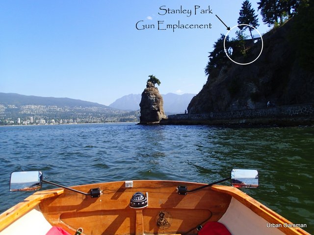
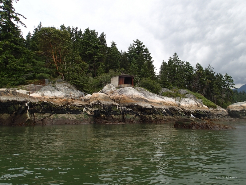
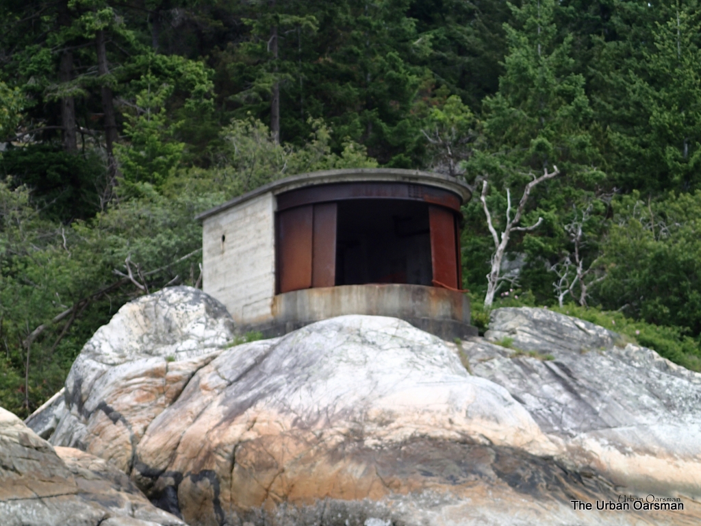
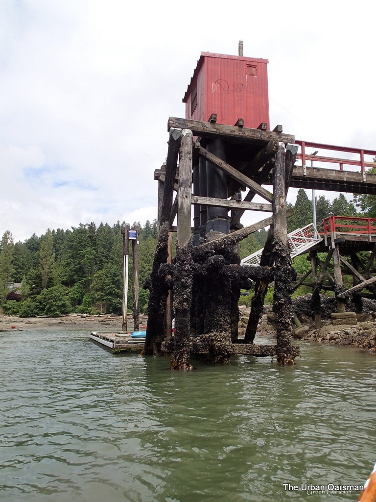
The North Point Grey Gun Emplacement.

Unlike the Gun emplacements at Lighthouse Park and Stanley Park, this one and the South Point Grey Gun Emplacement are covered with graffiti. 

The Urban Oarsman row to the North Arm of the Fraser from Hollyburn Sailing Club.
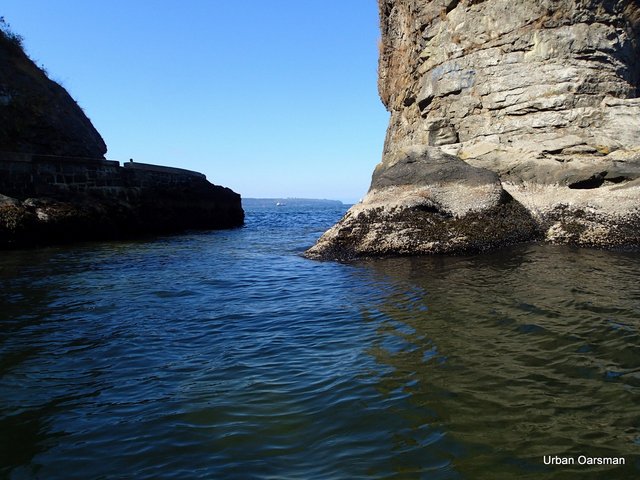
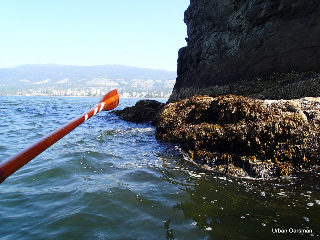
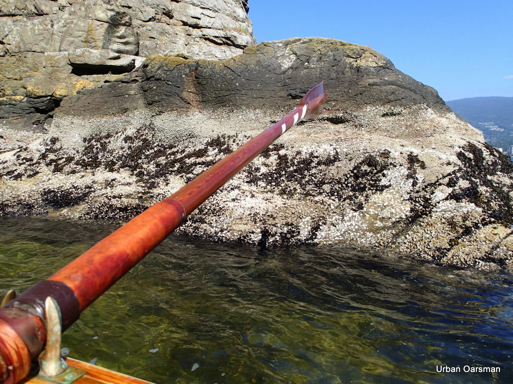
The water near the shore is shallow and rocky

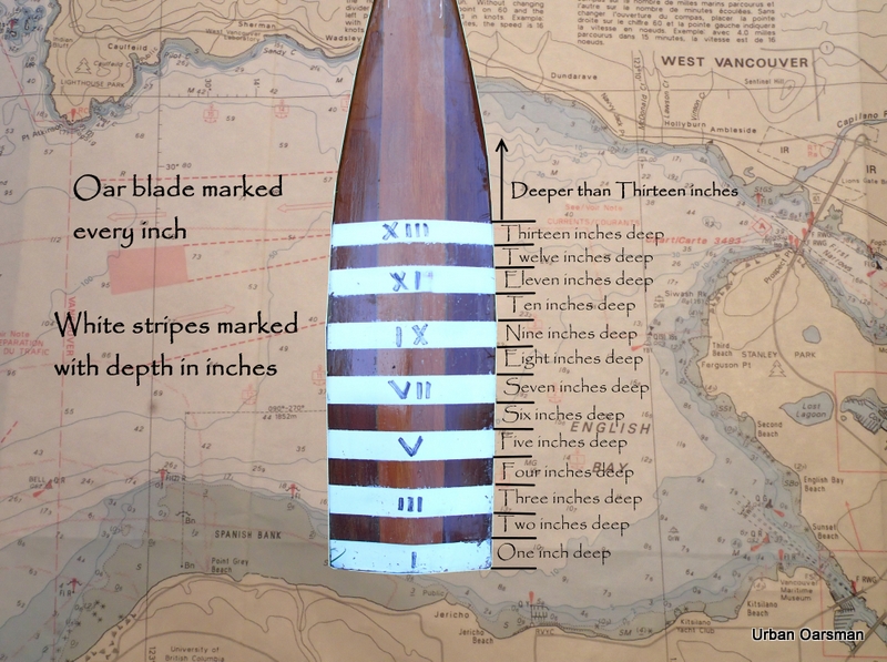
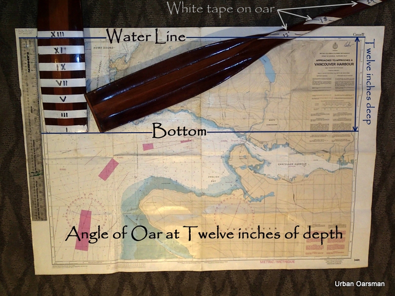
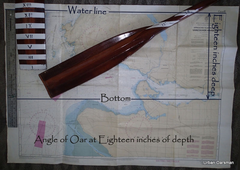
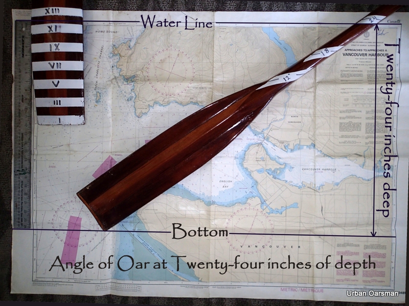
I am rowing Grwagedd Annwn backwards for better visibility, as the depthsounder oars tell me that the water is 18″ or less deep here. I think that I see a channel back out to the deeper water ahead.

The Urban Oarsman row to the North Arm of the Fraser from Hollyburn Sailing Club.
North Point Grey Gun Emplacement.

Looks like the ones at Lighthouse Park and Stanley Park.

 The Urban Oarsman row to the North Arm of the Fraser from Hollyburn Sailing Club.
Gwragedd Annnwn works her way backwards away from the beach past the shallows to deeper water.

I am rowing out the gap between two sandbars.  I wonder if a rip tide flows here when the tide is higher.

The Urban Oarsman row to the North Arm of the Fraser from Hollyburn Sailing Club.
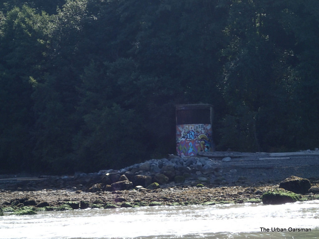
South Gun Emplacement at Point Grey.

The South Gun Emplacement has different graffiti than the North one.

The Urban Oarsman row to the North Arm of the Fraser from Hollyburn Sailing Club.
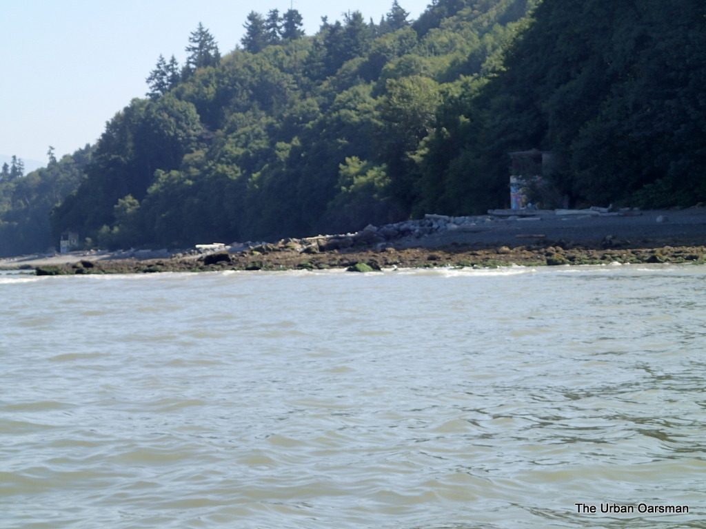
North and South Gun Emplacements.

View looking North-East of the two Gun Emplacements. 

The Urban Oarsman row to the North Arm of the Fraser from Hollyburn Sailing Club.
Looking North off Point Grey.

The view back home.  Still a little way to go to get to the North Arm Jetty.  I row on.

The Urban Oarsman row to the North Arm of the Fraser from Hollyburn Sailing Club.
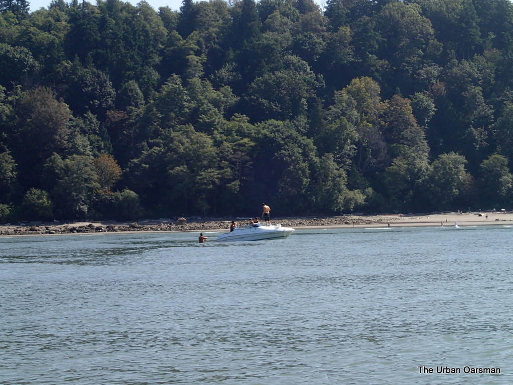
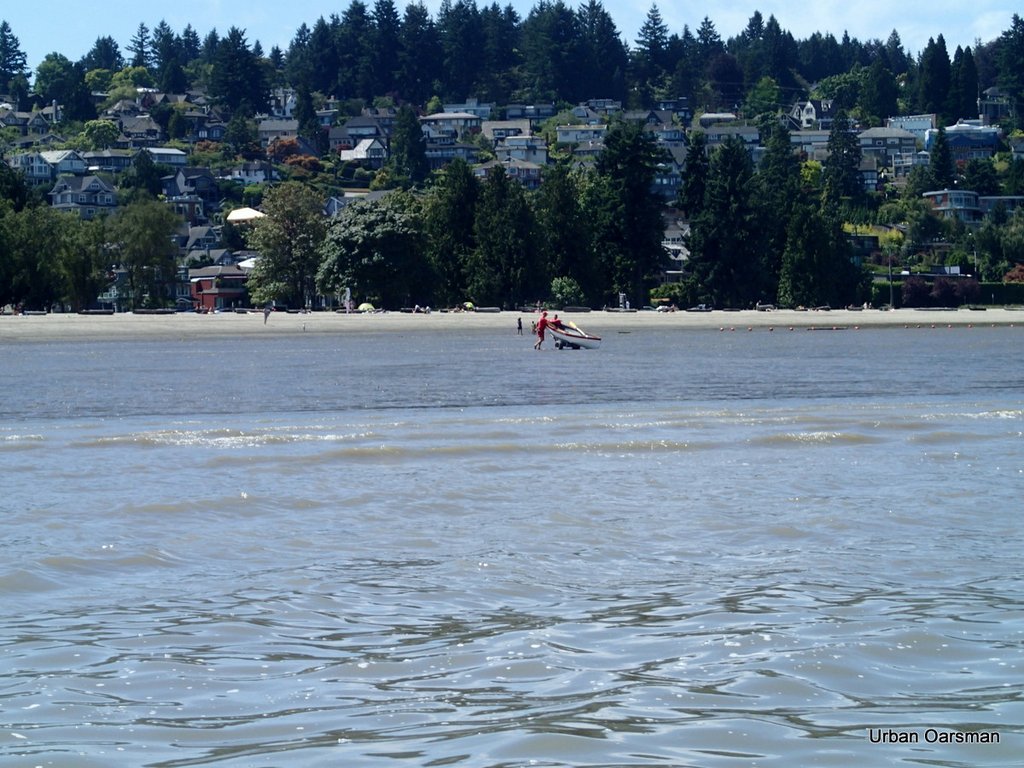
Boat anchored off Wreck Beach.

A powerboat anchored off Wreck Beach.  The man to the left of the boat is standing in the water.  It is very shallow and sandy here.  A good swimming beach.  I am still heading for the North Arm Jetty.

The Urban Oarsman row to the North Arm of the Fraser from Hollyburn Sailing Club.
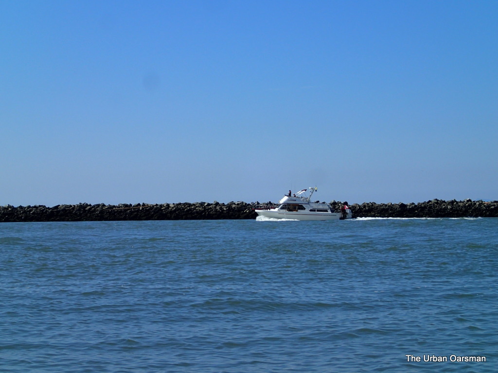
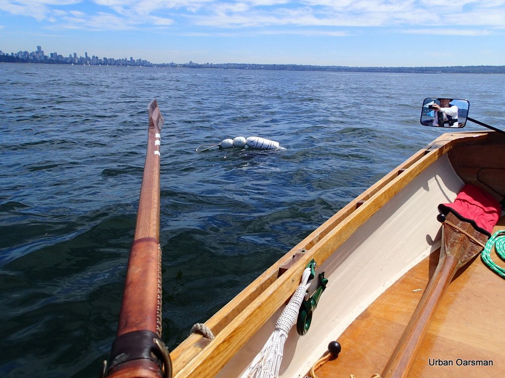
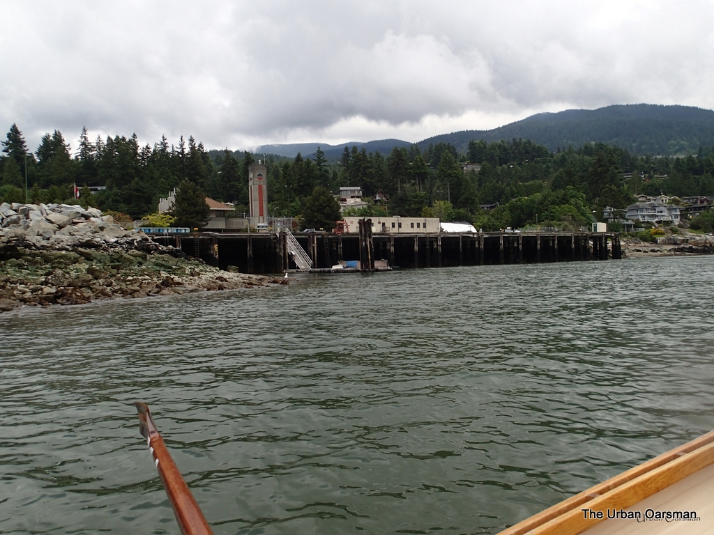
Powerboat heading up the North Arm.  The tide has not yet turned.

A powerboat heading up river.  The tide is almost slack.  This is about as far as I go.  Time for lunch until the tide begins to flood.

The Urban Oarsman row to the North Arm of the Fraser from Hollyburn Sailing Club.
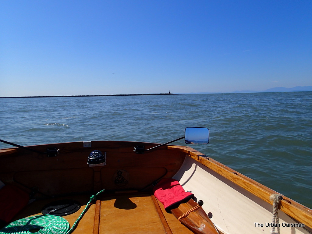
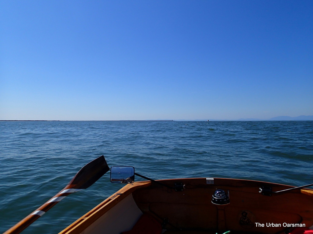
Leaving the North Arm behind.

Just about 11:30.  I am rowing back towards Hollyburn.  Long way to go. 

The Urban Oarsman row to the North Arm of the Fraser from Hollyburn Sailing Club.
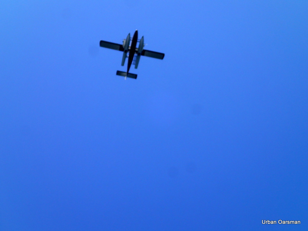
A Seaplane flies South.  Better flying down low?

This seaplane flew south past me at a low altitude.  I wonder why so low?

The Urban Oarsman row to the North Arm of the Fraser from Hollyburn Sailing Club.
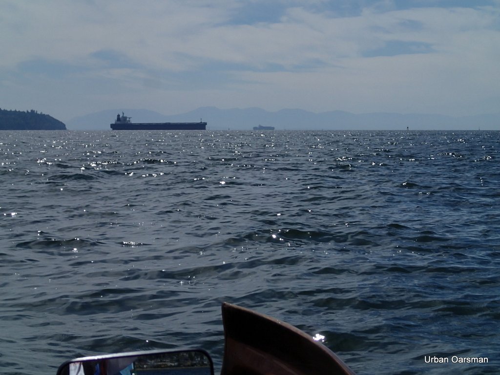
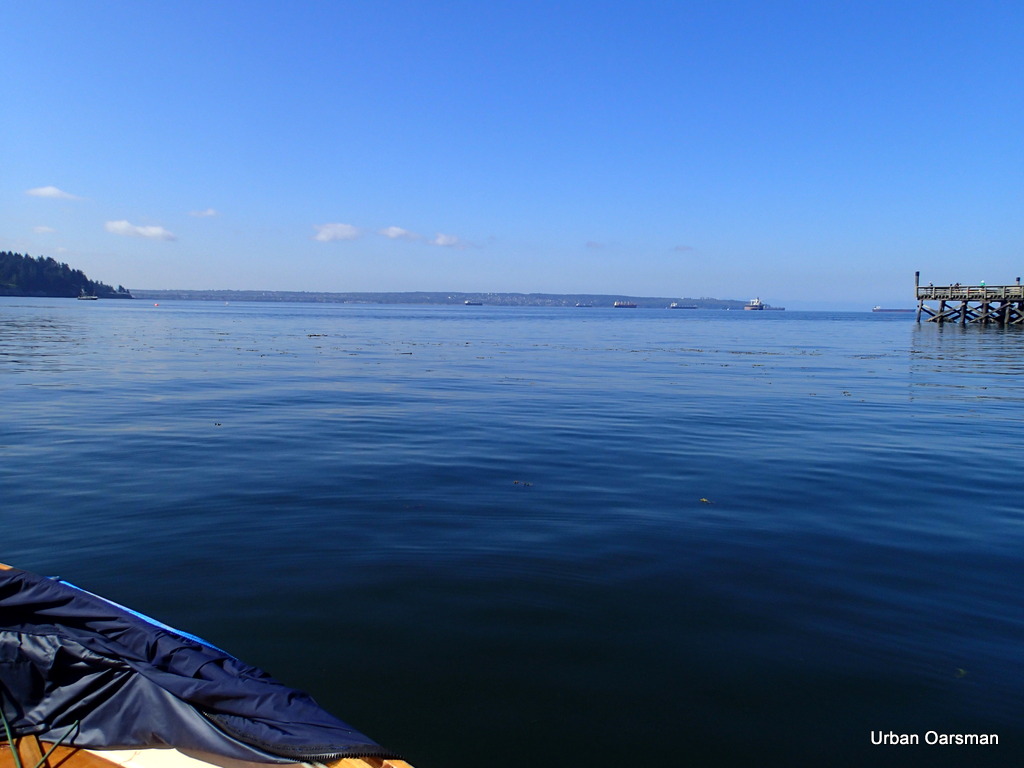
North Arm of the Fraser in the distance

On the row home, leaving the North Arm Jetty behind.

The Urban Oarsman row to the North Arm of the Fraser from Hollyburn Sailing Club.
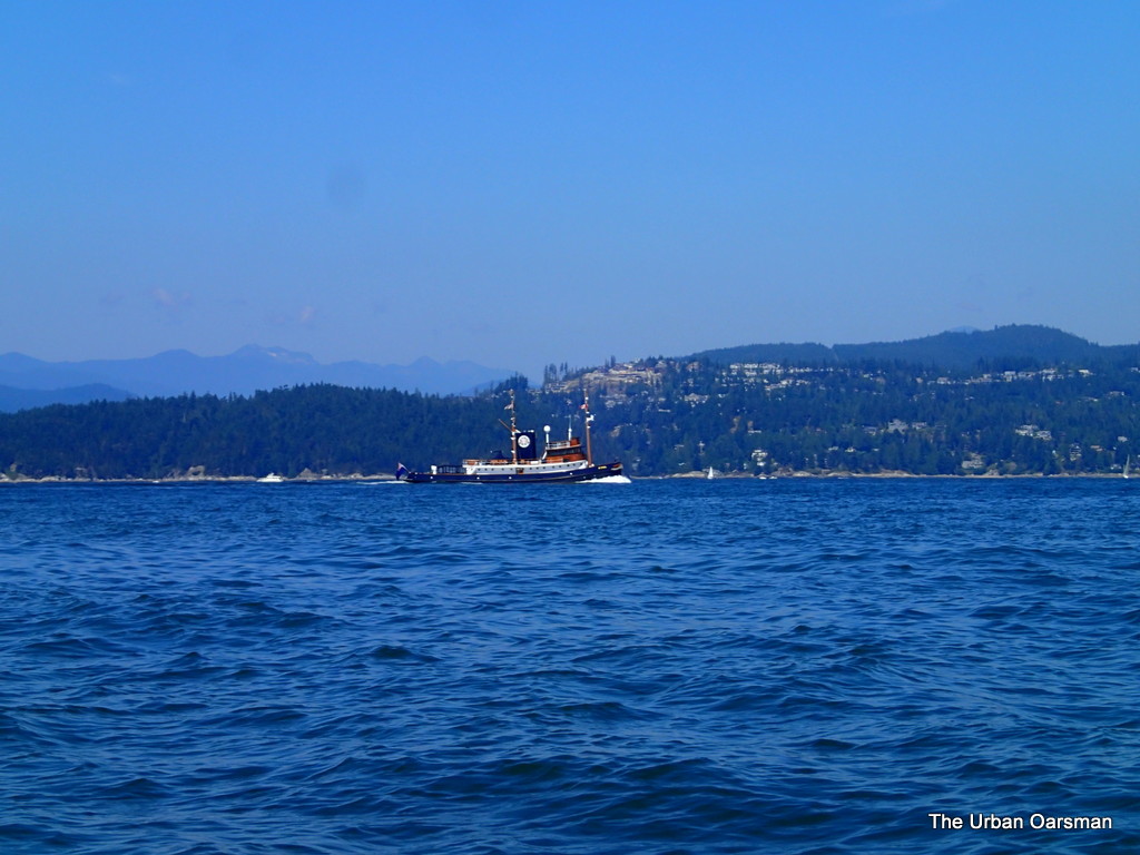
Tug Boat Yacht St. Ives.

Just ahead of the deep sea frieghter Les Victoria is the St. Ives.  This tug is usually moored at the Cate’s tugs dock by Lonsdale Quay.  Very pretty.

The Urban Oarsman row to the North Arm of the Fraser from Hollyburn Sailing Club.
The deep sea freighter Les Victoria enters port for Burrard Inlet.

As usual, I first heard about the Les Victoria entering port on the Vancouver Port Traffic channel.  She is moving quickly along into harbour.

The Urban Oarsman row to the North Arm of the Fraser from Hollyburn Sailing Club.
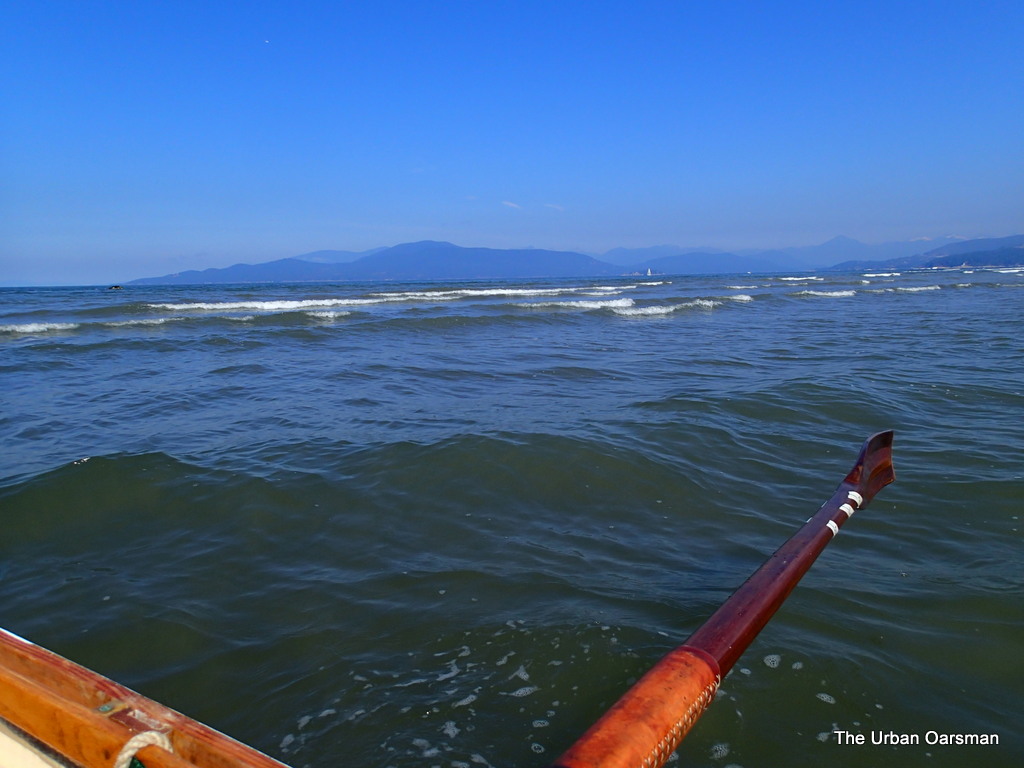
I wonder how many oarspower she has?

Happy that I am not in the shipping channel right now.

The Urban Oarsman row to the North Arm of the Fraser from Hollyburn Sailing Club.
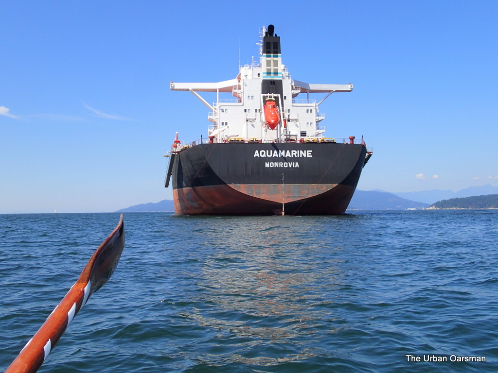
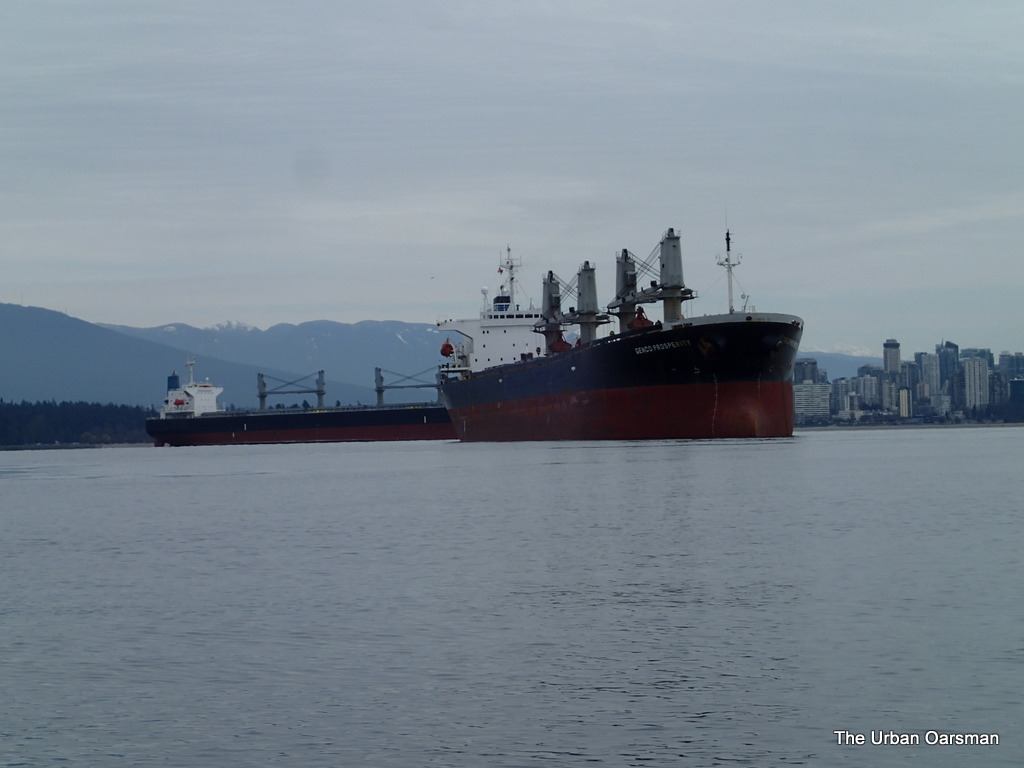
Passing the Aquamarine on the way home.

On the way back, I pass between the Aquamarine and the Angelic Power.

The Urban Oarsman row to the North Arm of the Fraser from Hollyburn Sailing Club.
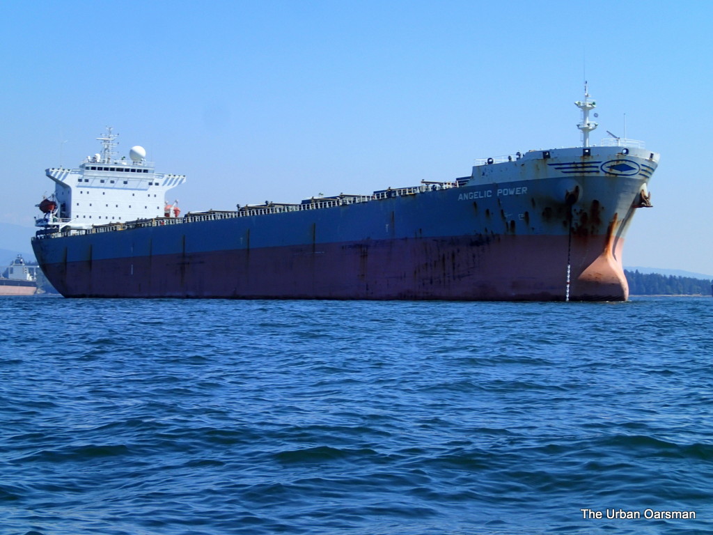
Angelic Power on the return.

Notice how much rougher the water is than on the way out.  The breeze has come up from the South-West.

The Urban Oarsman row to the North Arm of the Fraser from Hollyburn Sailing Club.
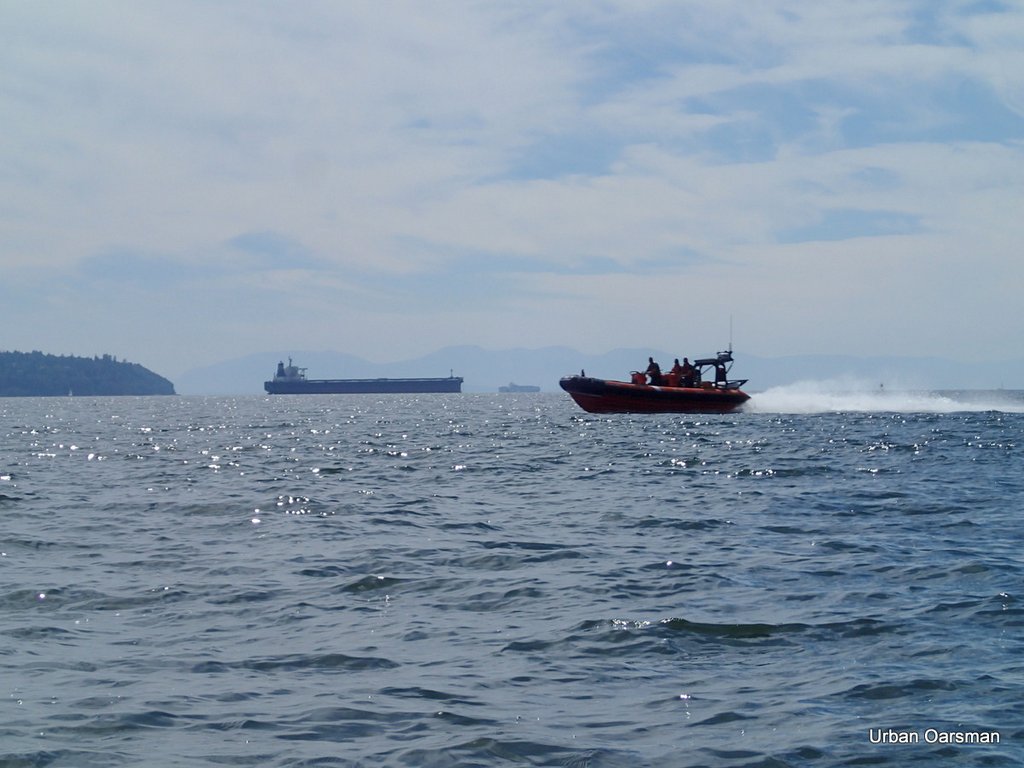
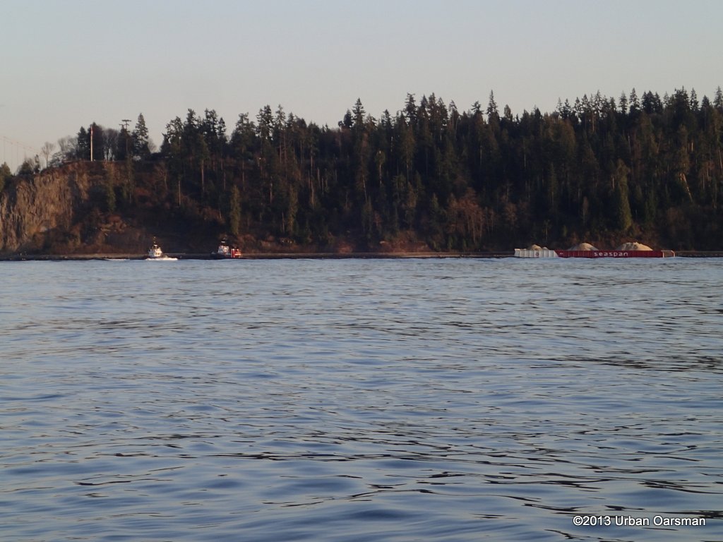
Seaspan Commander heading in.

The tug Seaspan Commander has finished her tow and is heading back to port.

The Urban Oarsman row to the North Arm of the Fraser from Hollyburn Sailing Club.
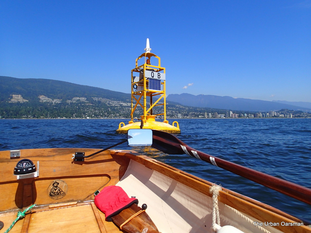
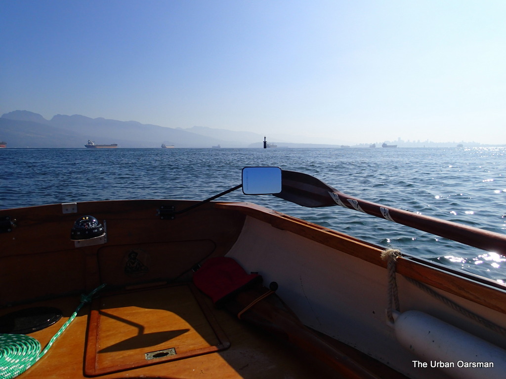
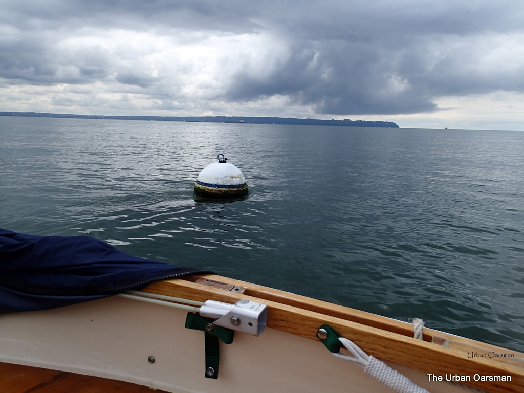
Traffic Separation Buoy QB.

Traffic Separation Buoy QB in in English bay.  Traffic Separation buoy QA is about 2 1/2 miles west of Point Grey outside of the bay.
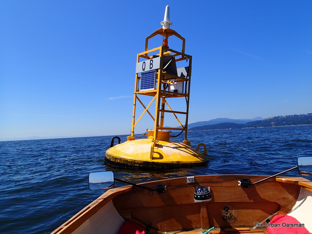
The Urban Oarsman row to the North Arm of the Fraser from Hollyburn Sailing Club.
Buoy QB.

There is a two knot flood current into English Bay here. 

The Urban Oarsman row to the North Arm of the Fraser from Hollyburn Sailing Club.
Looking South-West towards the anchored Deep Sea freighters in English Bay. 

Getting closer to HSC with every stroke.

The Urban Oarsman row to the North Arm of the Fraser from Hollyburn Sailing Club.
The “Pink Building”.  Almost home.
It is always “not long now” when I close on the “Pink building”.
The Urban Oarsman row to the North Arm of the Fraser from Hollyburn Sailing Club.
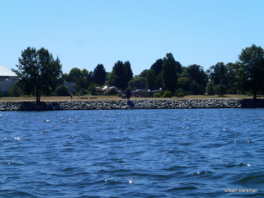
John Lawson Park and the Harmony Arts Festival.

The Harmony Arts Festival starts just west of the Sailing Club.

The Urban Oarsman row to the North Arm of the Fraser from Hollyburn Sailing Club.
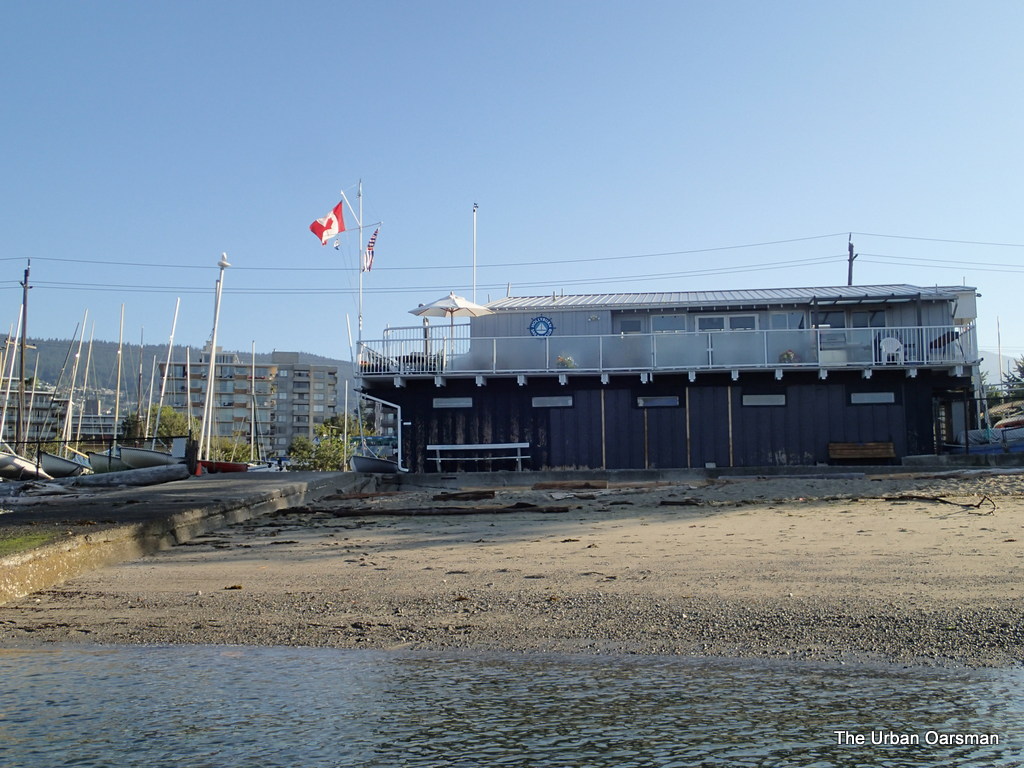
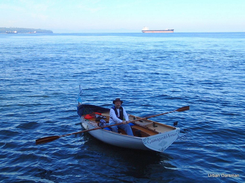
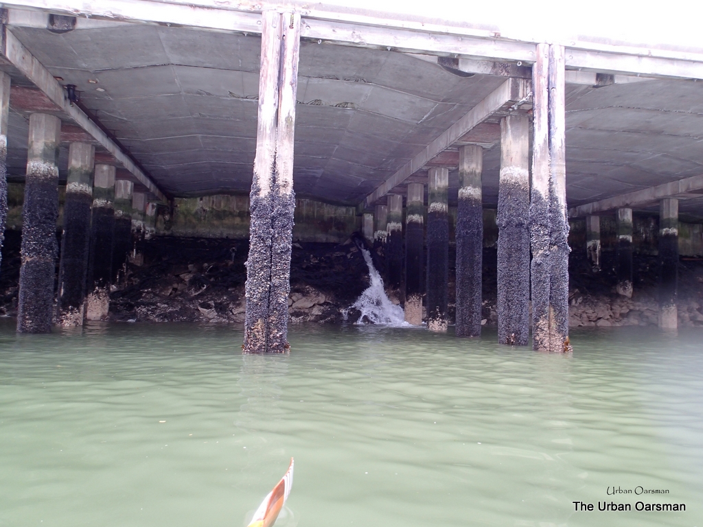
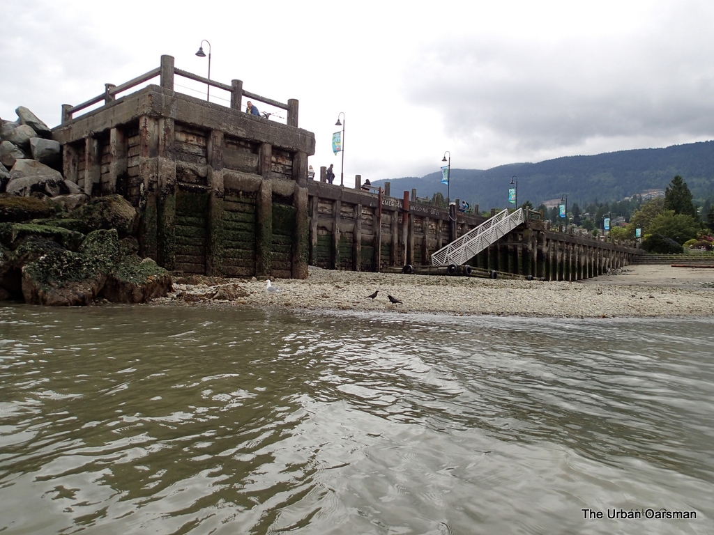
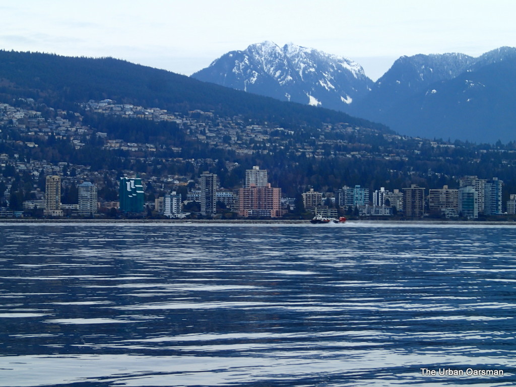
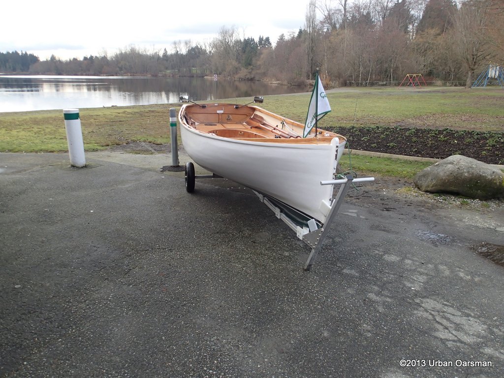
The Ambleside Fishing Pier and the Hollyburn Sailing Club.

Almost home.  by the time I land, I will have rowed Gwragedd Annwn for over six hours.  Under good conditions, the North Arm is three hours away.  Quite the row, you should try it sometime.

The Urban Oarsman


Happy rowing.

Mike

Posted in Under the Keel.... | Comments Off on Rowing to the Fraser River North Arm Jetty and back

The Urban Oarsman. Summer Sunshine Row

Summer Sunshine Row
The Summer Sunshine Row.  The tide was high at 6:47am at 4.3 meters or 14.1 feet.  It will be going out until 1:40pm at .5 meter or 1.6 feet.  The next high is at 8:32pm at 4.8 meters or 15.7 feet.
The rowing plan is to row across the shipping channel, South along Stanley Park, West along Kits, Jericho and Point Grey beaches, across English Bay, back to the West Vancouver shore and return to Hollyburn Sailing Club.
Gwragedd Annwn at Hollyburn Sailing Club
Gwragedd Annwn at the beach, Hollyburn Sailing Club
I have Gwragedd Annwn on the beach at Hollyburn Sailing Club at 8:45am.  The weather is perfect.
Summer Sunshine Row003-001
A loaded freighter outbound from First Narrows.
Just as I launch Gwragedd Annwn, a deep sea freighter comes out of Burrard Inlet and sails West out from under Lions Gate Bridge headed for the Strait of Georgia.  I have my VHS radio tuned to channel 12,  Vancouver Harbour Traffic radio.  There are no freighters due under the bridge for a while, so I make for the crossing.
OLYMPUS DIGITAL CAMERA
Not much wind at the club.
Leaving the Club behind, there is almost no wind, only a slight Westerly drift to rustle the flag.
OLYMPUS DIGITAL CAMERA
Gwragedd Annwn in the Maelstrom
Crossing the shipping channel, the ebbing tide creates quite a current.  The swells always build here.
OLYMPUS DIGITAL CAMERA
Almost through the Maelstrom
In the picture you can see the edge of the current.  Sometimes the Maelstrom goes all the way to Lighthouse Park (Point Atkinson).  In the distance you can see the freighter heading out.  The freighter is only ten minutes past where I am now.  Those things really move.
OLYMPUS DIGITAL CAMERA
The Maelstrom is in the centre of the shipping channel
Again, you can see a boat on the North Side of the current.  I am almost at the South edge of the Maelstrom heading for Siwash Rock.
OLYMPUS DIGITAL CAMERA
The Bowen Belle races out of First Narrows.
I think that this is a water taxi.  I have seen her in False Creek at Granville Island.
OLYMPUS DIGITAL CAMERA
The Prince of Whales tour boat coming out of Burrard Inlet
Sort of a cute name…”The Prince of Whales”.  A whale watching tour boat?  How far do they have to go to see whales, I wonder?
OLYMPUS DIGITAL CAMERA
Siwash Rock
It has taken me about 30 minutes to get here.  I will row up to the gap between the Seawall and Siwash Rock to see if it is deep enough to navigate.
OLYMPUS DIGITAL CAMERA
The gap between Siwash Rock and the Seawall.
There is a breaking rock in the middle of the channel.  The tide is falling.  I will not be able to circumnavigate Siwash Rock today.  I am too late for the tide.  It is 9:20am and the tide was at 3.4 meters at 9:00am.  The ballpark is for a 3.5 meter tide for Gwragedd Annwn be able to float in the gap.
OLYMPUS DIGITAL CAMERA
The Urban Oarsman in Gwragedd Annwn at the Gap.
The Urban Oarsman in his natural habitat.  I was speaking to a fellow on the Seawall, an oarsman named “Mike” and he offered to take my picture with my camera.  I do not often (or ever!) get to have a picture taken of me in Gwragedd Annwn.  Mike used to do a lot of rowing on the lakes in the interior.   He was bicycling around the Seawall.
OLYMPUS DIGITAL CAMERA
The Urban Oarsman in Gwragedd Annwn leaving Siwash Rock.
The Urban Oarsman in his natural element without sunglasses.  Stanley Park casts quite a shadow just South of Siwash Rock.  Mike was trying to get a photo of me with a freighter in the background.  I would like to thank Mike for taking these pictures.  One meets oarsmen in the most unlikely places.
OLYMPUS DIGITAL CAMERA
The Gun Emplacement above Siwash Rock in Stanley Park.
Most people who see this structure (from above) think that it is a viewing platform.  It is not.
I have seen people on top of it looking out at the view.  A good view for harbour defence.
OLYMPUS DIGITAL CAMERA
Tour boat out of False Creek
A tour boat zips along the Seawall.  Looking for whales I guess.
OLYMPUS DIGITAL CAMERA
Harbour Patrol boat laying floats for the English Bay Fireworks.
The Harbour Patrol boat “Takaya” was putting out floats to mark the exclusion zone around the fireworks barges.
OLYMPUS DIGITAL CAMERA
Buoy Q52 off English Bay Beach.
This buoy marks the Southern boundary of the False Creek Shipping Channel.
OLYMPUS DIGITAL CAMERA
Fellow rowboats in the Heritage Harbour by the Maritime Museum.
Three wooden rowboats at the Heritage Harbour.  The floathouse is the Heritage Harbour Wooden Boat Shop.
OLYMPUS DIGITAL CAMERA
North Star of Herschel Island.
In the Heritage Harbour there a number of wooden boats tied up.  The North Star of Herschel Island is probably the biggest one.
OLYMPUS DIGITAL CAMERA
Reflections on the stern of the North Star of Herschel Island.
Nice looking rowboat on davits.  Too bad that is is made of fibreglass.  Even in calm water, the reflections always dance on the hull or transom.
OLYMPUS DIGITAL CAMERA
A lone Cormorant watches.
Probably a good spot to spy fish from.
OLYMPUS DIGITAL CAMERA
Night Wind.
Big sailboats always look more impressive from the water.  See how smooth her hull is.
OLYMPUS DIGITAL CAMERA
Northern Spray.
I wonder if she has the same number of planks on each side.  Hard to tell from this photo.
OLYMPUS DIGITAL CAMERA
Cat boat Sylvester
A cat -rigged boat called Sylvester.  Too cute.  The Mariah Sea is the power boat behind her.
OLYMPUS DIGITAL CAMERA
Stand Up Paddle Boarders and the Kits lifeguard rowboat.
Following the current, I row West along the South shore towards Jericho Sailing Centre.
OLYMPUS DIGITAL CAMERA
Kitsilano Yacht Club float
When I was at UBC, and in the UBC Sailing Club, My friends and I entered a 24 hour enterprise race held here.  We did quite well, getting a medal and only one crew member got bonked on the head by the boom.  Those were the days….
OLYMPUS DIGITAL CAMERA
“The Wall”, the RVYC Breakwater at the Jericho Outstation
The “telephone” pole breakwater is quite impressive.  Some of the piles are loose and you can see them working in the swell.  The club holds its Optimist training programme to the South and East of the breakwater.
OLYMPUS DIGITAL CAMERA
The weather turret at the wall.
This structure and the light is marked  QY on the charts.  It is the RVYC Jericho weather station.
OLYMPUS DIGITAL CAMERA
Jericho Sailing Centre Association.
Because of the dry burger last time, I have brought my lunch this time.  A better deal.
OLYMPUS DIGITAL CAMERA
Urban Oarsman’s lunch.
All I need now is a cold one to go with it.  Or perhaps a cup of tea.
OLYMPUS DIGITAL CAMERA
A rubber Duck emergency at the Jericho Pier.  No room for anyone else to have an emergency.
I drifted around the pier while eating my lunch because the rubber ducks took up all the room at the float.  Why are there so many?  Are they in for lunch too?
OLYMPUS DIGITAL CAMERA
Life guards launching their rowboat at Spanish Banks Beach.
Almost two years ago, I went to the city works disposal yard, they were trying to sell a bunch of lifeguard boats in pretty rough shape and wanted real money for them.  This was before I built Gwragedd Annwn, and I was looking to see if it would be worthwhile to buy a lifeguard rowboat and rebuild it.  The answer was no, it was not worth it.  I estimated that it was cheaper to build from scratch rather than try to rebuild on of the lifeboat hulls.  A real shame.  I suppose that the boats were all trashed eventually.
OLYMPUS DIGITAL CAMERA
Cherry Galaxy at anchor in English Bay.
Leaving Spanish Banks/Point Grey Beach for West Vancouver.  The water is a little choppy, and the tide will be turning to flood into Vancouver Harbour any time.  Should make good time across.
OLYMPUS DIGITAL CAMERA
Freighter off Point Grey coming into Harbour.
This deep sea freighter is coming into English Bay on it’s way into Burrard Inlet.  Thanks to Vancouver Traffic for the info.  Twenty minutes later it is at the bridge.
Film clip of the freighter passing the Besiktas Azerbaijan (Istanbul) going into Burrard Inlet.  These deep sea freighters really move!
OLYMPUS DIGITAL CAMERA
Full Steam ahead into Harbour.
I guess that sometimes you just want to get ashore.  Now.  Right Now.
OLYMPUS DIGITAL CAMERA
Besiktas Azerbaijan (Istanbul)
Stern shot of the Besiktas Azerbaijan.  I believe that she is anchored at anchorage 9.
OLYMPUS DIGITAL CAMERA
Crab trap line float showing which way the current is flowing.

The flood tide is coming into the harbour at 1.5 knots.  The incoming swell is astern of Gwragedd Annwn.  What could be better?
OLYMPUS DIGITAL CAMERA
Coast Guard rubber duck zips by.
I wonder where this Rubber Duck is based?  How long to False Creek?  Well it is good that they are out.  Note the deep sea freighter in the centre of the picture.  It is far off of Point Grey and inbound for First Narrows and Burrard Inlet.  30 or 40 minutes?
OLYMPUS DIGITAL CAMERA
Another freighter lurks off Point Grey
Good thing that I am already on the West Vancouver side of the traffic separation buoy.  An easy row along the shore to Hollyburn Sailing Club.
OLYMPUS DIGITAL CAMERA
The Pink Building
The famous “Pink Building”.  It is called Villa Maris.  Its street address is 2222 Bellevue Avenue, West Vancouver.  It was built in the 60’s.
OLYMPUS DIGITAL CAMERA
Lurking freighter closes.
It has been twenty minutes since I last took the freighter’s picture.  She is moving fast.
OLYMPUS DIGITAL CAMERA
The freighter is making good time into port.
Five minutes after the last picture.  She is closing fast.  It is always a good idea to stay out of the freighter’s way.
OLYMPUS DIGITAL CAMERA
Freighter Passing in front of Hollyburn Sailing Club.
Another five minutes later.  Passes by in front of the Sailing Club.  I will have to wait until her bow wave reaches the beach before I land Gwragedd Annwn.  I do not want to have a panic party landing at the club.  Too many cameras.
OLYMPUS DIGITAL CAMERA
Deep Sea Container Ship going under Lions Gate Bridge.
Time to beach Gwragedd Annwn.  Row time: six hours forty-five minutes.  Twelve and one-half miles.  Quite the row.
one
Mike
Posted in Under the Keel.... | Comments Off on The Urban Oarsman. Summer Sunshine Row

The Urban Oarsman….The Dog Days of Summer Row

Dog Days of Summer Row 001
High tide will be around Twelve thirty seven.  The plan is to row with the current, cross the maelstrom, around Siwash Rock, and on to False Creek with the tide.  When the tide turns, I will ride the outflow from False Creek, along Stanley Park and back to Hollyburn Sailing Club.
As I drive down 15th Street in West Vancouver, I can see the rocks off the Western shore of Stanley Park are almost awash.  This is the “Rule of thumb” that there is enough water to row around Siwash Rock.
Dog Days of Summer Row001b
Leaving Hollyburn Sailing Club for Stanley Park and Siwash Rock

I row towards Stanley Park and Siwash Rock.

Dog Days of Summer Row002
The water is flat for crossing the Maelstrom

Rowing south towards Stanley Park.

Dog Days of Summer Row003
Hollyburn Sailing Club launching ramp and Clubhouse

As you can tell from the flag, there is not much wind, a slight breeze from the west.

Dog Days of Summer Row005
Swells from boat traffic.

English Bay is calm, there are only swells from passing boat traffic.  I turn my UHF radio to channel 12, the Vancouver Harbour Traffic Channel.  This channel tells you of all the commercial traffic in the Harbour, especially the freighters that are coming into Burrard Inlet and the time that they will pass under First Narrows.  This is good information to know.

Siwash Rock and Moon
Circumnavigatable Siwash Rock

Siwash Rock has enough water around it to row around.  The “Rule of Thumb” coming down 15th Street in West Vancouver has proven itself again.  Please note the waxing moon in the upper left corner of the photograph.  One day I hope to come here to take picture of Siwash at sunset.  Should be a grand row.

Siwash Rock Channel
The Channel between Siwash Rock and Stanley Park.

A photo of the gap between Siwash Rock and The Sea Wall.  There is a 1.5 knot current through the gap.  Because of the underwater topography, there is always a current from the west through the gap. whether the tide is coming in or going out.

Rowing the Siwash Rock Cannel
Rowing through the gap, from west to east.

I am going to row through the gap between Siwash Rock and the Seawall.

Rowing the Siwash Rock Channel
Almost through the gap.

I do not have to row very hard as there is a strong current through the gap when ever there is enough water to pass through.

I continue rowing to False Creek, Having rowed around Siwash Rock Twice.

Siwash Rock and Stanley Park gun emplacemet
Leaving Siwash Rock behind.

I row on towards False Creek.  Can you see the Stanley Park gun emplacement?  It is in the Picture.

Siwash Rock, Stanley Park gun emplacement
The Stanley Park gun/search light emplacement.

Some of my friends who went to UBC and lived in Fort Camp have told me that these (especially the one on the endowment lands beside wreck beach)are search light emplacements and not gun emplacements.  One day I will have to go inside on and see if there are footings for guns or search lights.

Breaking Rock #1
Indicator rock #1 on west side of Stanley Park

This rock is just west of Stanley Park and south of Siwash Rock.  I have marked it on the opening chart as #1, circled in red.

Overhead Flight
A seaplane going overhead to land in Coal Harbour. 

The airspace over Stanley Park is always busy.  There are always a lot of seaplanes and helicopters going overhead to and from Coal Harbour.

Breaking Rock 32
Indicator Rock #2 marked in red on the opening page

I row around another breaking rock on my way to False Creek.

Dog Days of Summer Row036
There should be a warning for  rowers (and boaters) too.

The West shore of Stanley Park has a number of breaking rocks that an Oarsman must stay clear of.

Ferguson Point.
Well clear of the breaking rock off Prospect Point.

Rowing past Prospect Point.  There are many hazards if you stay close to the shore line.

Breaking Rock #3
Indicator Rock #3 on the chart. 

I stay seaward of the rocks near the shore.

Ballancing Rocks
Balancing Rocks

I marked on the opening page chart where the Balancing Rocks are.  There are a lot of them.  I counted over sixty along this stretch of seawall.

Ballancing Rocks 2
Balancing Rocks

Another close-up of the Balancing Rocks.

Fireworks Barges, English Bay Beach
Fireworks Barges off English Bay Beach.
The "Drip" sculpture, Vanier Park
“The Drip”

This is “The Drip”, a sculpture in Vanier Park at the entrance to False Creek.

Vanier Park boat launch & Flag.
Kits boat launch.

There are two dock and launch ramps at the Kits boat launch.  When I am taking my wooden clinker lifeboat to the Vancouver Wooden Boat Festival, I usually launch here.  The tents in the background are for the “Bard on the Beach” events.  Usually quite good…You should go to a show there, it will be worth your while.

Abandoned Kits Coast Guard Station
Dead Coast Guard station at Kits.

This is the abandoned Coast Guard Station at Kits.  Hope I do not have any problems, I am a long way from the other Coast Guard Stations even though I am almost downtown right now.

Burrard Street Bridge
Burrard Street Bridge.
Bow of the Steam Tug "Master"
Bow of the Steam Tug “Master” waiting for the Vancouver Wooden Boat Festival.  The VWBF is on the last weekend in August on Granville Island.  I will be there with my clinker lifeboat “Snowdrop” for the 21st year.  I missed one year with her because I was rebuilding her and she was not ready to show.  Hope to see you at the festival, August 22nd to 25th, 2013.
Granville Street Bridge
Granville Street Bridge with Burrard Street Bridge in background.

I row on into False Creek.

Aquabus ferry in False Creek
False Creek ferry, the “Aquabus”.

There are so many boats anchored in False Creek that the False Creek ferries weave around them on their routes.

Boats moored in False Creek, Cambie Street Bridge
Boats anchored in False Creek between Granville Street and Cambie Street Bridges.

To the right of the picture is a Ferry stop on the dock on the water.

Painting out Graffiti, Cambie Street Bridge
Painting out the graffiti

As I rowed past, a worker was painting out the graffiti on the footings for the Cambie Street Bridge.

Industrial Remains of a dock
Old disused dock

I remember when barges used to be unloaded from this dock.  “The times they are a changing”.

Faked up shoreline, False Creek
Man made natural shoreline in Olympic Village.

This is a man made shoreline beside the Olympic Village.  Looks natural, but, all of it is man made.  Good job, almost looks as if  it could be natural.  I wonder is the crows appreciate it.

BC Place Stadium
BC Place Stadium with the new roof.

I do not know if the roof is open or closed.  I would think that with the weather we have been having, the roof is now open.

Fake inlet, False Creek
Other side of the  man made shoreline by Olympic Village.

This inlet looks like almost any other but there is no creek at the head of it.

Crows on the Point
Crows like the point.

The crows seem to like the point.  I wonder if any Eagles ever perch here.

Science World
Science World.

Science World.  There is a False Creek Ferry stop to the right of the picture.  This is where I turn around and return home.  I am about two and one-half hours into the row.

Unknown Object left-over from Expo'86
Expo ’86 left-over.

I believe that this sculpture is left over from Expo ’86.  I do not knot know what it is called.

Row boat at Quayside Marina
Nice looking row boat at Quayside marina.

Nice looking rowboat at Quayside marina.  An interesting way of bringing your boat ashore.

Another left over sculpture from Expo'86
Another Expo “86 leftover sculpture.

I believe that this one rotates around the pillar.  The two round things are floats.

Cormerants at the north foot of Granville Street ridge
Cormorants on the Burrard Street Bridge footings.

As I row out of False Creek I espy these Cormorants on the footings of the Burrard Street Bridge.  I usually see them on Siwash Rock or on the cliffs by Prospect Point.

Flag at Vanier Park
Vanier Park flag

I row out of False Creek and the Vanier Park flag is flapping limply.  There is less wind now then when I came in.  Perhaps an easier row home than I thought.

Good bye to the "Drip" at Vanier Park
Bye, bye “Drip”.
Freighters in English Bay, choppy water
English Bay looks a little choppy.

The wind has picked up the chop on English Bay.  Could be a long row home.  Three and one-half hours into the row.

Dead Head with flag, Sunset Beach
Deadhead with flag.

Deadheads are water saturated logs that float with only a small part of them showing.  Much like a iceberg.  Boaters will often mark deadheads that they find with a flag so the deadheads are more visible.

Fireworks Barge 2013, English Bay Beach
Fireworks Barges in front of English Bay Beach.

On the way home I row inshore of the barges in the quieter water.  This sounds like a good idea, but there is a counter current flowing southerly along the beach.  I stop and measure its speed, almost a knot and a half.  I guess I have to row a little faster.

Englilsh Bay Beach warning sign.
Boaters warning about swimmers and a tidal current indicator.

If you look closely at the buoy, you can see its bow wave in the current.  I am down to less than a knot of forward headway in this current.  Looks like it will be a long row.  Just over four hours into the row.

OLYMPUS DIGITAL CAMERA
Siwash Rock headland.

Siwash rock.  The counter-current has stopped and I am now making good time,  It took me almost an hour and a half to row from English Bay Beach to here.  Sometime I feel like the frog that just kept swimming in the butter churn until he churned up enough butter to float on.  Sometimes you just have to keep rowing to push over the hump.  Just the shipping channel to clear.  I hear on channel 12 that there is a freighter coming into Burrard Inlet for 4:00pm.  Just enough time to beat it. I only need 20 minutes to cross the Maelstrom (Shipping Channel).

OLYMPUS DIGITAL CAMERA
Gwragedd Annwn in her “berth”
After Six hours at the Oars, I am back home at Hollyburn Sailing Club.  Not quite the berth that the rowing boat had at the Quayside Marina, but, still snug enough for Gwragedd Annwn.
one

Happy rowing,

Mike

Posted in Under the Keel.... | Comments Off on The Urban Oarsman….The Dog Days of Summer Row

The Urban Oarsman rows the Maelstrom to Lighthouse Park

The Urban Oarsman rows the Maelstrom to Point Atkinson, Lighthouse Park

Click on the picture for larger format.


When the tide is ebbing out of Burrard Inlet, there is quite a current running out of harbour from Lions Gate Bridge.  The current flows along the West Vancouver Shore, tapering off near Lighthouse Park.  The maximum predicted current for today is 5.5 kts at 10:29 this morning.  Here is the tide table for Point Atkinson from the Fisheries and Oceans Canada site:

2013-05-26

(Sunday)

Time

Height

PDT

(m)

(ft)

00:53

3.2

10.5

05:51

4.5

14.8

13:09

0.2

0.7

20:31

4.7

15.4

I intend to ride the current out to Lighthouse Park and then ride the flood back into the harbour.  I will launch around 10:00am and start the return trip from Point Atkinson when the tide eases.  I will row along the shore in the back eddies until the tide begins to flood and then row out into the harbour to ride the current back to Hollyburn Sailing Club.  Here is an overview of the currents flow:

 Flood and Ebb tide flow

 At 9:30am I put Gwragedd Annwn in at HSC and row out into the Maelstrom.

   The current speed is between 4.25 and 5 knots. 

The waves are not too large today.  There is no oncoming (Westerly) wind to make them higher.  I have been out here when the surf kayaks are playing in the current.  Today is not the day for them to be out, too tame.  A good day to row, not to surf.

The Urban Oarsman rows the Maelstrom to Point Atkinson, Lighthouse Park
Too flat for the Surf Kayaks to play in.

Vancouver always looks good with a cloudy, not rainy sky.

 I have rowed the current almost four and one-half nautical miles in less than forty minutes.  Between my boat speed and the current speed, I am doing about 6.75 knots. 


The Urban Oarsman rows the Maelstrom to Point Atkinson, Lighthouse Park

Vancouver in the distance

Leaving Vancouver in the distance, the Current (and my oars) push Gwragedd Annwn towards Lighthouse Park, Point Atkinson and Howe Sound.


The Urban Oarsman rows the Maelstrom to Point Atkinson, Lighthouse Park

To the South, Point Grey

Looking South towards Point Grey.  Almost at the outer edge of English Bay.


04a-Panarama view

West.  Vancouver Island in the distance

This is a cobbled together picture looking West towards Vancouver Island.  It is pretty hard to get lost in English Bay unless you are going West.  North, South or East will bring you to a shore rather quickly, but, if you go West, it is thirty plus nautical miles until you hit a shore.  In a fog,  North, South and East I would row for an hour or two to find a shore. West?  I would row until I hit the Island.  Would be quite the row.

The Urban Oarsman rows the Maelstrom to Point Atkinson, Lighthouse Park

The Point Atkinson Lighthouse

Point Atkinson Lighthouse.  This is the view looking North from the water.  Needs painting.

The Urban Oarsman rows the Maelstrom to Point Atkinson, Lighthouse Park

Passage Island, Howe Sound.  Sewell’s tour boat.

 I meet a tour boat from Sewell’s out for a quick spin around Howe Sound.

The Urban Oarsman rows the Maelstrom to Point Atkinson, Lighthouse Park

Point Atkinson Lighthouse

 A closer look at the Lighthouse.  This is almost the same view as is being used in the “Cedar Cove” tv show ad spots.

The Urban Oarsman rows the Maelstrom to Point Atkinson, Lighthouse Park

Sewell’s Tour boat.

 The tour group speeds off, hoping to find something to look at before the boat & motors scare if off.

The Urban Oarsman rows the Maelstrom to Point Atkinson, Lighthouse Park

Point Atkinson Lighthouse.

 Looking East towards the Lighthouse.  Not a lot of hikers around the park today.

The Urban Oarsman rows the Maelstrom to Point Atkinson, Lighthouse Park

Looking up Howe Sound.  Grebe Islets.

 Looking North up Howe Sound.  Grebe Islets are to left of centre of the picture.

Gwragedd Annwn, Maelstrom, Row, English Bay, Rowing, Tidal Rips, Lions Gate Bridge, Urban Oarsman,  West Vancouver, Hollyburn Sailing Club, HSC, Ambleside, Lighthouse Park, Howe Sound, Point Atkinson,  Gun Emplacement, Caulfeild Cove, West Vancouver Lab at Sherman, Pilot Cove, Sandy Cove, West Bay, Navvy Jack Point, Urban Oarsman, Lighthouse, John Lawson Pier.

Searchlight Emplacement for WWII Harbour defence.

 Harbour Defence from WWII.  There are four of these structures around English Bay that I know of.  One is here at Lighthouse, two are at Point Grey and one is at Stanley Park by Siwash Rock.


The Urban Oarsman rows the Maelstrom to Point Atkinson, Lighthouse Park

Searchlight Emplacement 

 Close-up view of the searchlight  emplacement.  I wonder what type of gun Lighthouse park had.  Did it ever fire?

The Urban Oarsman rows the Maelstrom to Point Atkinson, Lighthouse Park

Point Atkinson Lighthouse Dock.

 The dock structure at the Park.  Has not been used in many years.  Needs work.


The Urban Oarsman rows the Maelstrom to Point Atkinson, Lighthouse Park

Mink on shore.

 One of the nice things about rowing is that you can get quite near the wildlife.  This is a photo of a mink foraging along the shore.  They move so quickly that it is hard to get even a poor picture of one.

The Urban Oarsman rows the Maelstrom to Point Atkinson, Lighthouse Park

Caulfeild Cove

 Caulfeild Cove.  I do not know why it is spelt Caulfeild and not Caulfield.  There is a small public dock here.  There are usually a few boats moored in the Cove.

The Urban Oarsman rows the Maelstrom to Point Atkinson, Lighthouse Park

Caulfeild Cove Dock.

 The dock at Caulfeild.  The tide is quite low.

The Urban Oarsman rows the Maelstrom to Point Atkinson, Lighthouse Park

Cypress Creek Delta.

 Cypress Creek.  There were fisherfolk trying for Sea Trout.  Were not lucky when I rowed past.

The Urban Oarsman rows the Maelstrom to Point Atkinson, Lighthouse Park

Mooring Buoy in current.

 The tide current past a mooring buoy.  The current is moving at about a knot and a half.

The Urban Oarsman rows the Maelstrom to Point Atkinson, Lighthouse Park

West Vancouver labortories Dock

 The West Vancouver laboratory dock.  This is where they grow the genetically enhanced salmon in tanks on shore.  I can imagine the “Space” network making a series of movies like the “Shark Attack” ones, featuring genetically altered Salmon terrorising the waters around Georgia Strait.  A monster salmon leaping up and snatching a bus off the Lions Gate Bridge?  I would watch it.  At least once.

The Urban Oarsman rows the Maelstrom to Point Atkinson, Lighthouse Park

Creek outflow under the Dock

 This might be the outfall from Sherman Creek or from the genetically enhanced fish tanks.  I should look for unusual fish around the outfall but, in the movies, that is how the first victim gets eaten.  I will just row by…

The Urban Oarsman rows the Maelstrom to Point Atkinson, Lighthouse Park

Colourful mysterious flag.

 This is just a colourful and unusual flag flying at a house on the beach.  The West Vancouverites are a colourful lot.

The Urban Oarsman rows the Maelstrom to Point Atkinson, Lighthouse Park

Dunderave Pier at low tide.

 Dundarave Pier at the foot of 25th Street, West Vancouver.   There is a restaurant, “The Beach House” at the top of the pier.  It used to be called  “Peppi’s”.  In around 1994, it became “The Beach House”.  I have never eaten here since the change.  There used to be a little concession stand/burger place west of the top of the pier.  It might be a “Vera’s” now.

The Urban Oarsman rows the Maelstrom to Point Atkinson, Lighthouse Park

Hungery seal off Ambleside Fishing Pier.

 The welcome back committee.  A seal waiting to steal a catch from the fisherfolk off of the Fishing Pier at Ambleside Beach.


Back to Hollyburn Sailing Club.


Another good row.


See you out on the water.


Mike 

Mike, the Urban Oarsman.

Mike, the Urban Oarsman.

Posted in Under the Keel.... | Comments Off on The Urban Oarsman rows the Maelstrom to Lighthouse Park

The Urban Oarsman asks: “How deep is the water?”

Depth Sounder Oars Title Page

As an Urban Oarsman, you will occasionally want to know how deep is the water that you are rowing in.

What is the easiest way to do this you ask?     

Depth Sounder Oars 

Turn your oars into a depth sounding device.  There are two methods:

Method one:    

Turn your oars into a Depth Sounding device by marking one oar with lines 1” thick on the blade. 

It helps to mark the lines so you know at a glance how deep the water is. 

To use: Hold oar with both hands and stick upright into water.  Read depth from scale on blade. 

Note: this only works in water as deep as the scale is on the oar.

How useful is this you might well ask?…well not very… 

Why?,

1.      Well Gwragedd Annwn needs eight to ten inches of water to float in.  If she is not floating I already know that she is in less than eight to ten inches of water. 

2.      You have to stop rowing and take the oar out of the oarlock to use the Depth Sounder Oar.

3.      You have to stand up in the boat to use the Depth Sounder Oar.

4.      The scale on the blade does not go very deep.

Depth Sounder Oars blade

Method two:

Is there a better way?  A way to measure the depth and row at the same time?  Yes there is. 

Let me explain…

While I was rowing in the pitch-black waters of Burnaby Lake, I noticed that sometimes my oars were striking the bottom as I rowed along.  The water was so black that I could not see through it to the bottom below, even in eight inches or less of water.  I would just notice that Gwragedd Annwn would stop moving and the oars were churning up mud because she had run aground in the weeds and mud in the shallows of Burnaby Lake. 

I noticed that the angle of my oars had a correlation to the depth of the water.  When my oar blades were covered to the shoulder of the blade by the water, I was in about twelve inches of water.  The deeper my oar stroke, the deeper the water.  It was not hard to figure out the angle and the corresponding depth.  I did this the easy way, I put Gwragedd Annwn up on the beach at HSC and blocked her up so she was level and her waterline was at twelve inches above the beach.  I then put her oars in the oarlocks and measured up from the beach to waterline and marked each oar.  When she was on her road trailer, I measured to determine where the waterline would be on the oars for eighteen and twenty-four inches of depth.  I marked my oars with white tape at Twelve, Eighteen and Twenty-four inches of depth. 

See photos:

depth sounder oar001

Gwragedd Annwn’s oar marked for Twelve Inches of depth.

 This is my normal rowing stroke.  I put the oars down between eight to twelve inches deep.

 The water line is at the shoulder of the blade.  The first stripe of tape is at the waterline, at twelve inches.

depth sounder oar003

Gwragedd Annwn’s Oar marked for Eighteen Inches of depth.

If I bury the oar to the second strip of tape, the oar tip is at Eighteen inches below the waterline. 

If I touch bottom with the oars, I know that I have about ten inches of clearance to the bottom. 

depth sounder oar005

Gwragedd Annwn’s Oar marked for Twenty-four Inches of depth.

If I bury the oars to the third strip, I am in Twenty-four or more inches of water. 

Notice the steep entry angle of the oars…”Rowing over Stumps” to quote Philip Bolger.

Rowing Gwragedd Annwn is good in any water twelve inches or deeper.  The oar blade is fully immersed and the angle at the oarlocks is easy to row with. 

 Once you have found where to put your stripes, get some one inch wide painting tape and mask off your oars.  Be sure to mark the aft or inside of the oar so you can see the stripes as you row.  You could do as I did, mark the forward or outside face of the blade with the horizontal strips every inch (or whatever measurement you like) and the aft or inside face with the angled stripes.

Paint the oar stripes white.  Let dry.  Mark the stripes with the measurements. 

You can use waterproof white tape instead of painting if you like. 

Go rowing.  Bury your oars to test the depth.  Take a stroke on the oars to sound the lead. 

Two feet or more? Good Rowing. 

Mike


The Urban Oarsman first Row of 2015
 
Posted in Under the Keel.... | Comments Off on The Urban Oarsman asks: “How deep is the water?”

Return to Still Creek

The Urban Oarsman returns to Still Creek

Click on picture for larger format image.

April 14th, 2013.  I have returned to Still Creek to explore as far upstream as I have water to row in.  I sorta copied this map of Still Creek from “The Waterways of Burnaby”, a PDF file I downloaded from the City of Burnaby site.  It looks as if there are a lot of creeks to explore that come off of Still Creek…What I did not realise is that it is the “Waterways of Burnaby” and the “Navigable Waterways of Burnaby” are not the same thing.  According to the City of Burnaby Website, The water level of Burnaby Lake varies according to the time of the year.  From March 15 to May 15, it is at 131.0′, May 15 to August 15, it is at 131.5′ and from August 15 to September 15, it is at 131.0′ and from September 15 to March 15, it is at 130.5′.  Burnaby Lake and Still Creek are five inches deeper than the last time I rowed here.  Should be able get further upstream than before.

I park in the parking lot next to the flying field.  I put Gwragedd Annwn onto her dolly from her trailer and walk down the trail to the Suspension Bridge.


The Urban Oarsman returns to Still CreekGwragedd Annwn on her trailer in the Parking Lot. The flying field is to the right (East). 


The Urban Oarsman Returns to Still CreekGwragedd Annwn at the Suspension Bridge.  I cross and launch her to the left (West). 


The Urban Oarsman returns to Still CreekThe Suspension Bridge over Still Creek, looking North.  Not a lot of clearance under the bridge for Gwragedd Annwn. 


The Urban Oarsman returns to Still CreekLaunching Gwragedd Annwn on the North-West Side of the Suspension Bridge.  Dolly in reeds, locked to a post.  I am going in the early spring before the reeds have grown too large to launch here.


The Urban Oarsman returns to Still CreekGood thing that I am going upstream, not a lot of room to go under the Bridge.


 The Urban Oarsman returns to Still Creek

This is a side channel called Pollywog Creek.  I should have brought a machete. 


The Urban Oarsman returns to Still Creek
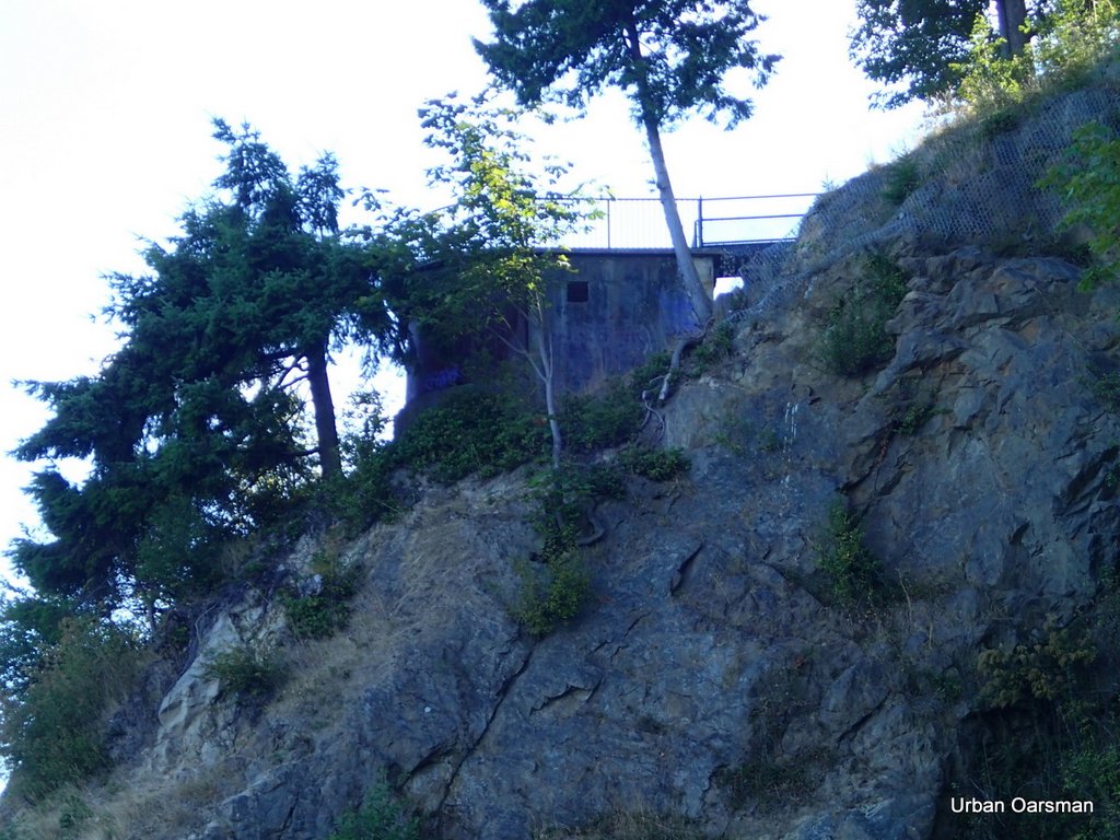
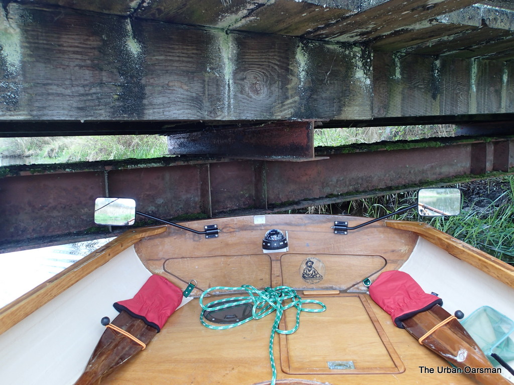
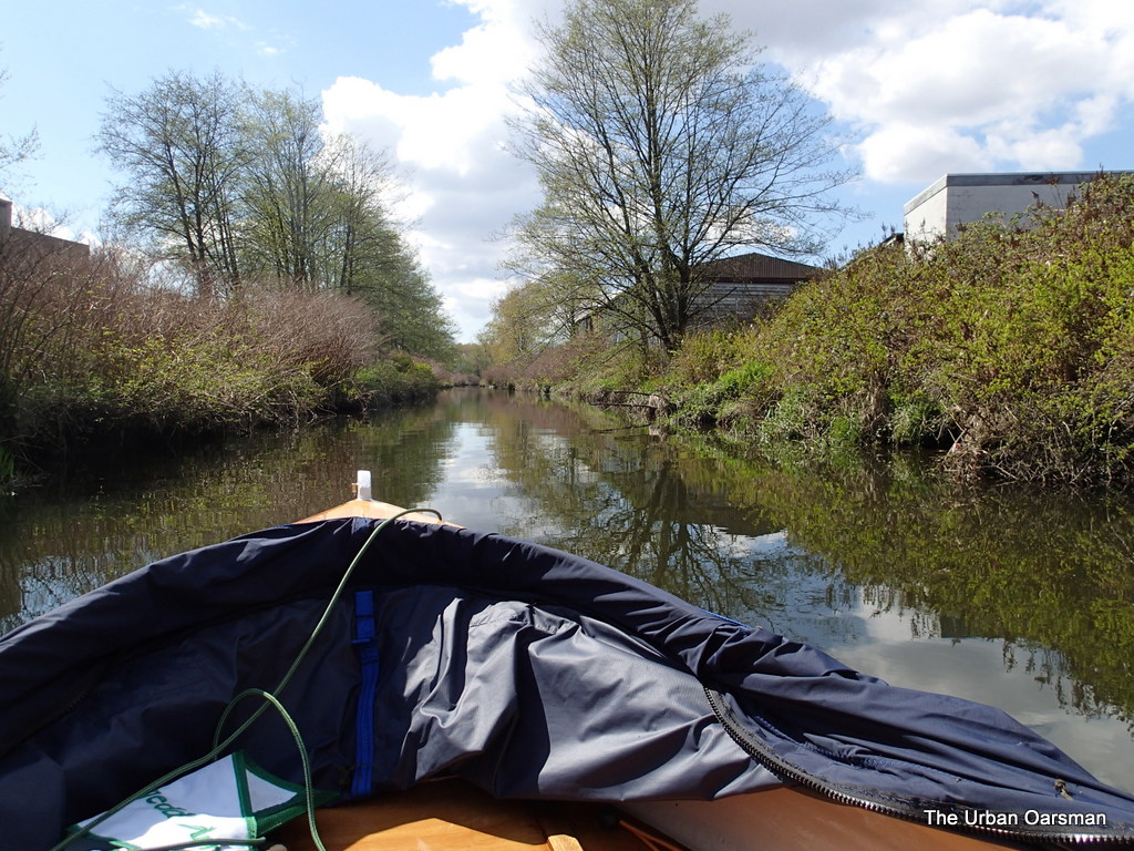
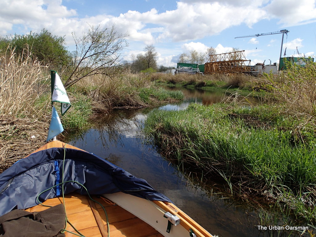
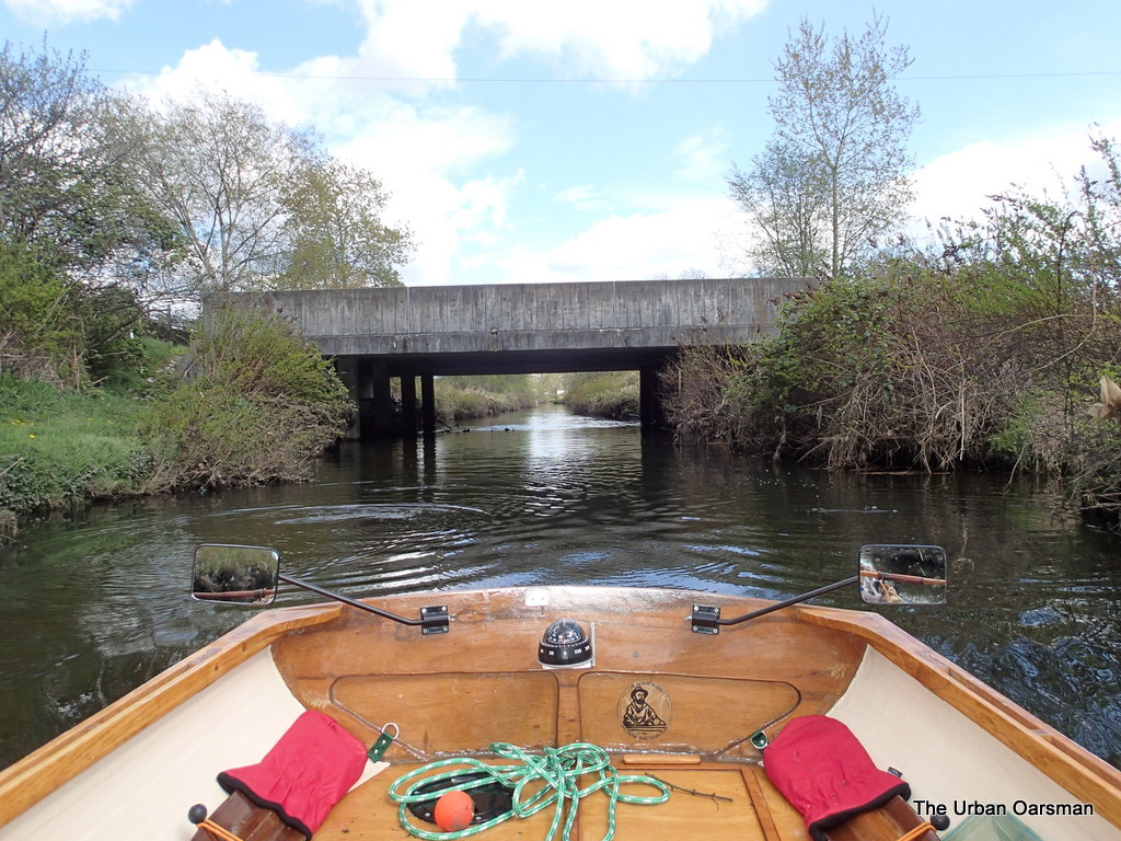
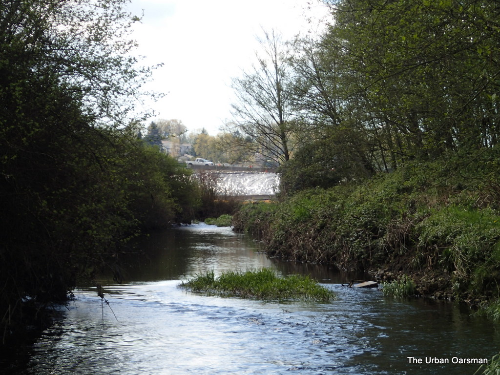
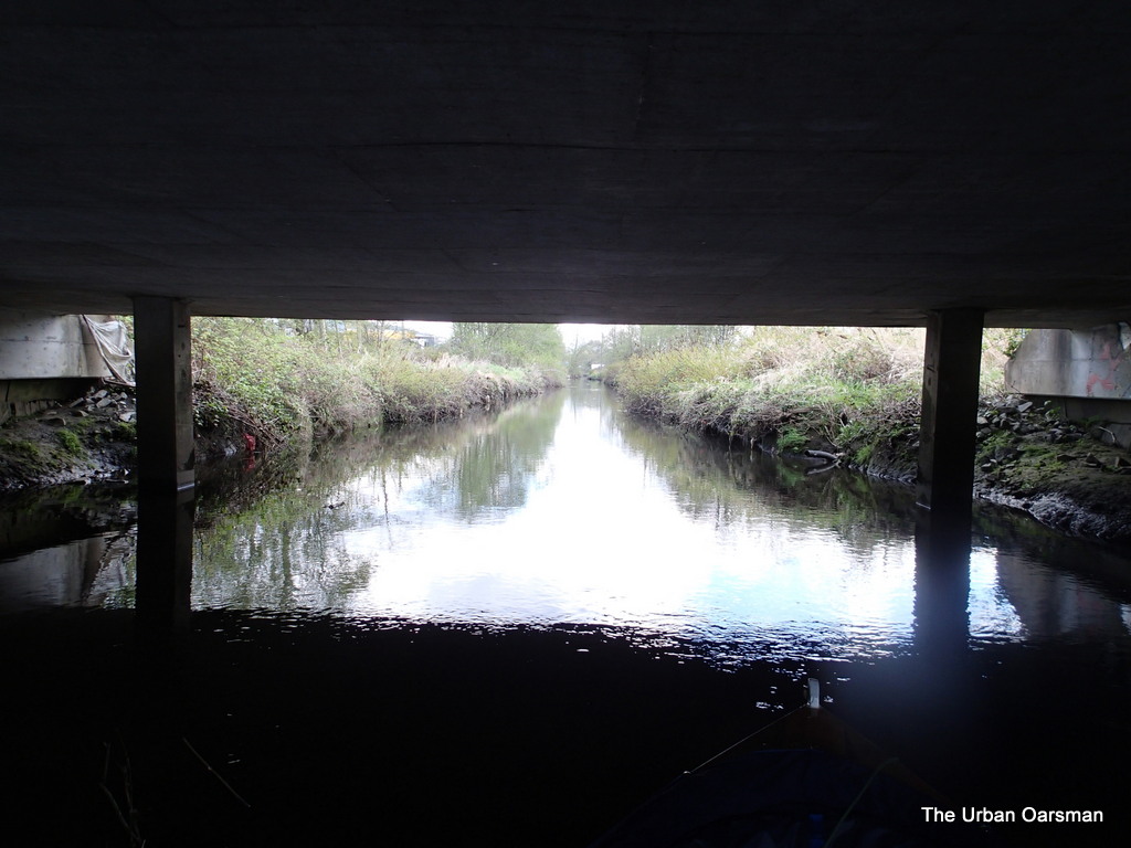
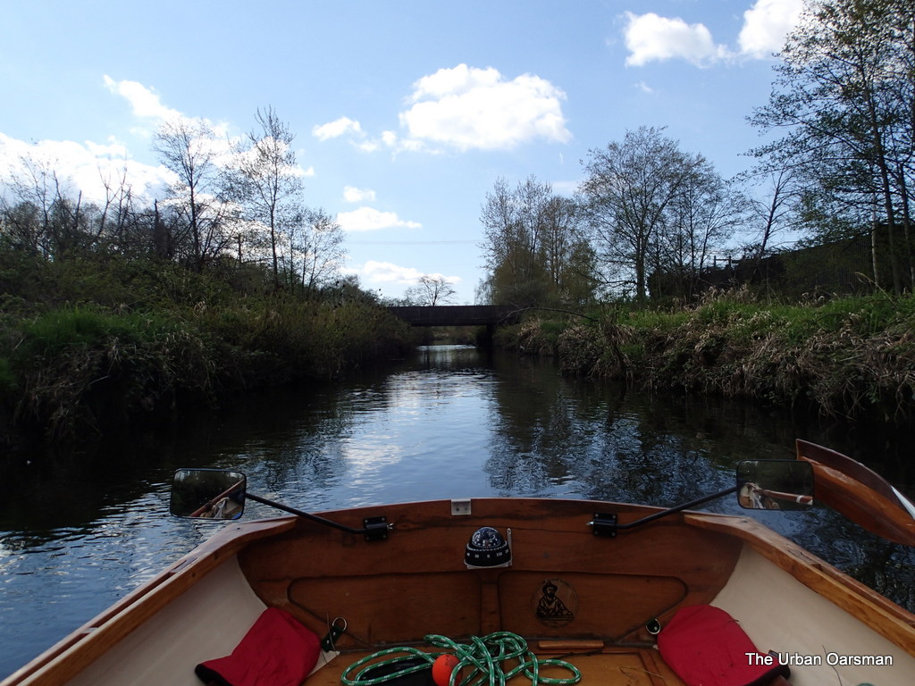
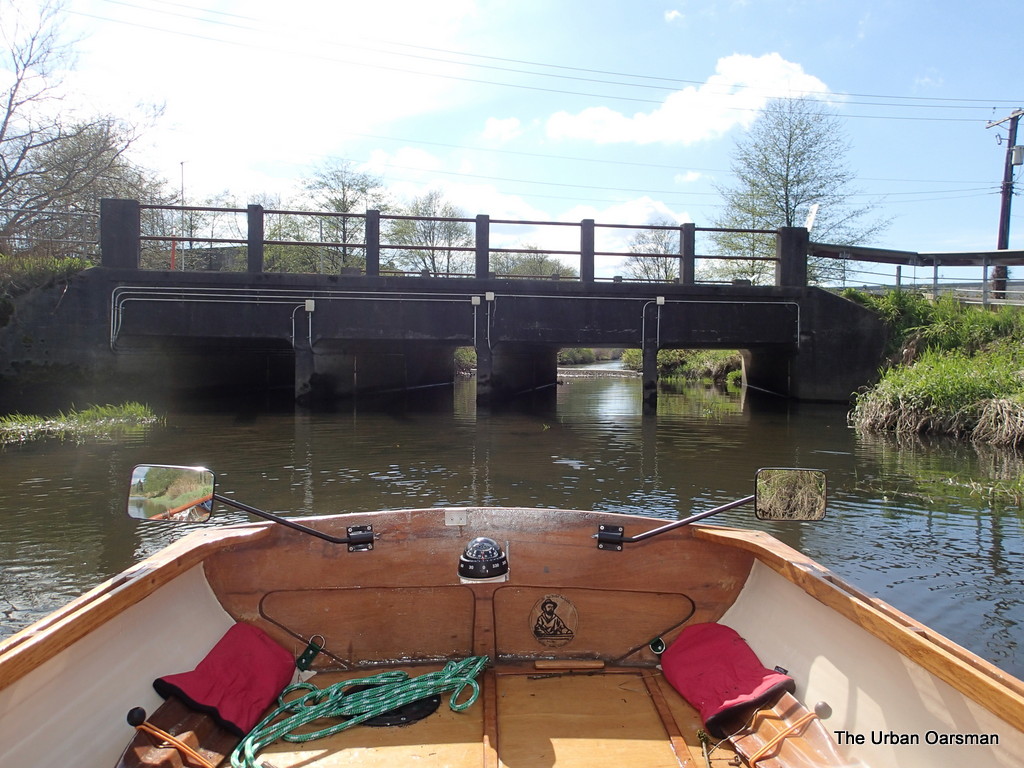
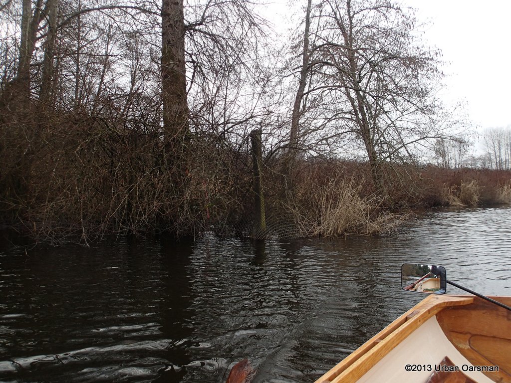
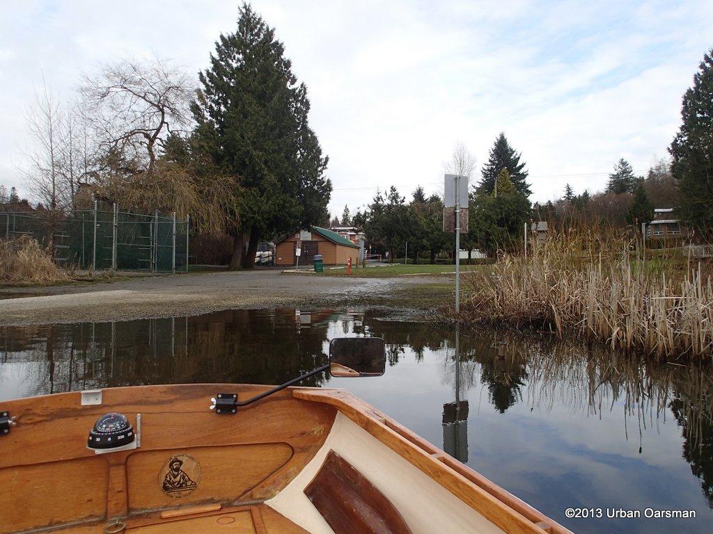
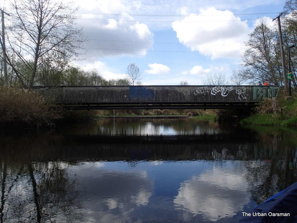
This is the pedestrian overpass at the end of Sperling Avenue.  Behind it you can see one of the floating debris barriers that I have to get around.  Hopefully there is enough room to the North side to slip Gwragedd Annwn by. 

 The Urban Oarsman returns to Still Creek

Pollywog Creek is to the Right (North), and Pole Line Creek is to the Left (South).

I guess that you could fish from the debris barrier.  It is connected to the shore on the South side.  

Just past the debris barrier, heading west up creek.


 The Urban Oarsman returns to Still Creek
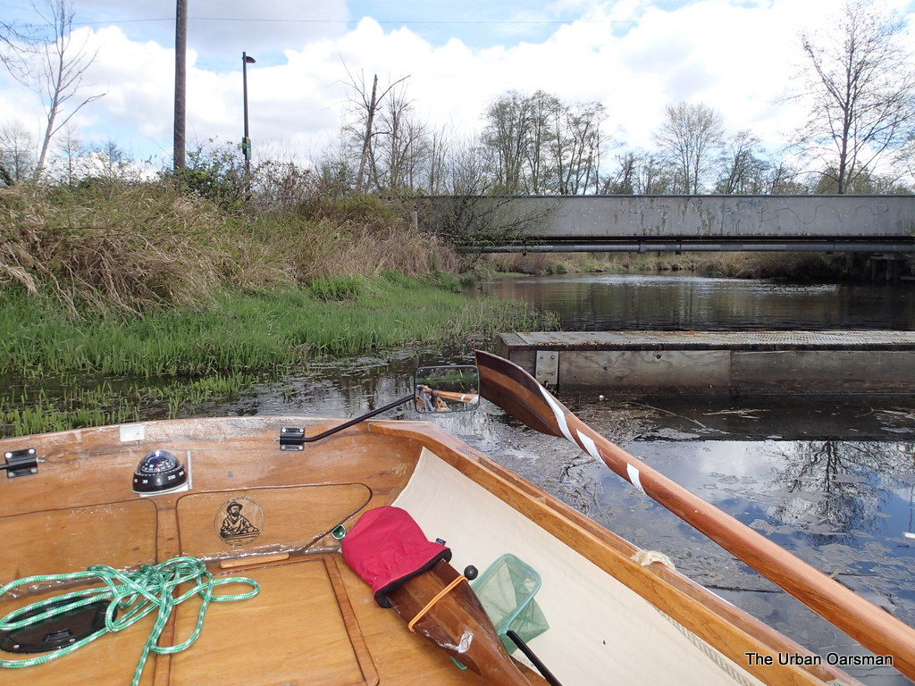
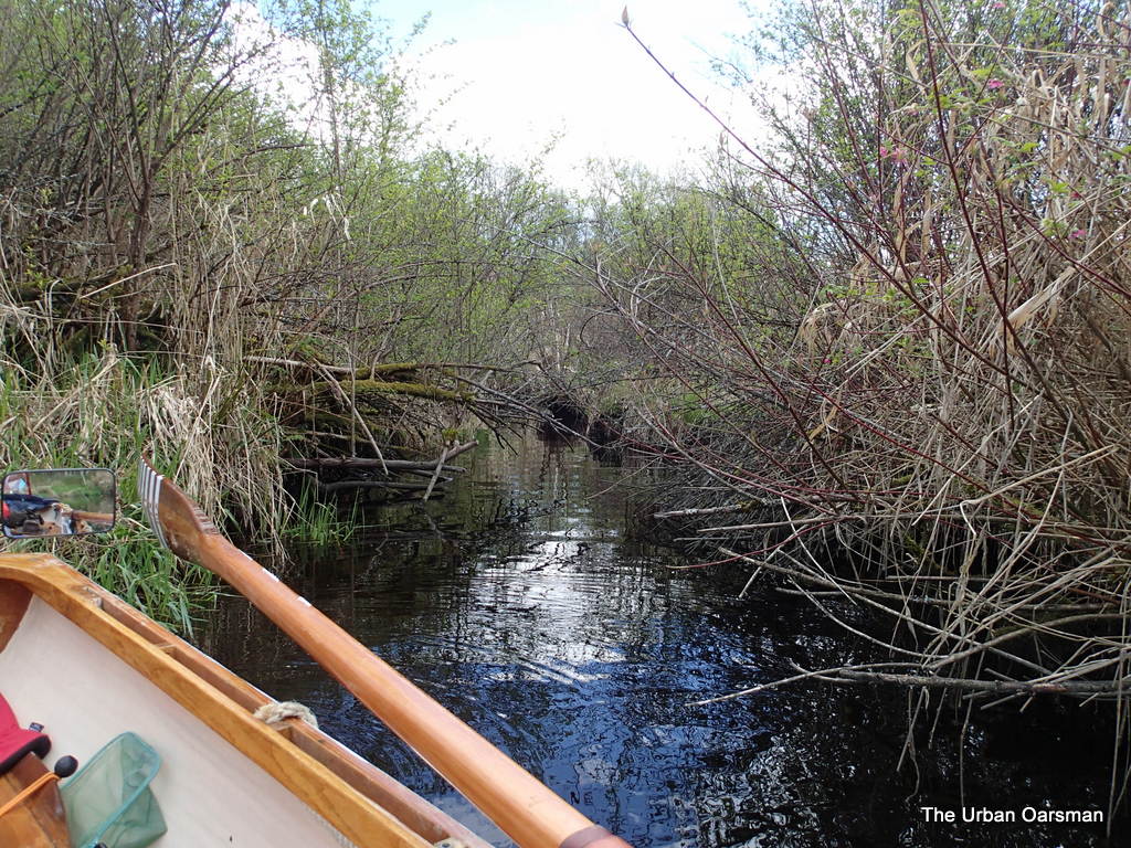
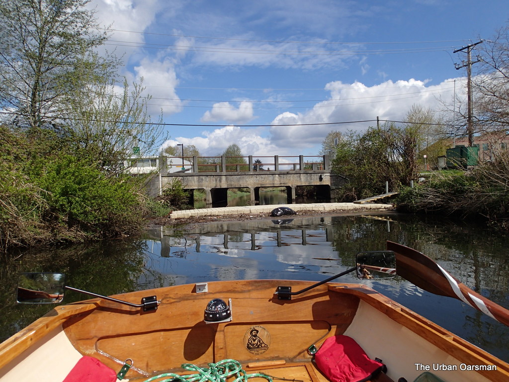
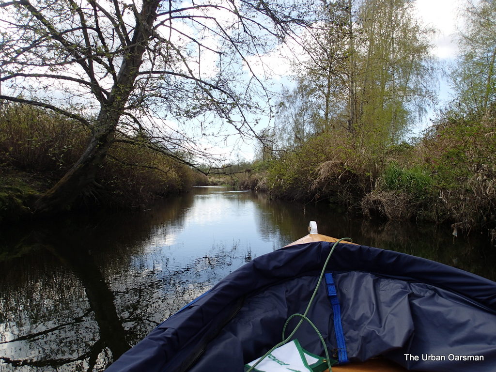
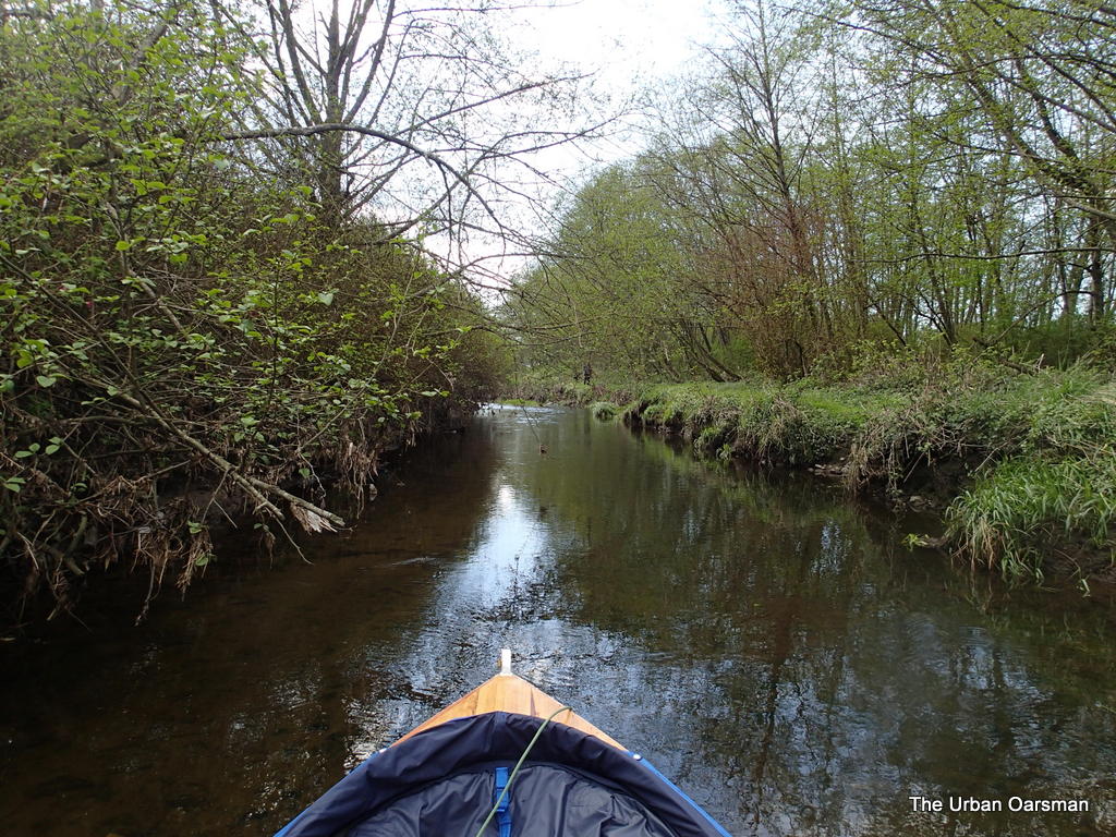
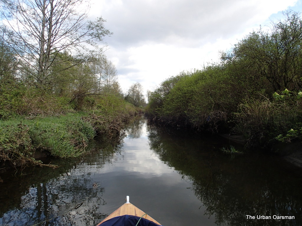
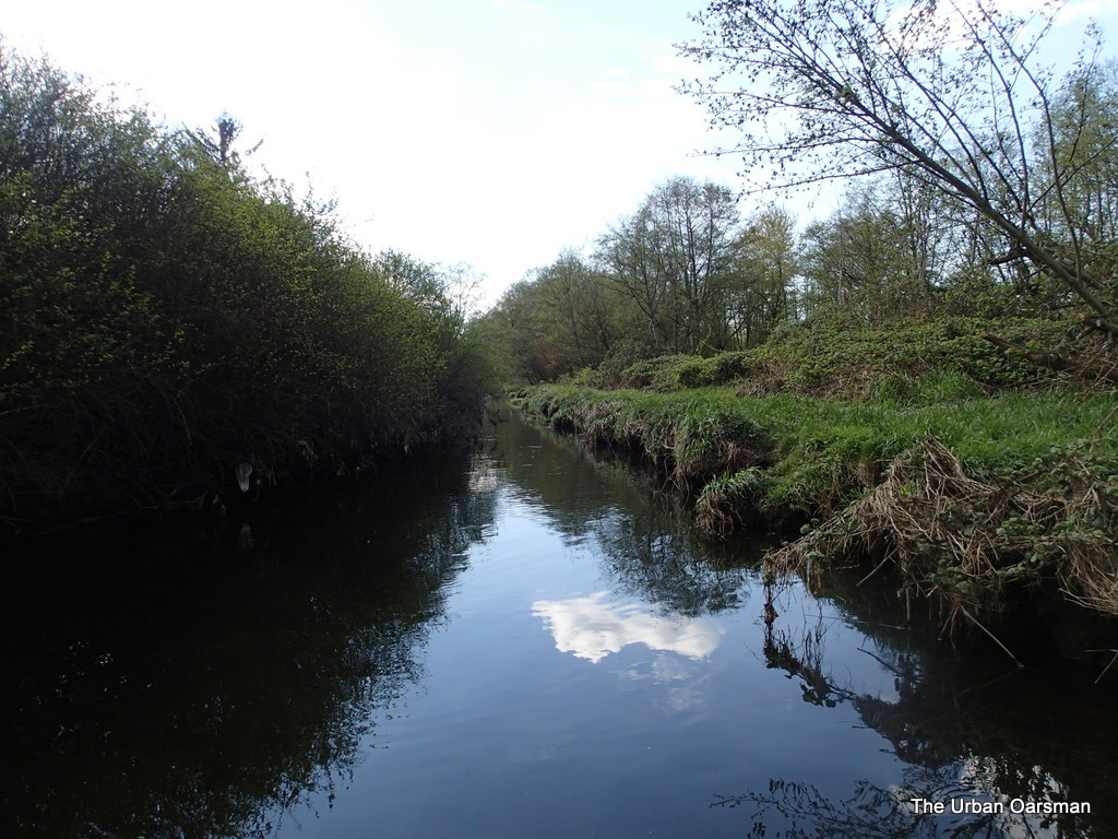
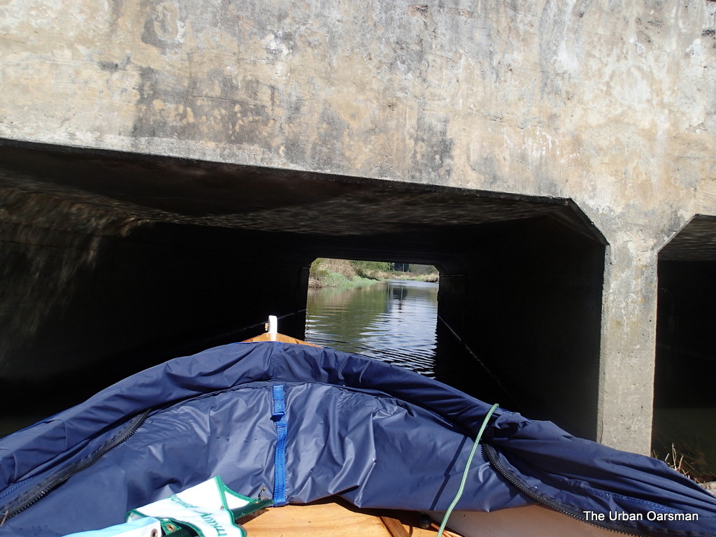
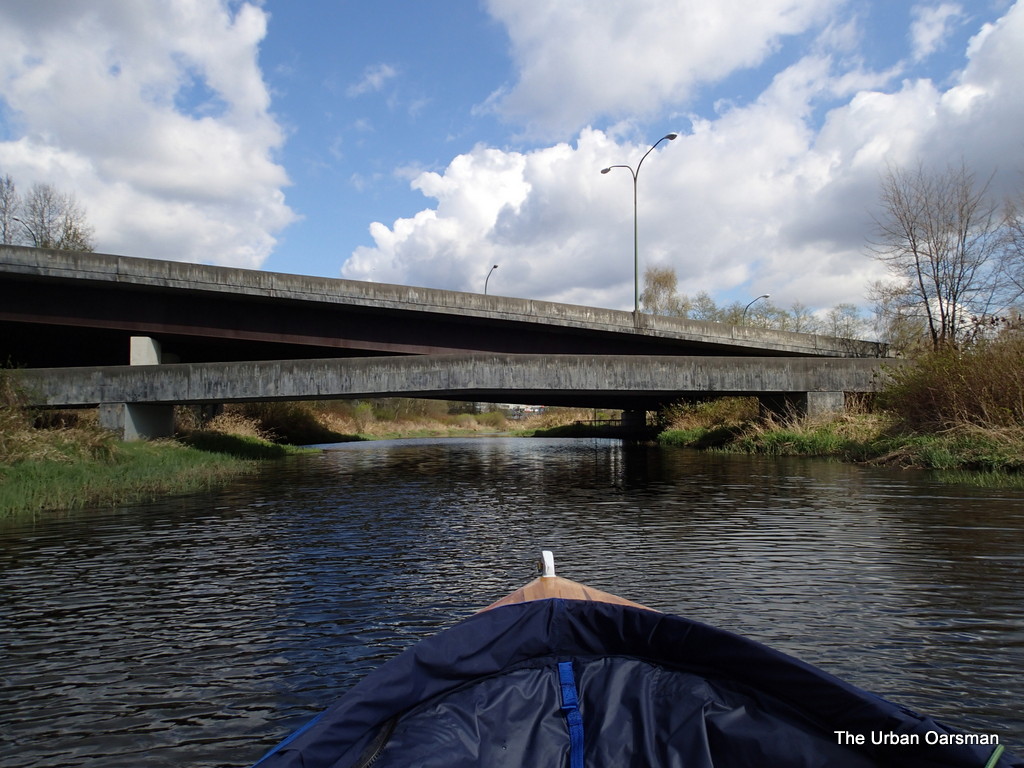
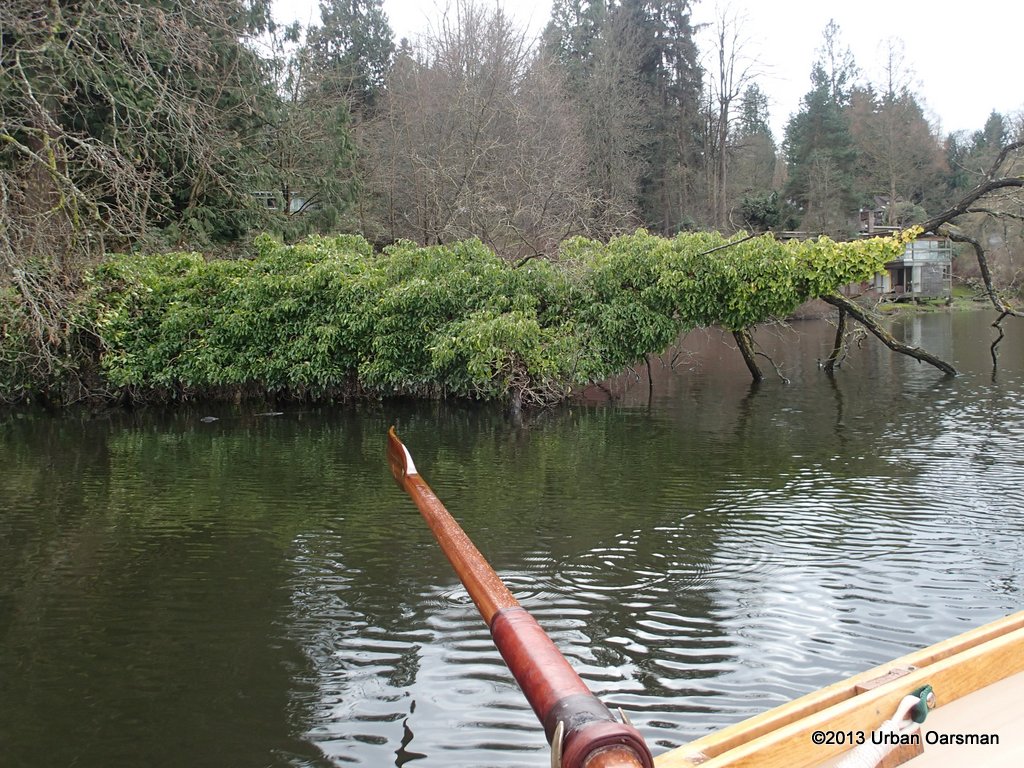
Looking North up Crabapple Creek.  I could only go as far as where the tree overhangs the creek. 
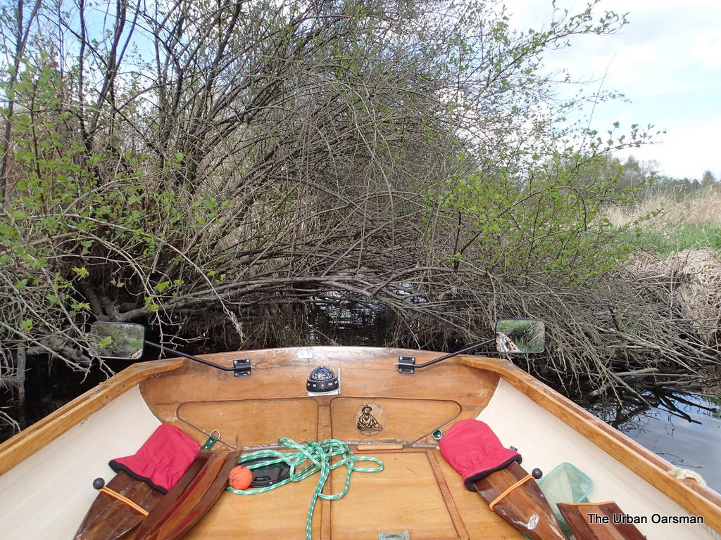
 

The Urban Oarsman returns to Still CreekWhere the tree overhangs Crabapple Creek. I do need a machete.  Or a chain saw.  


The Urban Oarsman returns to Still Creek

This view is looking South, out of Crabapple Creek towards Still Creek.  The entrance to Cranberry Creek is to the right, but is barely visible.  Not many of the side creeks are passable by Gwragedd Annwn.  Perhaps only by beavers. 


The Urban Oarsman returns to Still CreekThis is the entrance to Sunken Engine Creek which connects to Beecher Creek.


The Urban Oarsman returns to Still CreekLooking South down Sunken Engine Creek.  I cannot get Gwragedd Annwn very for up it, and certainly not to Beecher Creek branch.


Treasure In Still Creek, East of Douglas Road BridgeThe creek water is getting clearer the further I row West.  Just before the Douglas Road, I spot coins in the water.  Someone’s lucky wishing well? 


The Urban Oarsman returns to Still CreekLeaving Douglas Road and another debris barrier in my wake.


The Urban Oarsman returns to Still CreekThe view ahead to the west past the Douglas Road Bridge.


The Urban Oarsman returns to Still CreekA red-eared slider turtle sunning his/her self on the South Bank of the creek.

I have seen Red-eared Slider turtles before.  I have a BC Provincial Museum Handbook, #44, “The Reptiles of British Columbia”, by Patrick T. Gregory and R. Wayne Campbell, 1984, That only identifies two turtles as living in BC.  The Northwestern Pond turtle (Clemmys marmorata), collected in British Columbia twice in 1933 and 1936, last reported in 1966.  They further state ” In fact, the western Pond Turtle may never have occurred naturally in this province: the two records could be of turtles which escaped after being imported from the south for food” The Western Painted Turtle (Chrysemys picta bellii) which they state …”is restricted to the southern part of the province.”  They further state that “There is some question as to the status of coastal populations of Painted Turtles”, that they may be the results of escaped pets. 

I have yet to see a Painted or Western Pond Turtle on a rowing trip. 


The Urban Oarsman returns to Still CreekRowing Gwragedd Annwn up the creek past the industrial buildings on Regent Street to the right (South), and Still Creek Avenue to the left (North).


The Urban Oarsman returns to Still CreekThe Westminster Avenue bridge viewed from the Creek.


The Urban Oarsman returns to Still CreekThe view Past the Westminster Avenue bridge, the Industrial buildings are no longer on either side of the Creek.


The Urban Oarsman returns to Still CreekFurther up the Creek.  I can see the bottom much more clearly.  There are fish in the shallows.  I think that they are trout, but, never get a good enough view to make sure. 

The Urban Oarsman returns to Still CreekWhere the Creek starts flowing too fast and shallow to row up.  The truck is on Willingdon Avenue.  Costco is to the right (North) behind the trees.  This is a far as I go.  I have reached the “Headwaters” of Still Creek. 


The Urban Oarsman returns to Still CreekThe view back the way I came.  Costco is to the Left (North) behind the trees and the Trans-Canada Highway is to the right (South).  A view like this could be in any wilderness Rowing trip.  What really makes you know that you are in the city is the ever-present traffic noise. 


The Urban Oarsman returns to Still CreekLooking East again, there are bushes close to the shore and in the tight spots I break off branches passing by.  Gwragedd Annwn accumulates a lot of twigs in her bilge. 


The Urban Oarsman returns to Still CreekGoing under the Westminster Bridge on the way back. 


The Urban Oarsman returns to Still CreekLeaving the Westminster Avenue Bridge astern. 


The Urban Oarsman returns to Still CreekClose-up view of going under the Douglas Road Bridge.  On the East side of the bridge is where I saw the coins on the Creek bed. 


Still Creek TreasureI brought a magnet on a line and a net to salvage some of the coins. 


The Urban Oarsman returns to Still CreekSalvaged Booty!  Some how I do not think that I will get rich on the recovered treasure of Still Creek. 


The Urban Oarsman returns to Still CreekLeaving the Douglas Road Bridge and the Still Creek Treasure bed behind. 


The Urban Oarsman returns to Still CreekRowing up to the Kensingdon Avenue Pedestrian Bridge and road Bridge.  Still Creek is quite wide here and I wonder do Kayakers and Canoests paddle here?  It is a shame that there is no easier access for water craft to this stretch of Still Creek than the ad-hoc one I used with Gwragedd Annwn. 


The Urban Oarsman returns to Still CreekReflections on the underside of the pedestrian overpass. 


The Urban Oarsman returns to Still CreekI decide that the reeds are too thick and the ground too muddy to take Gwragedd Annwn out on the North-West side of the suspension bridge.  I will take her out on the South-East side where I retrieved her on the Burnaby Lake row.  To do this, I must get her under the bridge.  I find that if I move to the stern, she will just clear.  Using my body weight, I manuver her under the bridge, crawling along her deck to depress her enough to clear the bridge.  A slow and awkward process. 


The Urban Oarsman returns to Still CreekGwragedd Annwn on the South-East shore, ready to be hauled up the beaver rut to her dolly, her trailer and to home.


This is the end of the row “Return to Still Creek”.


I think that Burnaby Lake and Still Creek would get more rowing/paddling usage if there was a way to get your boat into the waters more easily.  A boat launch for human powered craft brought from your home to the lake for day use at the rowing centre would be a great idea.

I hope you try out Burnaby Lake and or Still Creek sometime.  A bit of wilderness right here.

one

Good Rowing,


Mike

Posted in Under the Keel.... | Comments Off on Return to Still Creek

Circumnavigating Siwash Rock

Siwash Rock Circumnavigation

One of the most recognised  land features in Stanley Park is Siwash Rock.

Siwash Rock is located on the West side of Stanley Park Between Ferguson Point and Prospect Point.  It is a Volcanic Dike eroded from softer sedimentary rock.  I have circumnavigated Siwash Rock many times, both by oar and by sail.

You need a high tide to do it.  The rock is awash only at high tide.  Here is a picture of the rock with about a nine foot tide:

Siwash Rock Circumnavigation

Siwash Rock, covered with mussels.  It must have been a good spawning year in 2011.

I have rowed around her on a twelve foot tide to circumnavigate the rock.

A close up of the gap to the right that you row over…..

Siwash Rock Circumnavigation

Again, this is at about a nine foot tide.  An twelve foot tide is enough enough water….for Gwragedd Annwn.

There are always a lot less people walking the Seawall in the winter.

Another view of the gap, dry, at about a (according to the tide charts) nine foot tide:

Siwash Rock Circumnavigation

The Siwash Rock gap, dry, Looking East towards Stanley Park

Photo of Siwash Rock looking West, with a (according to the tide charts) twelve-six tide:

Siwash Rock Circumnavigation

This photo was taken on September 9th, 2012 at 2:34pm.  The tide table said that it was a 12.9′ Tide in Vancouver Harbour.  From this experience, I would guess that I could circumnavigate with an 11′ tide, maybe a little less.

View from the West, with the same tide:

Siwash Rock Circumnavigation

I have drifted through the gap on an incoming tide at just over a knot.  I do not know how fast an the ebbing tide would carry Gwragedd Annwn and I through the gap.

.

november102012030

Similar view of the rock, taken Two hours and forty-five minutes earlier, about a nine foot tide.

Urban Oarsman Matt, His son, and I rowed to False Creek, stopping to Circumnavigate Siwash along the Way:

Siwash Rock Circumnavigation

Urban Oarsman Matt & Son rowing around Siwash Rock, 11:53 am, February 3rd, 2013, with a (about) twelve foot-six tide.  This is the first time Matt & Son had rowed around the rock.

.

Siwash Rock Circumnavigation

This a picture of the gap taken on January 13th, 2009, at 2:14 pm at a fourteen-six (about) tide.

Notice how fewer mussels there are around the base of the rock compared to recent photographs.

This picture was taken after the big windstorm that blew down the trees in Stanley Park.

.

Siwash Rock CircumnavigationOne of the features that is not easily seen from the Seawall is the “sea-eye”.  Is it a result of a lava tube when the volcanic dike was formed?

Siwash Rock Circumnavigation

There is a secret treasure hole in the North-West corner of the Rock.  It is not visible from the shore.  It is awash on a fifteen-foot tide or so.

I am sure that all the Pirate treasure, Native artifacts or water-proof geocashes are in here.  I have never rowed up to it and put my hand in to find out.  Would be a great spot.  Not many people know about this hole, but you do, because the Urban Oarsman knows of it, and you too.  So on the next high tide, take a cruise around Siwash Rock.  Look for your own treasure.  You will be glad you did.

.

Siwash Rock at Sunset:

Siwash Rock Circumnavigation

My goal this year is to get a photo of Siwash Rock with the setting moon.


Siwash Rock Circumnavigation

Another Row, Another Sunset.

Siwash Rock Circumnavigation

Siwash Rock, Depth-Sounder oars.

Siwash Rock Circumnavigation

Same spot, no Depth-Sounder oars.

Siwash Rock Circumnavigation

Same Spot, No Depth-Sounder Oars, no people on the Seawall.

Siwash Rock at sunset.  a great place to be for the Urban Oarsman.

The Urban Oarsman

Mike

Posted in Under the Keel.... | Comments Off on Circumnavigating Siwash Rock

Jericho Sailing Centre Row….Around the Freighters, there and back for a Beer and a Burger.

51-JSCA Burger & Beer Title page 3
March 24, 2013. I am going to row from Hollyburn Sailing Club at Ambleside Beach, West Vancouver, to the Jericho Sailing Centre at Jericho Beach. Note the red anchor squares with the numbers in them.  I will be rowing by some of the freighters anchored at them.
JSCA is 3.6 nautical miles South West from Hollyburn.  My rows to JSCA due to the tides and winds have averaged almost 5 nautical miles each way.  I will get lunch at the Galley Patio and Grill.
It will be a long row so I have extra cushions for the main thwart.
The High Low tide is at 11:08am, at 2.5 meters, the Low High is at 4:35 pm, at 3.8 meters, and the Low Low is at 10:54 pm, at 1.7 meters.
There is only a 1.3 meter rise in the tide at Vancouver today.  I should not have a fast run of tide to cross off Ambleside.
Gwragedd Annwn Hollyburn Sailing Club Beach
The sea is flat, there is almost no wind.  I should average three knots rowing across.
Nine-thirty in the morning on a crisp day in early spring.  The marine weather prediction is for a flat still day.


OLYMPUS DIGITAL CAMERA
The Coast Guard Hovercraft came out of the inner harbour and flew along the West Vancouver waterfront at high speed.  Here is the Hovercraft in front of the famous “Pink Building”.  It is marked as an aid to navigation in the Vancouver Harbour paper chart I have.  When my high school buddies and I sailed from Hollyburn Sailing Club across the Strait of Georgia to Qualicum Beach in 1975, the building was painted pink and pink it still is, thirty-eight years later.
Gwragedd Annwn, Lookiing South, China Steel Excellence from Kaohsiug

Gwragedd Annwn heading south across English Bay towards the Jericho Sailing Centre.  The Grey and Blue freighter is the “China Steel Excellence” registered in Kaohsiung.  Many of the freighters anchored in English Bay are light, waiting to be loaded. 


Salmon Dogging Seal
Quite often I get a seal or two following me as I row.  There always seems to be a few off the Ambleside fishing pier.  There are always a few fisher-folk feeding them there.  I believe that because my boat is travelling slowly, the seals think that I am trolling and looking to steal my fish.  But the joke is on them, as I have given up trying to catch fish when I go out.  “Sorry seals, there will be no Salmon from me for you to take”.  “Go back to the Ambleside fishing pier and let the fisher-folk feed you there”. 
Trained seal Jan 12, 2013012
The following Seal with puppy-dog eyes looking for a fish.  Coming closer for a fish, but I have none.
 I leave the seal behind, salmonless and pass the “China Steel Excellence”.  Does she have any other sister ships?  The “China Iron Excellence”? or the “China Copper Excellence”? or perhaps the “China Coal Excellence”?
Quite often in the winter, there will be over a dozen freighters at anchor in the bay.  Every now and then a small aluminium crew boat will race out to a freighter with a pilot.  You have to be cautious rowing by them as they may start up, hoist anchor and sail into the inner harbour. 
Freighters underway are very fast.  If I see one off of Point Grey, it will be coming under Lions Gate before I can clear the shipping channel.  A freighter is easily ten times faster than I am in Gwragedd Annwn. 
Stern shot of the China Steel Excellence.  She is looking a little rusty today.
Stern Shot of the China Steel Excellence, English Bay, Vancouver, BC

Many of the freighters are very long.  Here is a shot towards the bow:
China Steel Excellence, bow view

I do not like to get too close to the freighters, as they will never see a boat as small as mine and can become active with little notice.
The Urban Oarsman Rows to JSCA for a Beer & Burger for lunch
Bow shot of the China Steel Excellence, showing her bulbous bow.  The China Steel Excellence’s bow is actually quite flat.  I wonder what happened to give her that rust spot on the bow.  Hit something?  There are many forms of bulbous bow in the bay today. 
JSCA Burger & Beer024Bow shot at distance of the Alpha Millennium.
I continue rowing south towards Jericho Sailing Centre, with many more freighters in the way.
The Brilliant Trader has a larger bulbous bow than the China Steel Excellence has:
The Urban Oarsman Rows to JSCA for a Beer & Burger for lunch

The Brilliant Trader is drawing about 6.2 meters of water.  The freighter will draw 14 meters when full. 


The Urban Oarsman Rows to JSCA for a Beer & Burger for lunch


Close up shot of the Brilliant Trader’s bulbous bow.
The Anna Dorothea, I pass her by on my Starboard to her Port. 
The Urban Oarsman Rows to JSCA for a Beer & Burger for lunch
She has one of those “Roller Coaster” lifeboat launching systems.  On my Port side, towards Stanley Park, the Genco Prosperity sits on her anchor.  She has her lifeboat  slung by davits.


The Urban Oarsman Rows to JSCA for a Beer & Burger for lunch

Astern of the Genco Prosperity another freighter awaits on her moorings.  She too has her lifeboats on davits.  I row on towards Jericho.  I am almost across.  I am going to have lunch at the Jericho Sailing Centre Association Restaurant, The Galley Patio and Grill.


OLYMPUS DIGITAL CAMERA

A beautiful day but the Beer and the Angus Burger are uninspiring.  Perhaps Oarsmen should only eat here for the view. 
Gwragedd Annwn tweeking029
Gwragedd Annwn on the Beach at the Jericho Sailing Centre.  I have a special sand anchor to hold her here.  It is a large tent peg from Mountain Equipment Co-op that you use to pitch your tent in the snow. It is called a Bulldog 31cm Snow Stake.  Costs $1.75 plus tax.  Works great.  You need to have a thin line or make one of the holes in the tent peg bigger.

Two views of my sand anchor.  Note that the top hole has been enlarged for a 1/4″ rope.

OLYMPUS DIGITAL CAMERA

I have used this sand anchor for many years at Jericho.  Probably the best sand anchor around for the cost.  This one has been fine for me so far.

Mountain Equipment now has a bigger snow tent peg, but for a lot more money. It is called a Picket Snow Anchor.  There are two, one about $19.00 and a larger one for about $24.00.

The Urban Oarsman Rows to JSCA for a Beer & Burger for lunch

On the return trip to Hollyburn, I pass the APJ Shirin.  With her orange/red  paint job she is hard to miss.  She too, has her lifeboats on davits.  She looks to be drawing about 8 meters.  Still has some cargo?  Water Ballast? 
The Urban Oarsman Rows to JSCA for a Beer & Burger for lunch
The current flowing into English Bay past the anchored Rising Sun.  Note the angle of her anchor chain.  She is drawing nine meters.  There is a lot of pressure on her anchor.  The current is flowing into Burrard Inlet at about two knots.


The Urban Oarsman Rows to JSCA for a Beer & Burger for lunch

I am making pretty good time back to HSC.  With the incoming tide and my own boat speed, I a doing better than four knots.
I leave the freighters behind and make the shipping channel crossing to Hollyburn.
A row remembered for the freighters and not for the Burger or beer…
logo Lighthouse park
Mike
Posted in Under the Keel.... | Comments Off on Jericho Sailing Centre Row….Around the Freighters, there and back for a Beer and a Burger.

The Equinox Row, March 22nd, 2013.

The Urban Oarsman, the Spring Equinox Row

 A Hollyburn Sailing Club event.  Paddling and Rowing out to watch the Equinox Sunset, March 22, 2013

March 22nd, 2013.  The Equinox Row.  We leave Hollyburn Sailing Club and paddle and row west along the shore towards Lighthouse Park to watch the Equinox Sunset.

The Urban Oarsman, the Spring Equinox Row

Kayakers leaving Hollyburn Sailing Club (HSC) for the Equinox Sunset

The Urban Oarsman, the Spring Equinox Row

Ideal conditions, Paddling into the Sunset off Ambleside in West Vancouver BC.

The water is calm, winds light, conditions are perfect.  A good time to be on the water in English Bay.

The Urban Oarsman, the Spring Equinox Row

Tugboat Traffic under Lion’s Gate Bridge.  The “Equinox tow”.

The traffic is light coming into and out of the First Narrows.

The Urban Oarsman, the Spring Equinox Row

Riding the swell from the tugboats and the “Equinox Tow”.

We continue West up coast towards Lighthouse Park after the swells have passed.

The Urban Oarsman, the Spring Equinox Row

Paddling out  towards Lighthouse Park, Lions Gate Bridge (First Narrows) in Background.

The Urban Oarsman, the Spring Equinox Row

Ian’s solo paddle Canoe.


Ian built this pretty paddle canoe.  It is Robert Baker’s design “Piccolo” commissioned by the editors of “Wooden Boat” magazine.  He has brought it out to the Hollyburn Sailing Club Wooden Boat show.  For more photos go the the Hollyburn Sailing Club site: http://www.hollyburnsailingclub.ca/

The Hollyburn Sailing Club site is worth exploring. Click on the Photos tab in the top row to see photographs, both recent and from the long-ago past.

Hollyburn Sailing Club (HSC) is my home base.  It is an active Sailing, Rowing, Paddling and Stand up Paddling Club.  If you do not own your own boat, you can join the Co-op and use one of their boats.  The Co-op has sailing boats, kayaks and a paddle board. HSCis where I store Gwragedd Annwn and started this row from.

The Urban Oarsman, the Spring Equinox Row

Steve, the kayaker/photographer.

The photo Steve took of Gwragedd Annwn with me at the oars:

IMGP0675

Photo courtesy of Steve Britten.

This picture was taken around 6:10 pm.  An hour to go to Sunset.


The Urban Oarsman, the Spring Equinox Row

Equinox Sunset reflection off shoreline apartment buildings, West Vancouver, BC.
Lions Gate Bridge is in the background, Stanley Park to the right.


The Urban Oarsman, the Spring Equinox Row

Setting sun, off Lighthouse Park, 6:16pm, March 22nd, 2013.


The Urban Oarsman, the Spring Equinox Row

Setting sun, over the Lighthouse, Lighthouse Park, 6:22pm.

From anywhere in English Bay, no matter what the time of year, you never see the sun setting over the water, as there is always a mountain or the Island for the sun to set over.  When the sun is as far south as it gets, it set over the Island, when it is a far north as it gets, it sets over Lighthouse Park or Mt. Elpinstone on the Sunshine Coast (depending on where in English Bay you are watching the sunset).


The Urban Oarsman, the Spring Equinox Row

6:25pm, The sun is almost behind Lighthouse Park. 

IMGP0708

There is  some sun on us as the Paddlers and rower gather to watch her set.


The Urban Oarsman, the Spring Equinox Row

The equinox sun is behind the hill, Twilight and time to head back to HSC before dark.


The Urban Oarsman, the Spring Equinox Row

Twilight row home.  It is a twilight paddle for the Kayakers.  This is Ian in his solo paddle canoe.
A beautiful evening on the water off Ambleside.


The Urban Oarsman, the Spring Equinox Row

Almost back at HSC.  The end of an Equinox Row.


The Urban Oarsman

Mike

Posted in Under the Keel.... | Comments Off on The Equinox Row, March 22nd, 2013.

Deer Lake Afternoon

Click on picture for larger format image.deerlakeafternoonmarch7

The only way to get to Deer Lake is to take Sperling, and go south off of Canada Way.

fba4c-deerlakefinal

My hand drawn Deer Lake Chart of the Row.

There is no truck and trailer parking at Deer Lake.  The parking lot is designed for car parking and perhaps cartop boats.  But it is March 7th, and there is hardly anyone here. 

Deer Lake Afternoon002

Parked at Deer Lake.  Notice the large rocks that prevent you (or your boat trailer) from driving to the lake shore.

I had checked out Deer Lake two weeks earlier on my way home.  Then there had been two model hydroplanes racing from the beach.  Today there is no one on the lake. 

I uncouple the trailer from the FJ and put it in the parking stall next to mine.  I back the trailer’s wheels up to the big rocks that prevent cars from driving off the lot to the lake. 

My plan is to slide Gwragedd Annwn off the Road Trailer and onto her dolly on the other side of the rocks.


Deer Lake Afternoon004


Good theory, bad execution.  The road trailer rolls forward as Gwragedd Annwn comes off.  Fortunately she drops between the rocks and almost on the dolly. A little tugging and she is good to go. 

Deer Lake Afternoon005

Past the barrier rock and on the way to the Lake.

 The grass gives way to firm wet sand at the shore of the Lake.  The water is very shallow at the East end of the lake; the beach is packed sand and silt.  I get the impression that the sand is held together with goose poop, as there is certainly a lot of it here. 

Deer Lake Afternoon006

Gwragedd Annwn resting on the beach.

I take the dolly back and chain it and the Road Trailer to the FJ.

 Deer Lake Afternoon007

Back to Gwragedd Annwn.  I push her off the beach and before she is afloat, I can not see the bottom, the water looks quite black. 


Deer Lake Afternoon008
Leavving the beach on the Eastern Shore of Deer Lake.

The view to the West does not look very urban looking but the housing on the Correctional Institute site is noticeable. 

Deer Lake Afternoon010

Foot Path on the North Shore of the Lake

The North Shore of the Lake has a footpath along it.  Shadbolt Centre is located there.  Also on the North Shore is the outlet for Deer Lake, Deer Lake Brook.  I row into the Brook, and I can see the bridge that goes over the Brook.  The water is much clearer here, more than three feet of visibility. 


Deer Lake Afternoon013
Deer Lake Brook flows out of the lake.

Deer Lake Afternoon016

Where Deer Lake starts to flow swiftly into Deer Lake Brook, with the Bridge in the background

I row out and continue along the North Shore.  There is a walking trail quite close to the shore.

 At the Western end of the Lake, there is a Wildlife Habitat Zone.  No boating or fishing.  Too bad, this is the least developed and most interesting part of the lake.   

Deer Lake Afternoon027
One of the four marker buoys for the Wildlife Habitat Zone.  Note the “No Kayaks” symbol

There are three lawn chairs on the shore just before the “Zone”.  I guess you fish as close to the border as you can.   

OLYMPUS DIGITAL CAMERA
Fishing spot in the reeds.

I row along the Wildlife Habitat Zone buoys to the South Shore.  A chain link fence comes down the slope and ends in the lake. 

Deer Lake Afternoon032

The chain link fence down the slope into the water on the South Shore of Deer Lake

 Left over from the Correctional Institute?  The north side is over grown and relatively wild.  The trail must be further away from the shore line here.   

There is some housing on the North Side of the Lake, on the East end.  One house is right on the water.  A great setting, but, I wonder, how great a setting in the summer? 

Deer Lake Afternoon038

The only Lake shore house.

Just by Chickadee Creek there is a great ivy covered tree leaning into the water.

Deer Lake Afternoon040

The Ivy covered tree.

 At the North East end of Deer Lake is the Boat Rental.  There is a dock that a father and son are fishing from.  A gravel launching ramp goes into the lake here.  I wonder if you can trailer from here.  I will have to phone when the Boat Rental is open in the summer and find out. 

Deer Lake Afternoon042

Deer Lake Boat Rental Building with the gravel launch ramp in the foreground.

I continue rowing counter-clockwise around the lake, back along the North side again.  There are a few spits of rain.  As I am floating near the North shore, sponging out some of the rain, a Lady walking the path asks me if I am alright, not sinking.  I reply that I am fine, just sponging out some of the rain.  Maybe it rained more that I thought. 

I look to the South, towards the house on the shore and spot the Deer Lake monster, lurking and pretending to be a log.  I give the creature a wide berth.  I do not want to become the next victim.

Deer Lake Afternoon050

The Deer Lake monster slowly coming towards me.

My row is almost over.  I have been on the Lake for two and one half hours.  The Lake is all of two kilometres around.  I row back to the East beach.

Deer Lake Afternoon051

 Gwragedd Annwn on the beach while I get her dolly.

Deer Lake Afternoon054

Putting Gwragedd Annwn on her dolly for the trip to the parking lot.

I try another route to the parking lot, beside the concession building.  There is barely enough space to squeeze by the rocks and a post.

Deer Lake Afternoon057

The tight squeeze between the post and the rock.

Deer Lake Afternoon055

Passing the first barrier

Deer Lake Afternoon056

I load Gwragedd Annwn back onto her road trailer for the ride home.

Deer Lake Afternoon061

Winching Gwragedd Annwn on to the road trailer.

 Ready to go home.

Deer Lake Afternoon066

Gwragedd Annwn on road trailer, dolly strapped on top, ready to go home.

  A good row if you only have an afternoon.

A map of Deer Lake posted by the parking lot showing the Wildlife Habitat Zone and the Creeks

Deer Lake Afternoon069

The Deer Lake map/sign at the parking lot.

Good night Deer Lake….

Deer Lake Afternoon067

Deer Lake Sunset

one


Good Rowing ,

Mike

Posted in Under the Keel.... | Comments Off on Deer Lake Afternoon